Kinnula
Municipality in Central Finland, Finland From Wikipedia, the free encyclopedia
Municipality in Central Finland, Finland From Wikipedia, the free encyclopedia
Kinnula is a municipality of Finland.
Kinnula | |
|---|---|
Municipality | |
| Kinnulan kunta Kinnula kommun | |
 Kinnula church | |
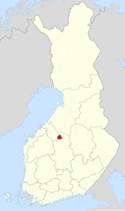
 Location of Kinnula in Finland | |
| Coordinates: 63°22′N 024°58′E | |
| Country | |
| Region | Central Finland |
| Sub-region | Saarijärvi–Viitasaari sub-region |
| Government | |
| • Municipal manager | Kirsi Kellokangas |
| Area (2018-01-01)[1] | |
| • Total | 495.71 km2 (191.39 sq mi) |
| • Land | 460.2 km2 (177.7 sq mi) |
| • Water | 35.48 km2 (13.70 sq mi) |
| • Rank | 190th largest in Finland |
| Population (2024-08-31)[2] | |
| • Total | 1,503 |
| • Rank | 278th largest in Finland |
| • Density | 3.27/km2 (8.5/sq mi) |
| Population by native language | |
| • Finnish | 98.9% (official) |
| • Swedish | 0.1% |
| • Sami | 0.1% |
| • Others | 1% |
| Population by age | |
| • 0 to 14 | 17.4% |
| • 15 to 64 | 49.2% |
| • 65 or older | 33.4% |
| Time zone | UTC+02:00 (EET) |
| • Summer (DST) | UTC+03:00 (EEST) |
| Website | www.kinnula.fi |
It is located in the Central Finland region. The municipality has a population of 1,503 (31 August 2024)[2] and covers an area of 495.71 square kilometres (191.39 sq mi) of which 35.48 km2 (13.70 sq mi) is water.[1] The population density is 3.27 inhabitants per square kilometre (8.5/sq mi).
Neighbouring municipalities are Kivijärvi, Lestijärvi, Perho, Pihtipudas, Reisjärvi and Viitasaari.
The municipality is unilingually Finnish.
There are all together 66 lakes in Kinnula. Biggest lakes are Kivijärvi, Yläjäppä Alajäppä and Iso-Koirajärvi.[4] Salamajärvi National Park is partly located in Kinnula.
Results of the 2011 Finnish parliamentary election in Kinnula:
Seamless Wikipedia browsing. On steroids.
Every time you click a link to Wikipedia, Wiktionary or Wikiquote in your browser's search results, it will show the modern Wikiwand interface.
Wikiwand extension is a five stars, simple, with minimum permission required to keep your browsing private, safe and transparent.