Top Qs
Timeline
Chat
Perspective
Jonggol
Town and District in West Java, Indonesia From Wikipedia, the free encyclopedia
Remove ads
Jonggol is a town and an administrative district (Indonesian: Kecamatan) in the Bogor Regency, West Java, Indonesia. The town is located 50 km to the southeast of Jakarta. The district is part of the Greater Jakarta metropolitan area, and is situated within the Bekasi river basin. It covers a land area of 118.86 km2, and had a population of 122,697 at the 2010 Census[2] and 143,512 at the 2020 Census;[3] the official estimate as at mid 2024 was 155,396 (comprising 78,278 males and 77,118 females).[1] The district centre is at the town of Jonggol, and the district is sub-divided into 14 villages (desa), all sharing the postcode of 16830, as listed below with their areas and populations as at mid 2024.[1] Besides being a district, Jonggol is now the centre of a vast tourist area in the southeast of the Jakarta Metropolitan Area which includes several neighbouring districts - Sukamakmur, Cariu, Tanjungsari, Cileungsi, and Klapanunggal.


Remove ads
History
Under Dutch administration, Jonggol was the centre of a wider administrative area (Kawedanan Jonggol), and after the proclamation of Independence it was stated that the kawedanan would be re-established as part of the proposed State of Pasundan. This was not done, but Jonggol was one of the areas subsequently considered in 2010 for new central administration (capital) of the Republic of Indonesia.[4]
Remove ads
Geography
Jonggol town is located about 50 kilometres (31 mi) southeast of Jakarta. The average elevation in the district is 295 metres, maximum 732 m (1.890 m in Mounth Baud, Sukamakmur, Jonggol District), and minimum 150 metres above sea level.
Toll Road Access
Climate
Jonggol has a tropical rainforest climate (Af) with heavy to very heavy rainfall year-round.
Remove ads
Gallery
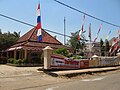 Administrative office of Jonggol District

See also
References
Wikiwand - on
Seamless Wikipedia browsing. On steroids.
Remove ads