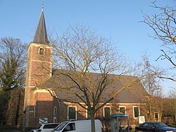
Tielt-Winge
Municipality in Flemish Community, Belgium From Wikipedia, the free encyclopedia
Tielt-Winge (Dutch pronunciation: [ˌtiltˈʋɪŋə]) is a municipality located in the Belgian province of Flemish Brabant. The municipality comprises the towns of Houwaart, Meensel-Kiezegem, Sint-Joris-Winge and Tielt. On 1 January 2006, Tielt-Winge had a total population of 11.604.[2] The total area is 44.16 km² which gives a population density of 227 inhabitants per square kilometre.
Tielt-Winge | |
|---|---|
 | |
| Coordinates: 50°55′N 04°54′E | |
| Country | Belgium |
| Community | Flemish Community |
| Region | Flemish Region |
| Province | Flemish Brabant |
| Arrondissement | Leuven |
| Government | |
| • Mayor | Rudi Beeken (OpenVLD) |
| • Governing party/ies | OpenVld, CD&V |
| Area | |
• Total | 44.52 km2 (17.19 sq mi) |
| Population (2018-01-01)[1] | |
• Total | 10,707 |
| • Density | 240/km2 (620/sq mi) |
| Postal codes | 3390, 3391 |
| NIS code | 24135 |
| Area codes | 016 |
| Website | www.tielt-winge.be |

References
External links
Wikiwand - on
Seamless Wikipedia browsing. On steroids.


