| Ref# |
Year designated |
Name |
Image |
Built |
Location
Coordinates |
Region/state |
Country |
Category |
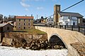
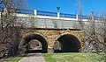
| 1 |
1966 |
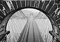
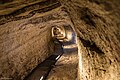
Bollman Truss Bridge |
 |
1869 |
Savage
39°8′5.4″N 76°49′30.3″W |
Maryland |
United States |
bridges |
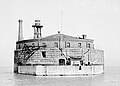
| 2 |
1967 |
Bidwell Bar Bridge |
 |
1856 |
Oroville
39°32′14.8″N 121°27′15.6″W |
California |
United States |
bridges |
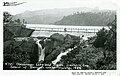
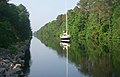
| 3 |
1967 |
Erie Canal |
 |
1825 |
Hudson River to Lake Erie
43°2′35.6″N 76°1′20.2″W |
New York |
United States |
water transportation |
| 4 |
1967 |
Middlesex Canal |
 |
1803 |
Middlesex County
42°30′21.4″N 71°9′25.8″W |
Massachusetts |
United States |
water transportation |
| 5 |
1968 |
Central Pacific Railroad |
 |
1863–1869 |
Sacramento eastward
38°34′57″N 121°30′22.8″W |
California |
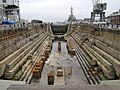
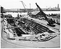
United States |
roads & rails |
| 6 |
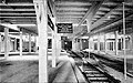
1968 |
Durango-Silverton Branch of the D&RGW RR |
 |
1882 |
Durango
37°35′27.7″N 107°46′41.6″W |
Colorado |
United States |
roads & rails |
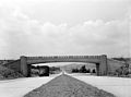
| 7 |
1968 |
Ellicott's Stone |
 |
1799 |
Mobile
30°59′52″N 88°1′21.1″W |
Alabama |
United States |
surveys & maps |
| 8 |
1968 |
Acequias of San Antonio |
 |
1718 |
San Antonio
29°19′57.1″N 98°27′41.1″W |
Texas |
United States |
water supply & control |
| 9 |
1968 |
Joining of the Rails - Transcontinental Railroad |
 |
1869 |
Promontory
41°37′4.7″N 112°33′5.8″W |
Utah |
United States |
roads & rails |
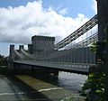
| 10 |
1968 |
Wheeling Suspension Bridge |
 |
1849 |
Wheeling
40°4′12.8″N 80°43′36.7″W |
West Virginia |
United States |
bridges |
| 11 |
1969 |
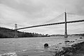
Alvord Lake Bridge |
 |
1889 |
San Francisco
37°46′8.4″N 122°27′17.6″W |
California |
United States |
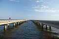
bridges |
| 12 |
1969 |
Charleston - Hamburg Railroad |
 |
1833 |
Charleston to Hamburg
32°47′22.9″N 79°56′15.8″W |
South Carolina |
United States |
roads & rails |
| 13 |
1970 |
Ascutney Mill Dam |
 |
1834 |
Windsor
43°28′35″N 72°23′44.5″W |
Vermont |
United States |
dams |
| 14 |
1970 |
Bridgeport Covered Bridge |
 |
1862 |
Nevada County
39°17′34.2″N 121°11′41.7″W |
California |
United States |
bridges |
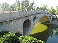
| 15 |
1970 |
Cornish–Windsor Covered Bridge |
 |
1866, rebuilt 1988 |
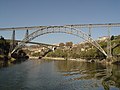
Windsor to Cornish
43°28′25.3″N 72°23′2.1″W |
Vermont and New Hampshire |
United States |
bridges |
| 16 |
1970 |
Frankford Avenue Bridge |
 |
1697 |
Philadelphia
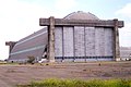
40°2′36.7″N 75°1′14″W |
Pennsylvania |
United States |
bridges |
| 17 |
1970 |
Potowmack Canal and Locks |
 |
1799 |
Great Falls
38°59′25.3″N 77°14′58.1″W |
Virginia |
United States |
water transportation |
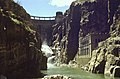
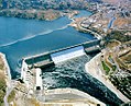
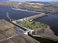
| 18 |
1970 |
Theodore Roosevelt Dam & Salt River Project |
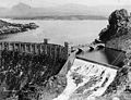 |
1911 |
33°40′17.9″N 111°9′40.8″W |
Arizona |
United States |
water supply & control |
| 19 |
1970 |
Union Canal Tunnel |
 |
1828 |
Lebanon
40°20′58.5″N 76°27′41″W |
Pennsylvania |
United States |
water transportation |
| 20 |
1971 |
Bethlehem Waterworks |
 |
1761 |
Bethlehem
40°37′8.7″N 75°22′58.2″W |
Pennsylvania |
United States |
water supply & control |
| 21 |
1971 |
Druid Lake Dam |
 |
1871 |
Baltimore
39°19′7″N 76°37′53″W |
Maryland |
United States |
dams |
| 22 |
1971 |
Eads Bridge |
 |
1874 |
St. Louis
38°37′44″N 90°10′43.3″W |
Missouri |
United States |
bridges |
| 23 |
1971 |
First Owens River - Los Angeles Aqueduct |
 |
1913 |
Owens Valley
36°58′32.4″N 118°12′38″W |
California |
United States |
water supply & control |
| 24 |
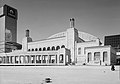
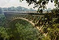
1971 |
Mormon Tabernacle |
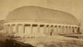 |
1867 |
Salt Lake City
40°46′13.6″N 111°53′35.3″W |
Utah |
United States |
buildings |
| 25 |
1972 |
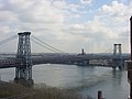
Cabin John Aqueduct |
 |
1863 |
Cabin John
38°58′22″N 77°8′54.9″W |
Maryland |
United States |
water supply & control |
| 26 |
1972 |
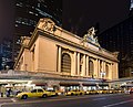
Chesbroughs Water Supply System Chicago |
 |
1869 |
Chicago
41°53′49.8″N 87°37′27.9″W |
Illinois |
United States |
water supply & control |
| 27 |
1972 |
Brooklyn Bridge |
 |
1883 |
New York City
40°42′22″N 73°59′48.8″W |
New York |
United States |
bridges |
| 28 |
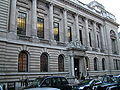
1972 |
Gunnison Tunnel |
 |
1909 |
Montrose
38°29′36″N 107°43′17″W |
Colorado |
United States |
tunnels |
| 29 |
1972 |
Roebling's Delaware Aqueduct of the Delaware & Hudson Canal |
 |
1848, restored 1983 |
Lackawaxen to Minisink Ford
41°28′57.5″N 74°59′4.1″W |
Pennsylvania & New York |
United States |
water transportation |
| 30 |
1972 |
Miami Conservancy District |
 |
1922 |
near Dayton
39°45′49.2″N 84°11′29.2″W |
Ohio |
United States |
water supply & control |
| 31 |
1973 |
Buffalo Bill Dam |
 |
1910 |
Cody
44°30′5.3″N 109°10′59.4″W |
Wyoming |
United States |
dams |
| 32 |
1973 |
Cheesman Reservoir |
 |
1905 |
Southwest of Denver
39°12′27″N 105°16′20.1″W |
Colorado |
United States |
dams |
| 33 |
1973 |
Embudo Stream Gauging Station |
 |
1889 |
Embudo
36°12′18.4″N 105°57′49.2″W |
New Mexico |
United States |
water supply & control |
| 34 |
1973 |
Ingalls Building |
 |
1903 |
Cincinnati
39°6′1″N 84°30′45.1″W |
Ohio |
United States |
buildings |
| 35 |
1973 |
Pelton Impulse Water Wheel |
 |
1878 |
Camptonville
39°27′7″N 121°2′55″W |
California |
United States |
power generation |
| 36 |
1973 |
Starrucca Viaduct |
 |
1848 |
Lanesboro
41°57′51.3″N 75°35′0.6″W |
Pennsylvania |
United States |
bridges |
| 37 |
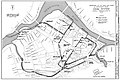
1974 |
Kansas City Park and Boulevard System |
 |
1893 to 1915 |
Kansas City
39°4′57″N 94°33′18″W |
Missouri |
United States |
surveys & maps |
| 38 |
1974 |
Milwaukee Metropolitan Sewage Treatment Plant, home of Milorganite[2] |
 |
1919 |
Milwaukee
43°1′21.3″N 87°53′57.3″W |
Wisconsin |
United States |
water supply & control |
| 39 |
1974 |
Philadelphia Municipal Water Supply |
 |
1801 |
Philadelphia
39°57′56″N 75°10′51″W |
Pennsylvania |
United States |
water supply & control |
| 40 |
1974 |
Stone Arch Bridge |
 |
1883 |
Minneapolis
44°58′50.8″N 93°15′12.3″W |
Minnesota |
United States |
bridges |
| 41 |
1975 |
Castillo de San Marcos |
 |
1695 |
St. Augustine
29°53′52″N 81°18′41″W |
Florida |
United States |
buildings |
| 42 |
1975 |
Croton Water Supply System |
 |
1842 |
New York City
41°0′42.5″N 73°52′36.4″W |
New York |
United States |
water supply & control |
| 43 |
1975 |
Folsom Hydroelectric Power System |
 |
1895 |
Folsom
38°40′46.6″N 121°10′37.2″W |
California |
United States |
power generation |
| 44 |
1975 |
Granite Railway |
 |
1826 |
Quincy
42°14′44.6″N 71°2′9″W |
Massachusetts |
United States |
roads & rails |
| 45 |
1975 |
Hoosac Tunnel |
 |
1875 |
Berkshire County
42°40′31.1″N 73°2′45.1″W |
Massachusetts |
United States |
tunnels |
| 46 |
1975 |
Lawrence Experiment Station |
 |
1886 |
Lawrence
42°41′53.8″N 71°9′55.7″W |
Massachusetts |
United States |
research & educational |
| 47 |
1975 |
Marlette Lake Water System |
 |
1873 to 1887 |
Virginia City
39°13′9.5″N 119°47′20.1″W |
Nevada |
United States |
water supply & control |
| 48 |
1975 |
Mount Washington Cog Railway |
 |
1869 |
Mount Washington
44°16′26″N 71°19′55″W |
New Hampshire |
United States |
roads & rails |
| 49 |
1975 |
Smithfield Street Bridge |
 |
1883 |
Pittsburgh
40°26′5.4″N 80°0′7.7″W |
Pennsylvania |
United States |
bridges |
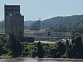
| 50 |
1975 |
Tunkhannock Viaduct |
 |
1915 |
Nicholson
41°37′34.2″N 75°46′34.4″W |
Pennsylvania |
United States |
bridges |
| 51 |
1976 |
Crozet's Blue Ridge Tunnel |
 |
1858 |
Waynesboro
38°2′3.1″N 78°51′28.4″W |
Virginia |
United States |
tunnels |
| 52 |
1976 |
Cumbres and Toltec Scenic Railroad |
 |
1880 |
Chama to Antonito
36°59′42″N 106°17′51.1″W |
New Mexico and Colorado |
United States |
roads & rails |
| 53 |
1976 |
Elephant Butte Dam |
 |
1916 |
Truth or Consequences
33°9′14.9″N 107°11′31.3″W |
New Mexico |
United States |
dams |
| 54 |
1976 |
First Concrete Pavement |
 |
1893 |
Bellefontaine
40°21′37.5″N 83°45′33.6″W |
Ohio |
United States |
roads & rails |
| 55 |
1976 |
International Boundary Marker No. 1[3] |
 |
1855 |
Doña Ana County
31°47′2″N 106°31′47.1″W |
New Mexico |
United States |
surveys & maps |
| 56 |
1976 |
King's Road |
 |
1766 to 1775 |
New Smyrna
29°38′23.4″N 81°16′50.3″W |
Florida |
United States |
roads & rails |
| 57 |
1976 |
National Road |
 |
1811–1839 |
Cumberland to Vandalia
39°57′38.7″N 82°27′2″W |
Maryland to Illinois |
United States |
roads & rails |
| 58 |
1977 |
Charlestown Naval Dry Dock |
 |
1833 |
Boston
42°22′23.7″N 71°3′19.3″W |
Massachusetts |
United States |
water transportation |
| 59 |
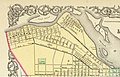
1977 |
City Plan of Savannah |
 |
1733 |
Savannah
32°4′32″N 81°5′31″W |
Georgia |
United States |
surveys & maps |
| 60 |
1977 |
Great Falls Raceway and Power System |
 |
1800 |
Paterson
40°54′55.1″N 74°10′52.1″W |
New Jersey |
United States |
power generation |
| 61 |
1977 |
First New York Subway |
 |
1904 |
New York City
40°42′45.3″N 74°0′24.2″W |
New York |
United States |
roads & rails |
| 62 |
1977 |
Mason–Dixon line |
 |
1767 |
39°43′16.1″N 80°7′5.3″W |
Maryland & Pennsylvania |
United States |
surveys & maps |
| 63 |
1977 |
Minot's Ledge Lighthouse |
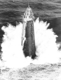 |
1860 |
off Scituate
42°16′11″N 70°45′32.9″W |
Massachusetts |
United States |
water transportation |
| 64 |
1977 |
Mullan Road |
 |
1862 |
Walla Walla
46°46′8.3″N 118°12′22.6″W |
Washington |
United States |
roads & rails |
| 65 |
1977 |
Dry Dock No 1 Norfolk Naval Shipyard |
 |
1833 |
Portsmouth
36°49′14″N 76°17′35″W |
Virginia |
United States |
water transportation |
| 66 |
1977 |
Reversal of the Chicago River |
 |
1900 |
Chicago
41°42′18″N 87°56′2″W |
Illinois |
United States |
water transportation |
| 67 |
1977 |
Vulcan Street Plant |
 |
1882 |
Appleton
44°15′29.2″N 88°23′50.2″W |
Wisconsin |
United States |
power generation |
| 68 |
1977 |
William E. Ward House |
 |
1876 |
Rye Brook
41°1′32.5″N 73°40′3.1″W |
New York |
United States |
buildings |
| 69 |
1978 |
Boston Subway |
 |
1897 |
Boston
42°21′23.8″N 71°3′43.6″W |
Massachusetts |
United States |
roads & rails |
| 70 |
1978 |
Dunlap's Creek Bridge |
 |
1839 |
Brownsville
40°1′17.2″N 79°53′17.2″W |
Pennsylvania |
United States |
bridges |
| 71 |
1978 |
Hudson and Manhattan Railroad Tunnel |
 |
1908 |
Jersey City to New York City
40°43′56.7″N 74°1′11.6″W |
New Jersey & New York |
United States |
tunnels |
| 72 |
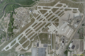
1978 |
Newark International Airport |
 |
1928 |
Newark
40°41′22.2″N 74°10′28.2″W |
New Jersey |
United States |
aviation |
| 73 |
1978 |
United States Military Academy |
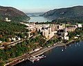 |
1813 |
West Point
41°23′34.8″N 73°57′28.8″W |
New York |
United States |
research & educational |
| 74 |
1979 |
Cleveland Hopkins Airport |
 |
1925 |
Cleveland
41°24′45″N 81°50′53″W |
Ohio |
United States |
aviation |
| 75 |
1979 |
Fink Deck Truss Bridge |
 |
1870 |
Lynchburg
37°26′24.3″N 79°9′56″W |
Virginia |
United States |
bridges |
| 76 |
1979 |
Fink Through Truss Bridge |
 |
1858 |
Hamden
40°36′14.3″N 74°54′8.1″W |
New Jersey |
United States |
bridges |
| 77 |
1979 |
Iron Bridge |
 |
1779 |
Ironbridge
52°37′38.4″N 2°29′7.6″W |
West Midlands |
England |
bridges |
| 78 |
1979 |
Moffat Tunnel |
 |
1928 |
Winter Park
39°53′37.5″N 105°42′41.3″W |
Colorado |
United States |
tunnels |
| 79 |
1979 |
Rockville Bridge |
 |
1902 |
Harrisburg
40°19′59.9″N 76°54′38.8″W |
Pennsylvania |
United States |
bridges |
| 80 |
1980 |
Goodyear Airdock |
 |
1929 |
Akron
41°1′54.9″N 81°28′14.6″W |
Ohio |
United States |
aviation |
| 81 |
1980 |
Hydraulic-Inclined Plane System of the Morris Canal |
 |
1831 |
Waterloo Village
40°54′55.2″N 74°21′23.8″W |
New Jersey |
United States |
water transportation |
| 82 |
1981 |
Borden Base Line |
 |
1831 |
Hatfield
42°25′33.7″N 72°37′9″W |
Massachusetts |
United States |
surveys & maps |
| 83 |
1981 |
Chain of Rocks Water Purification Plant |
 |
1904 |
St. Louis
38°45′18.5″N 90°11′11.6″W |
Missouri |
United States |
water supply & control |
| 84 |
1981 |
Charles River Basin Project |
 |
1910 |
Boston
42°22′3.8″N 71°4′12.8″W |
Massachusetts |
United States |
water supply & control |
| 85 |
1981 |
Cortland Street Drawbridge |
 |
1902 |
Chicago
41°55′1.1″N 87°39′51.4″W |
Illinois |
United States |
bridges |
| 86 |
1981 |
George Washington Bridge |
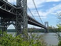 |
1931 |
Fort Lee to New York City
40°51′6.1″N 73°57′9.7″W |
New Jersey & New York |
United States |
bridges |
| 87 |
1981 |
Louisville Water Works |
 |
1875 to 1896 |
Louisville
38°16′50″N 85°42′4.3″W |
Kentucky |
United States |
water supply & control |
| 88 |
1981 |
Montgomery Bell's Tunnel |
 |
1818 |
Cheatham County
36°8′48.5″N 87°7′19.3″W |
Tennessee |
United States |
tunnels |
| 89 |
1981 |
Snoqualmie Falls Cavity Generating Station |
 |
1899 |
Snoqualmie
47°32′39.5″N 121°50′29.3″W |
Washington |
United States |
power generation |
| 90 |
1981 |
Union Station |
 |
1894 |
St. Louis
38°37′41.2″N 90°12′28.8″W |
Missouri |
United States |
roads & rails |
| 91 |
1981 |
Washington Monument |
 |
1885 |
Washington
38°53′22.1″N 77°2′6.9″W |
District of Columbia |
United States |
buildings |
| 92 |
1981 |
Whipple Truss Bridge |
 |
1855 |
Schenectady
42°49′5.2″N 73°55′27″W |
New York |
United States |
bridges |
| 93 |
1982 |
Carrollton Viaduct |
 |
1829 |
Baltimore
39°16′31.5″N 76°39′18″W |
Maryland |
United States |
bridges |
| 94 |
1982 |
Detroit-Windsor Tunnel |
 |
1930 |
Detroit
42°19′28″N 83°2′25.4″W |
Michigan |
United States |
tunnels |
| 95 |
1982 |
Eads South Pass Navigation Works |
 |
1879 |
Port Eads
28°59′50″N 89°8′38″W |
Louisiana |
United States |
water transportation |
| 96 |
1982 |
Holland Tunnel |
 |
1927 |
Jersey City to New York City
40°43′38.9″N 74°1′16″W |
New Jersey & New York |
United States |
tunnels |
| 97 |
1982 |
John A. Roebling Suspension Bridge |
 |
1866 |
Cincinnati
39°5′34.8″N 84°30′35.6″W |
Ohio |
United States |
bridges |
| 98 |
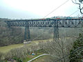
1982 |
Kinzua Railway Viaduct |
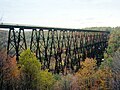 |
1882 |
McKean County
41°45′47.3″N 78°35′21.1″W |
Pennsylvania |
United States |
bridges |
| 99 |
1982 |
Rogue River Bridge |
 |
1931 |
Gold Beach
42°25′40.5″N 124°24′47.5″W |
Oregon |
United States |
bridges |
| 100 |
1982 |
Second Street Bridge |
 |
1886 |
Allegan
42°31′32.7″N 85°50′54.6″W |
Michigan |
United States |
bridges |
| 101 |
1982 |
Watertown Arsenal |
 |
1859 |
Watertown
42°21′44″N 71°9′58″W |
Massachusetts |
United States |
research & educational |
| 102 |
1983 |
Atlantic City Convention Hall |
 |
1929 |
Atlantic City
39°21′18″N 74°26′19.1″W |
New Jersey |
United States |
buildings |
| 103 |
1983 |
Bailey Island Bridge |
 |
1928 |
Harpswell
43°44′57.1″N 69°59′19.3″W |
Maine |
United States |
bridges |
| 104 |
1983 |
Blenheim Bridge |
 |
1855 |
North Blenheim
42°28′18.4″N 74°26′29.4″W |
New York |
United States |
bridges |
| 105 |
1983 |
Iron Building of the U.S. Army Arsenal |
 |
1859 |
Watervliet
42°43′5.9″N 73°42′14.5″W |
New York |
United States |
buildings |
| 106 |
1983 |
Ohio Canal System |
 |
1848 |
Akron
40°52′39.2″N 81°35′1.4″W |
Ohio |
United States |
water transportation |
| 107 |
1983 |
Peavey–Haglin Experimental Concrete Grain Elevator |
 |
1900 |
St. Louis Park
44°56′32.7″N 93°20′42.8″W |
Minnesota |
United States |
buildings |
| 108 |
1983 |
Sault Ste. Marie Hydroelectric Complex |
 |
1902 |
Sault Ste. Marie
46°29′50.8″N 84°19′55.7″W |
Michigan |
United States |
power generation |
| 109 |
1983 |
Zuiderzee Enclosure Dam |
 |
1927 to 1932 |
Zaandam
52°59′37.5″N 5°9′19.1″E |
North Holland |
Netherlands |
water supply & control |
| 110 |
1984 |
Columbia River Scenic Highway |
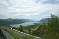 |
1922 |
Portland
45°39′19.3″N 121°54′13.2″W |
Oregon |
United States |
roads & rails |
| 111 |
1984 |
Columbia-Wrightsville Bridge |
 |
1930 |
Columbia
40°1′42.4″N 76°31′5.6″W |
Pennsylvania |
United States |
bridges |
| 112 |
1984 |
Golden Gate Bridge |
 |
1937 |
San Francisco
37°49′11.7″N 122°28′42.7″W |
California |
United States |
bridges |
| 113 |
1984 |
Hoover Dam |
 |
1935 |
Boulder City
36°0′57.7″N 114°44′14.8″W |
Nevada & Arizona |
United States |
dams |
| 114 |
1984 |
Lowell Waterpower System |
 |
1821 |
Lowell
42°38′48.5″N 71°18′41.6″W |
Massachusetts |
United States |
power generation |
| 115 |
1984 |
Panama Canal |
 |
1914 |
Colón to Panama City9°7′2.2″N 79°43′7.6″W |
|
Panama |
water transportation |
| 116 |
1984 |
Rocky River Pumped Storage Hydro-Plant |
|
1925 |
New Milford
41°34′49.7″N 73°26′13.2″W |
Connecticut |
United States |
power generation |
| 117 |
1985 |
Bayonne Bridge |
 |
1931 |
Bayonne to Staten Island
40°38′29.8″N 74°8′31.6″W |
New Jersey & New York |
United States |
bridges |
| 118 |
1985 |
Beginning Point of the U.S. Public Land Survey |
 |
1785 |
Liverpool
40°38′19.7″N 80°31′8.4″W |
Ohio |
United States |
surveys & maps |
| 119 |
1985 |
Cape Cod Canal |
 |
1914 |
Barnstable County
41°45′51.1″N 70°34′6.3″W |
Massachusetts |
United States |
water transportation |
| 120 |
1985 |
Chesapeake and Delaware Canal |
 |
1828 (rebuilt 1927) |
New Castle
39°32′34″N 75°43′14″W |
Delaware |
United States |
water transportation |
| 121 |
1985 |
Davis Island Lock and Dam |
 |
1885 |
Pittsburgh
40°29′35″N 80°3′56″W |
Pennsylvania |
United States |
water transportation |
| 122 |
1985 |
Forth Railway Bridge |
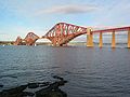 |
1890 |
North Queensferry to South Queensferry
56°0′1.5″N 3°23′19.4″W |
|
Scotland |
bridges |
| 123 |
1985 |
Going-to-the-Sun Road |
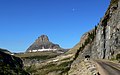 |
1932 |
Glacier National Park
48°41′42″N 113°49′1.2″W |
Montana |
United States |
roads & rails |
| 124 |
1985 |
High Bridge |
 |
1877 |
Jessamine & Mercer Counties
37°49′1.7″N 84°43′12.4″W |
Kentucky |
United States |
bridges |
| 125 |
1985 |
Statue of Liberty |
 |
1886 |
New York Harbor
40°41′21.5″N 74°2′40.4″W |
New York[4] |
United States |
buildings |
| 126 |
1986 |
White River Concrete Arch Bridge |
 |
1930 |
Cotter
36°16′2″N 92°32′39″W |
Arkansas |
United States |
bridges |
| 127 |
1986 |
Cranetown Triangulation Site |
 |
1817 |
Cedar Grove
40°49′43.9″N 74°13′27.1″W |
New Jersey |
United States |
surveys & maps |
| 128 |
1986 |
Eiffel Tower |
 |
1889 |
Paris
48°51′30.2″N 2°17′40.2″E |
Île-de-France |
France |
buildings |
| 129 |
1986 |
El Camino Real |
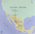 |
1598–1800s |
Santa Fe and Mexico City
34°3′38.7″N 106°53′36.6″W |
New Mexico |
United States and Mexico |
roads & rails |
| 130 |
1986 |
El Camino Real (The Royal Road) Eastern Branch |
 |
from 16th century |
San Antonio
29°26′45.8″N 98°30′12.3″W |
Texas |
United States |
roads & rails |
| 131 |
1986 |
New Castle Ice Harbor |
 |
1803 |
New Castle
39°39′28″N 75°33′39″W |
Delaware |
United States |
water transportation |
| 132 |
1986 |
Norris Dam |
 |
1936 |
Knoxville
36°13′28″N 84°5′31.5″W |
Tennessee |
United States |
dams |
| 133 |
1986 |
San Francisco–Oakland Bay Bridge |
 |
1937 |
San Francisco to Oakland
37°47′53.6″N 122°22′40.7″W |
California |
United States |
bridges |
| 134 |
1986 |
Sewall's Bridge |
 |
1761 (rebuilt 1934) |
York
43°8′10.2″N 70°39′38.3″W |
Maine |
United States |
bridges |
| 135 |
1986 |
Triborough Bridge Project |
 |
1936 |
New York City
40°47′26.6″N 73°55′33.2″W |
New York |
United States |
bridges |
| 136 |
1986 |
U.S. Army Corps of Engineers Waterways Exp. Station |
 |
1929 |
Vicksburg
32°18′4.2″N 90°52′18″W |
Mississippi |
United States |
research & educational |
| 137 |
1986 |
U.S. Capitol |
 |
1793, rebuilt 1863 |
Washington
38°53′23″N 77°0′33″W |
District of Columbia |
United States |
buildings |
| 138 |
1987 |
Allegheny Portage Railroad |
 |
1834 |
Hollidaysburg
40°27′23″N 78°33′3.4″W |
Pennsylvania |
United States |
roads & rails |
| 139 |
1987 |
Bonneville Dam, Columbia River System |
 |
1937 |
Bonneville
45°38′39.7″N 121°56′26.7″W |
Oregon |
United States |
power generation |
| 140 |
1987 |
Bridges of Keeseville |
 |
1843, 1878, 1888 |
Keeseville
44°30′13.2″N 73°28′57.3″W |
New York |
United States |
bridges |
| 141 |
1987 |
Dismal Swamp Canal |
 |
1805 |
Chesapeake to South Mills
36°35′34.1″N 76°23′5.4″W |
Virginia to North Carolina |
United States |
water transportation |
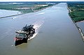
| 142 |
1987 |
Houston Ship Channel |
 |
1837–present |
Houston
29°44′35.8″N 95°6′16.5″W |
Texas |
United States |
water transportation |
| 143 |
1987 |
Kamehameha V Post Office |
 |
1871 |
Honolulu
21°18′34.6″N 157°51′47.4″W |
Hawaii |
United States |
buildings |
| 144 |
1987 |
Frisco Bridge |
 |
1892 |
Memphis
35°7′43.6″N 90°4′34.7″W |
Tennessee & Arkansas |
United States |
bridges |
| 145 |
1987 |
Quebec Bridge |
 |
1917 |
Quebec City
46°44′45.6″N 71°17′17.3″W |
Quebec |
Canada |
bridges |
| 146 |
1988 |
Belle Fourche Dam |
 |
1911 |
Belle Fourche
44°43′51.3″N 103°40′36.8″W |
South Dakota |
United States |
dams |
| 147 |
1988 |
École Nationale des Ponts et Chaussées |
 |
1747 |
Paris
48°51′20.9″N 2°19′49.9″E |
Île-de-France |
France |
research & educational |
| 148 |
1988 |
Keokuk Hydro-Power System |
 |
1913 |
Keokuk
40°23′56.6″N 91°21′49″W |
Iowa |
United States |
power generation |
| 149 |
1988 |
Portion of the Pennsylvania Turnpike between the Irwin Interchange and Carlsie Interchange |
 |
1940/11964/1968 |
40°1′49.9″N 78°29′33.6″W |
Pennsylvania |
United States |
roads & rails |
| 150 |
1988 |
River des Peres Sewerage & Drainage Works |
 |
1924 to 1931 |
St. Louis
38°39′42.3″N 90°18′33.9″W |
Missouri |
United States |
water supply & control |
| 151 |
1988 |
Sydney Harbour Bridge |
 |
1932 |
Sydney
33°51′8.1″S 151°12′38.6″E |
New South Wales |
Australia |
bridges |
| 152 |
1989 |
Royal Colonial Boundary of 1665 |
 |
1728–1819 |
Middlesboro
36°36′2.9″N 83°40′31.5″W |
Kentucky |
United States |
surveys & maps |
| 153 |
1989 |
Zhaozhou Bridge |
 |
605 AD |
Zhaoxian
37°43′12.9″N 114°45′47.7″E |
Hebei |
China |
bridges |
| 154 |
1990 |
Fort Peck Dam |
 |
1940 |
Fort Peck
48°0′10.1″N 106°24′58″W |
Montana |
United States |
dams |
| 155 |
1990 |
Maria Pia Bridge |
 |
1877 |
Oporto
41°8′23.4″N 8°35′49.6″W |
Norte |
Portugal |
bridges |
| 156 |
1990 |
Salginatobel Bridge |
 |
1930 |
Grisons
46°58′54.4″N 9°43′5.1″E |
Graubünden |
Switzerland |
bridges |
| 157 |
1991 |
Eddystone Lighthouse |
 |
1882 |
off Plymouth
50°11′2″N 4°16′5.1″W |
|
England |
water transportation |
| 158 |
1991 |
Fritz Engineering Laboratory |
|
1910 |
Bethlehem
40°36′28.9″N 75°22′34.3″W |
Pennsylvania |
United States |
research & educational |
| 159 |
1991 |
St. Clair Tunnel |
 |
1891 |
Port Huron
42°57′32.4″N 82°25′22.2″W |
Michigan |
United States |
tunnels |
| 160 |
1991 |
Thames Tunnel |
 |
1843 |
London
51°30′12.7″N 0°3′13.3″W |
|
England |
tunnels |
| 161 |
1992 |
Acquedotto Traiano-Paolo |
 |
110 AD |
Rome
42°3′12.9″N 12°20′18.7″E |
Lazio |
Italy |
water supply & control |
| 162 |
1992 |
Bridges of Niagara |
 |
1849, 1855, 1883, 1898, 1941 |
Niagara Gorge
43°5′24.8″N 79°4′3.4″W |
Ontario and New York |
Canada and United States |
bridges |
| 163 |
1992 |
Duck Creek Aqueduct |
 |
1846 |
Metamora
39°26′46.1″N 85°7′48″W |
Indiana |
United States |
water supply & control |
| 164 |
1992 |
Hohokam Canal System |
 |
600 – 1450 AD |
Maricopa County
33°26′43.8″N 111°48′56.2″W |
Arizona |
United States |
water supply & control |
| 165 |
1992 |
San Jacinto Monument |
 |
1939 |
Houston
29°44′59.5″N 95°4′50.6″W |
Texas |
United States |
buildings |
| 166 |
1993 |
Blimp Hangars |
 |
1942 |
Tustin
33°42′10.8″N 117°49′26.3″W |
California |
United States |
aviation |
| 167 |
1993 |
Denison Dam |
 |
1943 |
Denison
33°49′52.6″N 96°34′16″W |
Texas & Oklahoma |
United States |
dams |
| 168 |
1993 |
Hanford B Reactor |
 |
1944 |
Richland
46°37′49.1″N 119°38′50.3″W |
Washington |
United States |
power generation |
| 169 |
1993 |
Stevens Pass Railroad Tunnels & Switchback System |
 |
1900 |
Stevens Pass
47°44′52.4″N 121°7′26.3″W |
Washington |
United States |
tunnels |
| 170 |
1994 |
Colorado River Aqueduct |
 |
1933–1941 |
Blythe
34°17′23.6″N 114°10′19.5″W |
California |
United States |
water supply & control |
| 171 |
1994 |
Kavanagh Building |
 |
1936 |
Buenos Aires
34°35′43.7″S 58°22′28.9″W |
|
Argentina |
buildings |
| 172 |
1994 |
Missouri River Bridges |
 |
1926 |
Chamberlain
43°48′42.1″N 99°20′16.1″W |
South Dakota |
United States |
bridges |
| 173 |
1995 |
Red Hill Underground Fuel Storage Facility |
 |
1943 |
Honolulu
21°22′18″N 157°53′44″W |
Hawaii |
United States |
tunnels |
| 174 |
1994 |
Viaducto del Malleco |
 |
1890 |
Malleco River
37°57′47″S 72°26′20″W |
Central Chile |
Chile |
bridges |
| 175 |
1994 |
White Pass and Yukon Route |
 |
1900 |
Whitehorse, Yukon to Skagway, Alaska
59°37′28″N 135°8′18.3″W |
Yukon Territory to Alaska |
Canada & United States |
roads & rails |
| 176 |
1995 |
Alaska Highway |
 |
1942 |
Dawson Creek to Delta Junction
59°54′39.6″N 131°33′20.6″W |
British Columbia to Alaska |
Canada & United States |
roads & rails |
| 177 |
1995 |
Banaue Rice Terraces |
 |
100 BC |
Banaue
16°55′57.4″N 121°3′30.1″E |
Ifugao |
Philippines |
water supply & control |
| 178 |
1995 |
Acueducto de Queretaro |
 |
1738 |
Querétaro
20°35′48″N 100°22′20.6″W |
|
Mexico |
water supply & control |
| 179 |
1995 |
Victoria Falls Bridge |
 |
1905 |
Zambezi River
17°55′41.7″S 25°51′26.1″E |
|
Zimbabwe & Zambia |
bridges |
| 180 |
1996 |
Armour-Swift-Burlington Bridge |
 |
1912 |
Kansas City
39°7′0″N 94°34′47.5″W |
Missouri |
United States |
bridges |
| 181 |
1996 |
Dublin-Belfast railway line |
 |
1839 |
Dublin to Belfast
53°43′0″N 6°20′15″W |
|
Ireland & Northern Ireland |
roads & rails |
| 182 |
1996 |
Kentucky Dam |
 |
1944 |
Gilbertsville
37°0′46.4″N 88°16′10.1″W |
Kentucky |
United States |
dams |
| 183 |
1996 |
Lake Moeris Quarry Road |
|
2575–2137 BC |
Lake Moeris
29°37′24.2″N 30°38′40.4″E |
|
Egypt |
roads & rails |
| 184 |
1996 |
City Plan of Philadelphia |
 |
1682 |
Philadelphia
39°57′28.6″N 75°10′14.2″W |
Pennsylvania |
United States |
surveys & maps |
| 185 |
1996 |
San Antonio River Walk & Flood Control System |
 |
1929 to 1941 |
San Antonio
29°25′30.7″N 98°29′29.7″W |
Texas |
United States |
water control & supply |
| 186 |
1997 |
Grand Coulee Dam |
 |
1941 |
Grand Coulee
47°57′23.8″N 118°58′51.6″W |
Washington |
United States |
dams |
| 187 |
1997 |
Lake Washington Ship Canal & Hiram M. Chittenden Locks |
 |
1917 |
Seattle
47°39′55.7″N 122°23′49.6″W |
Washington |
United States |
water transportation |
| 188 |
1997 |
Navajo Bridge |
 |
1929 |
Page
36°49′3.4″N 111°37′52.3″W |
Arizona |
United States |
bridges |
| 189 |
1997 |
North Island Main Trunk Railway |
 |
1885–1908 |
Auckland to Wellington
39°13′39.8″S 175°23′55.5″E |
North Island |
New Zealand |
roads & rails |
| 190 |
1997 |
Northampton Street Bridge |
 |
1896 |
Easton to Phillipsburg
40°41′29.3″N 75°12′14.4″W |
Pennsylvania & New Jersey |
United States |
bridges |
| 191 |
1997 |
Snowy Mountains Scheme |
 |
1974 |
Snowy Mountains
35°36′40.1″S 148°17′29.8″E |
New South Wales |
Australia |
power generation |
| 192 |
1997 |
Texas Commerce Bank Building (formerly Gulf, now Chase) |
 |
1929 |
Houston
29°45′32″N 95°21′49.7″W |
Texas |
United States |
buildings |
| 193 |
1997 |
Walnut Street Bridge |
 |
1890 |
Harrisburg
40°15′27.1″N 76°53′9.8″W |
Pennsylvania |
United States |
bridges |
| 194 |
1998 |
Brooks AFB, Old Hangar 9 |
 |
1918 |
San Antonio
29°20′38.5″N 98°26′38.9″W |
Texas |
United States |
aviation |
| 195 |
1998 |
Canton Viaduct |
 |
1835 |
Canton
42°9′28.8″N 71°9′14.5″W |
Massachusetts |
United States |
bridges |
| 196 |
1998 |
Göta Canal |
 |
1810 to 1832 |
Gothenburg
58°29′53.9″N 16°10′28.9″E |
Västra Götaland |
Sweden |
water transportation |
| 197 |
1998 |
Moseley Wrought Iron Arch Bridge |
 |
1864 |
North Andover
42°40′8.6″N 71°7′21.3″W |
Massachusetts |
United States |
bridges |
| 198 |
1998 |
Tehachapi Pass Railroad Line |
 |
1876 |
Kern County
35°12′3″N 118°32′13″W |
California |
United States |
roads & rails |
| 199 |
1999 |
Acueducto de Segovia |
 |
50 AD |
Segovia
40°56′52.7″N 4°7′4.3″W |
Castile and León |
Spain |
water supply & control |
| 200 |
1999 |
Arroyo Seco Parkway |
 |
1940 |
Los Angeles
34°4′23″N 118°14′2″W |
California |
United States |
roads & rails |
| 201 |
1999 |
Blue Ridge Parkway |
 |
begun 1935 |
Shenandoah NP to Great Smokey Mountains NP
36°26′28.5″N 81°5′42.9″W |
Virginia to North Carolina |
United States |
roads & rails |
| 202 |
1999 |
Cape Hatteras Lighthouse |
 |
1870 |
Cape Hatteras
35°15′2″N 75°31′43.7″W |
North Carolina |
United States |
water transportation |
| 203 |
1999 |
Maine Turnpike |
 |
1947 |
43°21′17.2″N 70°35′26.2″W |
Maine |
United States |
roads & rails |
| 204 |
1999 |
McNeill Street Pumping Station |
 |
1887 |
Shreveport
32°31′3.8″N 93°45′25.9″W |
Louisiana |
United States |
water supply & control |
| 205 |
2000 |
Cedar Falls Hydroelectric Project |
 |
1901 |
Seattle
47°25′9.2″N 121°46′54.4″W |
Washington |
United States |
power generation |
| 206 |
2000 |
Forth and Clyde Canal and Union Canal |
 |
1790 |
55°56′18″N 4°9′18.8″W |
|
Scotland |
water transportation |
| 207 |
2000 |
Hagia Sophia |
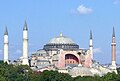 |
537 AD |
Istanbul
41°0′31.2″N 28°58′48.6″E |
Istanbul |
Turkey |
buildings |
| 208 |
2000 |
Muskingum River Navigation System |
 |
1837 |
Zanesville
39°43′59.5″N 81°54′29.4″W |
Ohio |
United States |
water transportation |
| 209 |
2000 |
Seventh Street Improvement Arches |
 |
1909 |
St. Paul
44°57′23″N 93°4′38″W |
Minnesota |
United States |
bridges |
| 210 |
2000 |
West Baden Springs Hotel |
 |
1902 |
West Baden Springs
38°34′1.3″N 86°37′6.6″W |
Indiana |
United States |
buildings |
| 211 |
2001 |
Bunker Hill Covered Bridge |
 |
1895, rebuilt 1994 |
Claremont
35°43′17.5″N 81°6′54.8″W |
North Carolina |
United States |
bridges |
| 212 |
2001 |
Galveston Seawall and Grade Raising |
 |
1904 (expanded through 1963) |
Galveston
29°18′9″N 94°46′27″W |
Texas |
United States |
water supply & control |
| 213 |
2001 |
Baltimore & Ohio Roundhouse & Shop Complex |
 |
1842 to 1850s |
Martinsburg
39°27′33″N 77°57′36″W |
West Virginia |
United States |
buildings |
| 214 |
2002 |
Conwy Suspension Bridge |
 |
1826 |
Conwy
53°16′49.7″N 3°49′25.6″W |
Conwy |
Wales |
bridges |
| 215 |
2002 |
Conwy Tubular Bridge |
 |
1849 |
Conwy
53°16′49″N 3°49′25″W |
Conwy |
Wales |
bridges |
| 216 |
2002 |
Dorton Arena |
 |
1952 |
Raleigh
35°47′38.4″N 78°42′37.3″W |
North Carolina |
United States |
buildings |
| 217 |
2002 |
East Maui Irrigation System |
 |
1876 to 1923 |
East Maui
20°52′0″N 156°13′0″W |
Hawaii |
United States |
water supply & control |
| 218 |
2002 |
Five Stone Arch Bridges |
 |
1830 to 1866 |
Hillsborough
43°7′49″N 71°56′41.1″W |
New Hampshire |
United States |
bridges |
| 219 |
2002 |
Louisville and Portland Canal Locks & Dam |
 |
1830, rebuilt 1962 |
Louisville
38°16′18.5″N 85°46′45.6″W |
Kentucky |
United States |
water transportation |
| 220 |
2002 |
Marshall Building |
|
1906 |
Milwaukee
43°2′0.9″N 87°54′31.2″W |
Wisconsin |
United States |
buildings |
| 221 |
2002 |
Menai Suspension Bridge |
 |
1826 |
Anglesey
53°13′13.1″N 4°9′48.1″W |
|
Wales |
bridges |
| 222 |
2002 |
Old Cape Henry Light, |
 |
1792, replaced 1881 |
Virginia Beach
36°55′32.8″N 76°0′29.3″W |
Virginia |
United States |
water transportation |
| 223 |
2002 |
Portland Head Light |
 |
1787 |
Cape Elizabeth
43°37′23.2″N 70°12′28.4″W |
Maine |
United States |
water transportation |
| 224 |
2002 |
Shannon Hydroelectric Scheme |
 |
1929 |
52°42′20″N 8°36′46″W |
|
Ireland |
power generation |
| 225 |
2002 |
Waldo-Hancock Suspension Bridge |
 |
1931 |
Bucksport
44°33′37.6″N 68°48′5.9″W |
Maine |
United States |
bridges |
| 226 |
2003 |
Horseshoe Curve |
 |
1854 |
Altoona
40°29′54″N 78°29′9.1″W |
Pennsylvania |
United States |
roads & rails |
| 227 |
2003 |
Suez Canal |
 |
1869 |
Port Said to Suez
30°42′18″N 32°20′39″E |
|
Egypt |
water transportation |
| 228 |
2003 |
Tennessee State Capitol |
 |
1845 to 1877 |
Nashville
36°9′57.1″N 86°47′3.4″W |
Tennessee |
United States |
buildings |
| 229 |
2004 |
Hwaseong Fortress |
 |
1796 |
Suwon
37°17′0″N 127°0′57.6″E |
Gyeonggi-do |
Republic of Korea |
buildings |
| 230 |
2004 |
Mesa Verde Reservoirs |
 |
750 to 1180 AD |
Montezuma County
37°14′26.3″N 108°30′16.7″W |
Colorado |
United States |
water supply & control |
| 231 |
2004 |
Northern Pacific High Line Bridge No 64 |
 |
1908 |
Valley City
46°56′18.9″N 97°59′26.9″W |
North Dakota |
United States |
bridges |
| 232 |
2004 |
Old Wisla Bridge |
 |
|
Tczew
54°5′33.7″N 18°48′22.2″E |
Vistula River |
Poland |
bridges |
| 233 |
2005 |
Great Western Railway |
 |
1838 |
51°37′16.2″N 1°21′26.8″W |
|
England & Wales |
roads & rails |
| 234 |
2005 |
Philadelphia City Hall |
 |
1901 |
Philadelphia
39°57′10.1″N 75°9′48.8″W |
Pennsylvania |
United States |
buildings |
| 235 |
2005 |
Sweetwater Dam |
 |
1888 |
Spring Valley
32°41′29.8″N 117°0′29.2″W |
California |
United States |
dams |
| 236 |
2005 |
Stanley Hydraulics Laboratory at the University of Iowa |
 |
established 1919 |
Iowa City
41°39′25.8″N 91°32′29″W |
Iowa |
United States |
research & educational |
| 237 |
2006 |
Machu Picchu |
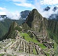 |
1460 AD |
13°9′48″S 72°32′44″W |
|
Peru |
urban development |
| 238 |
2006 |
Portland Observatory |
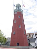 |
1807 |
Portland
43°39′55.4″N 70°14′53.7″W |
Maine |
United States |
water transportation |
| 239 |
2006 |
Tipon |
 |
1200 – 1534 AD |
13°34′15″S 71°46′59″W |
|
Peru |
water supply & control |
| 240 |
2007 |
Caledonian Canal |
 |
1822 |
Great Glen
57°6′44.9″N 4°44′18.8″W |
|
Scotland |
water transportation |
| 241 |
2007 |
Craigellachie Bridge Moray |
 |
1814 |
Strathspey
57°29′28.8″N 3°11′38″W |
|
Scotland |
bridges |
| 242 |
2008 |
Choate Bridge |
 |
1764 |
Ipswich
42°40′46.1″N 70°50′13.6″W |
Massachusetts |
United States |
bridges |
| 243 |
2008 |
Goldfields Water Supply |
 |
1903 |
Kalgoorlie
31°57′36″S 116°10′16.7″E |
Western Australia |
Australia |
water supply & control |
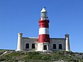
| 244 |
2008 |
Lacey V. Murrow Bridge and Mount Baker Ridge Tunnels |
 |
1940 |
King County
47°35′23.2″N 122°16′44.3″W |
Washington |
United States |
bridges |
| 245 |
2008 |
Woodhead Dam |
 |
1897 |
Cape Town
33°58′38.2″S 18°24′7.9″E |
Western Cape |
South Africa |
dams |
| 246 |
2009 |
Guayabo Ceremonial Center |
 |
300 BC - AD 1400 |
Turrialba
9°58′21.7″N 83°41′26.6″W |
Turrialba |
Costa Rica |
civil engineering profession |
| 247 |
2009 |
Vancouver's Mapping of the West Coast of North America |
 |
1791–1795 |
45°0′0″N 124°0′43″W |
|
Canada, Mexico and United States |
surveys & maps |
| 248 |
2009 |
Poughkeepsie-Highland Bridge |
 |
1886–1888 |
Poughkeepsie
41°42′38.5″N 73°56′41.1″W |
New York |
United States |
bridges |
| 249 |
2009 |
Manhattan Bridge |
 |
1909 |
New York City
40°42′27″N 73°59′26.9″W |
New York |
United States |
bridges |
| 250 |
2009 |
Queensboro Bridge |
 |
1909 |
New York City
40°45′24.2″N 73°57′15.1″W |
New York |
United States |
bridges |
| 251 |
2009 |
Williamsburg Bridge |
 |
1903 |
New York City
40°42′49.2″N 73°58′20.5″W |
New York |
United States |
bridges |
| 252 |
2010 |
Mackinac Bridge |
 |
1958 |
Straits of Mackinac
45°48′48.8″N 84°43′42″W |
Michigan |
United States |
bridges |
| 253 |
2010 |
Rensselaer Polytechnic Institute |
 |
1824 |
Troy
42°43′48″N 73°40′39″W |
New York |
United States |
research & educational |
| 254 |
2010 |
Thomas Viaduct Railroad Bridge[5] |
 |
1835 |
Elkridge and Relay
39°13′17.5″N 76°42′48.1″W |
Maryland |
United States |
bridges |
| 255 |
2011 |
Utica Memorial Auditorium |
 |
1959 |
Utica
43°6′17.9″N 75°14′0.5″W |
New York |
United States |
buildings |
| 256 |
2011 |
Tacoma Narrows Bridges[6] |
 |
1940–1950 |
Tacoma
47°16′8″N 122°33′3″W |
Washington |
United States |
bridges |
| 257 |
2011 |
Flight of Five Locks |
 |
1915 |
Waterford
42°48′2.8″N 73°41′29.1″W |
New York |
United States |
water transportation |
| 258 |
2011 |
Petra |
 |
309 BC |
30°19′43″N 35°26′31″E |
Ma'an Governorate |
Jordan |
buildings |
| 259 |
2012 |
Zion-Mount Carmel Tunnel and Highway |
 |
1930 |
Zion National Park
37°12′40.7″N 112°57′29.6″W |
Utah |
United States |
roads & rails |
| 260 |
2012 |
Huey P. Long Bridge |
 |
1935 |
Jefferson Parish
29°56′38.8″N 90°10′7.6″W |
Louisiana |
United States |
bridges |
| 261 |
2012 |
Grand Central Terminal |
 |
1913 |
New York City
40°45′10.3″N 73°58′37.9″W |
New York |
United States |
roads & rails |
| 262 |
2013 |
Titan Clydebank crane |
 |
1907 |
Clydebank
55°53′50.5″N 4°24′31.2″W |
West Dunbartonshire |
Scotland |
buildings |
| 263 |
2013 |
Waterford Bridges |
 |
1909 |
Troy and Waterford
42°47′19.3″N 73°40′25.8″W |
New York |
United States |
bridges |
| 264 |
2013 |
Lake Pontchartrain Causeway |
 |
1956 |
Lake Pontchartrain
30°11′59.2″N 90°7′21.7″W |
Louisiana |
United States |
bridges |
| 265 |
2014 |
The Dalles Dam |
 |
1957 |
Columbia River
45°36′50.3″N 121°8′3″W |
Oregon & Washington |
United States |
dams |
| 266 |
2015 |
Gladesville Bridge |
 |
1964 |
Sydney
33°50′31.3″S 151°8′51.8″E |
New South Wales |
Australia |
bridges |
| 267 |
2016 |
Cape Agulhas Lighthouse |
 |
1848 |
L'Agulhas
34°49′45.7″S 20°0′32.4″E |
|
South Africa |
water transportation |
| 268 |
2016 |
Arrowrock Dam |
 |
1912 |
Boise and Elmore
43°35′43″N 115°55′21.1″W |
Idaho |
United States |
dams |
| 269 |
2016 |
All-American Canal[7] |
 |
1940 |
Imperial County
32°52′59″N 114°27′54″W |
California |
United States |
water supply & control |
| 270 |
2016 |
Canal du Midi[8] |
 |
1681 |
Toulouse to Étang de Thau
43°12′52.9″N 2°25′49.8″E |
Occitania |
France |
water transportation |
| 271 |
2016 |
Liverpool and Manchester Railway[9] |
 |
1830 |
Liverpool to Manchester
53°27′10.8″N 2°36′58.6″W |
North West England |
England |
roads & rails |
| 272 |
2017 |
Bonnet Carré Spillway |
 |
1931 |
St. Charles Parish
30°0′7.2″N 90°26′23.3″W |
Louisiana |
United States |
dams |
| 273 |
2017 |
Duluth Aerial Ferry/Lift Bridge[10] |
 |
1905 |
Duluth
46°46′45.8″N 92°5′35.3″W |
Minnesota |
United States |
bridges |
| 274 |
2017 |
Mississippi River Basin Model[11] |
 |
1966 |
Jackson
32°18′21.8″N 90°19′8.2″W |
Mississippi |
United States |
research & educational |
| 275 |
2017 |
Chaffey Brothers Irrigation Works[12] |
 |
1887 |
Mildura and Renmark
34°15′1.6″S 142°13′28.8″E |
Victoria and South Australia |
Australia |
water supply & control |
| 276 |
2017 |
Qhapaq Ñan: The Great Inka Road System[13] |
 |
1000 BC - 1533 AD |
13°13′0.3″S 72°23′5.2″W |
|
Colombia to Chile |
roads & rails |
| 277 |
2017 |
Tunnel of Eupalinos[14] |
 |
520 BC |
Samos
37°41′40.6″N 26°55′48″E |
North Aegean |
Greece |
tunnels |
| 278 |
2018 |
Augusta Canal and Industrial District |
 |
1845 |
Augusta
33°31′17.6″N 82°0′38.9″W |
Georgia |
United States |
power generation |
| 279 |
2018 |
Old River Station[15] |
 |
1907 |
Cincinnati
39°4′17″N 84°25′40″W |
Ohio |
United States |
water supply & control |
| 280 |
2018 |
Boundary Layer Wind Tunnel Laboratory[16] |
|
1965 |
London
43°0′14″N 81°16′32.5″W |
Ontario |
Canada |
research & educational |
| 281 |
2018 |
Institution of Civil Engineers[17] |
 |
1818 |
London
51°30′4″N 0°7′44.4″W |
|
England |
research & educational |
| 282 |
2018 |
Union Chain Bridge[18] |
 |
1820 |
Horncliffe to Fishwick
55°45′9.3″N 2°6′24.4″W |
|
England to Scotland |
bridges |
| 283 |
2019 |
Kaibab Trail Suspension Bridge[19] |
 |
1928 |
Grand Canyon
36°6′53.2″N 112°5′21.1″W |
Arizona |
United States |
bridges |
| 284 |
2019 |
Union Pacific Railroad[20] |
 |
1868 |
Omaha westward
41°15′0.9″N 95°55′37.4″W |
Nebraska |
United States |
roads & rails |
| 285 |
2019 |
Silver Bridge Collapse - Creation of National Inspection Standards[21] |
 |
1967 |
Point Pleasant
38°50′42″N 82°8′28″W |
West Virginia |
United States |
bridges |
| 286 |
2020 |
NASA Vehicle Assembly Building[22] |
 |
1966 |
Titusville
28°35′11″N 80°39′5″W |
Florida |
United States |
buildings |
| 287 |
2021 |
Main Avenue Bridge[23] |
 |
1939 |
Cleveland
41°29′55.2″N 81°42′18.5″W |
Ohio |
United States |
bridges |
| 288 |
2021 |
Sydney Opera House[12] |
 |
1973 |
Sydney
33°51′24″S 151°12′55″E |
New South Wales |
Australia |
buildings |
| 289 |
2022 |
David Thompson's Surveying and Mapping of the Northwest of North America[24] |
 |
1814 |
|
|
Canada & United States |
surveys & maps |
| 290 |
2022 |
Portage Lake Bridge[25] |
 |
1959 |
Hancock and Houghton
47°7′25.9″N 88°34′26.7″W |
Michigan |
United States |
bridges |
| 291 |
2022 |
Salmon Creek Dam[26] |
 |
1914 |
Juneau
58°20′30″N 134°24′12″W |
Alaska |
United States |
dams |
| 292 |
2023 |
New Orleans Drainage System[27] |
 |
1900 |
New Orleans
29°59′12″N 90°7′28″W |
Louisiana |
United States |
water supply & control |
| 293 |
2023 |
Crystal Springs Dam[28] |
 |
1890 |
San Mateo County
37°31′43″N 122°21′44″W |
California |
United States |
dams |
| 294 |
2024 |
Morris Dam[29] |
 |
1934 |
Azusa
34°10′29″N 117°52′52″W |
California |
United States |
dams |
|


.jpg)


.png)


.jpg)
.jpg)


_-_Geographicus_-_CarolinaGeorgia-bowen-1747.jpg)

_Spillway_01.jpg)


.jpg)


1940.jpg)


.jpg)


_001.jpg)


.jpg)


.jpg)


.jpg)
.jpg)
.jpg)


