Top Qs
Timeline
Chat
Perspective
Henderson Valley
Locality in New Zealand From Wikipedia, the free encyclopedia
Remove ads
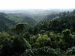
Henderson Valley is a locality in West Auckland, New Zealand. The major road in the locality is Henderson Valley Road, and Scenic Drive is on the western boundary.[3]
Remove ads
History
The Henderson Valley is in the traditional rohe of Te Kawerau ā Maki,[4] and was traditionally known as Ōpanuku.[5] Ōpanuku refers to one of the oldest Te Kawerau ā Maki ancestors, Panuku, the wife of Parekura who died after being kidnapped by a warrior named Nihotupu.[6][4] Te Kawerau ā Maki had a settlement along the Opanuku Stream known as Ōpareira.[6] The name refers to Pareira, the niece of early ancestor and voyager Toi-te-huatahi. Pareira lived at Te Wai-o-Pareira / Henderson Creek and would seasonally inhabit the Henderson Valley, harvesting the resources of the forest.[6]
The Opanuku Stream which flows down the valley was one of the earliest waterways to be dammed for kauri logging in West Auckland, in the 1850s.[7] The valley was settled by pākehā by the 1880s, with Henderson Valley Road providing access.[8][9]
In the 1920s, the Henderson Valley Scenic Reserve/Carey Park was a popular picnic and swimming area known as Ferndale, where the Brown Owl Tea Rooms was located.[10]
Remove ads
Demographics
Summarize
Perspective
Henderson Valley statistical area covers 15.04 km2 (5.81 sq mi)[1] and had an estimated population of 1,440 as of June 2025,[2] with a population density of 96 people per km2.

Henderson Valley had a population of 1,422 in the 2023 New Zealand census, a decrease of 18 people (−1.2%) since the 2018 census, and an increase of 69 people (5.1%) since the 2013 census. There were 735 males, 678 females and 12 people of other genders in 489 dwellings.[13] 4.2% of people identified as LGBTIQ+. The median age was 42.5 years (compared with 38.1 years nationally). There were 264 people (18.6%) aged under 15 years, 237 (16.7%) aged 15 to 29, 726 (51.1%) aged 30 to 64, and 198 (13.9%) aged 65 or older.[12]
People could identify as more than one ethnicity. The results were 86.9% European (Pākehā); 14.3% Māori; 7.8% Pasifika; 7.4% Asian; 0.8% Middle Eastern, Latin American and African New Zealanders (MELAA); and 2.3% other, which includes people giving their ethnicity as "New Zealander". English was spoken by 97.9%, Māori language by 1.9%, Samoan by 1.5%, and other languages by 12.2%. No language could be spoken by 1.3% (e.g. too young to talk). New Zealand Sign Language was known by 0.6%. The percentage of people born overseas was 23.6, compared with 28.8% nationally.
Religious affiliations were 25.9% Christian, 0.2% Hindu, 0.4% Islam, 0.6% Māori religious beliefs, 0.4% Buddhist, 0.4% New Age, and 1.3% other religions. People who answered that they had no religion were 62.2%, and 8.4% of people did not answer the census question.
Of those at least 15 years old, 318 (27.5%) people had a bachelor's or higher degree, 636 (54.9%) had a post-high school certificate or diploma, and 207 (17.9%) people exclusively held high school qualifications. The median income was $49,400, compared with $41,500 nationally. 201 people (17.4%) earned over $100,000 compared to 12.1% nationally. The employment status of those at least 15 was that 630 (54.4%) people were employed full-time, 177 (15.3%) were part-time, and 30 (2.6%) were unemployed.[12]
Remove ads
Education
Henderson Valley School is a coeducational contributing primary (years 1–6) school with a roll of 325 students as of July 2025.[14][15] The school opened in 1915.[16]
Notes
Wikiwand - on
Seamless Wikipedia browsing. On steroids.
Remove ads


