Hartkirchen
Place in Upper Austria, Austria From Wikipedia, the free encyclopedia
Place in Upper Austria, Austria From Wikipedia, the free encyclopedia
Hartkirchen is a municipality in the district of Eferding in the Austrian state of Upper Austria.
You can help expand this article with text translated from the corresponding article in German. (November 2016) Click [show] for important translation instructions.
|
Hartkirchen | |
|---|---|
 | |
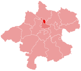
 Location within Upper Austria | |
| Coordinates: 48°21′50″N 14°00′10″E | |
| Country | Austria |
| State | Upper Austria |
| District | Eferding |
| Government | |
| • Mayor | Wolfram Moshammer (SPÖ) |
| Area | |
| • Total | 39.08 km2 (15.09 sq mi) |
| Elevation | 273 m (896 ft) |
| Population (2018-01-01)[2] | |
| • Total | 4,099 |
| • Density | 100/km2 (270/sq mi) |
| Time zone | UTC+1 (CET) |
| • Summer (DST) | UTC+2 (CEST) |
| Postal code | 4081 |
| Area code | 07273 |
| Vehicle registration | EF |
| Website | www.hartkirchen.ooe.gv.at |
Hartkirchen lies in the Hausruckviertel. About 27 percent of the municipality is forest and 60 percent farmland.
Seamless Wikipedia browsing. On steroids.
Every time you click a link to Wikipedia, Wiktionary or Wikiquote in your browser's search results, it will show the modern Wikiwand interface.
Wikiwand extension is a five stars, simple, with minimum permission required to keep your browsing private, safe and transparent.