Guillestre
Commune in Provence-Alpes-Côte d'Azur, France From Wikipedia, the free encyclopedia
Commune in Provence-Alpes-Côte d'Azur, France From Wikipedia, the free encyclopedia
Guillestre (French pronunciation: [ɡijɛstʁ]; Vivaro-Alpine: Guilhèstra) is a commune in the Hautes-Alpes department in southeastern France.
You can help expand this article with text translated from the corresponding article in French. (July 2014) Click [show] for important translation instructions.
|
Guillestre | |
|---|---|
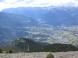
 A panoramic view of Guillestre to the right, and the village of Risoul, left | |
| Coordinates: 44°40′N 6°39′E | |
| Country | France |
| Region | Provence-Alpes-Côte d'Azur |
| Department | Hautes-Alpes |
| Arrondissement | Briançon |
| Canton | Guillestre |
| Government | |
| • Mayor (2020–2026) | Christine Portevin[1][2] |
| Area 1 | 51.29 km2 (19.80 sq mi) |
| Population (2021)[3] | 2,292 |
| • Density | 45/km2 (120/sq mi) |
| Time zone | UTC+01:00 (CET) |
| • Summer (DST) | UTC+02:00 (CEST) |
| INSEE/Postal code | 05065 /05600 |
| Elevation | 867–2,694 m (2,844–8,839 ft) (avg. 1,050 m or 3,440 ft) |
| 1 French Land Register data, which excludes lakes, ponds, glaciers > 1 km2 (0.386 sq mi or 247 acres) and river estuaries. | |
The village lies in the northwestern part of the commune, on the left bank of the Chagné, a stream, tributary of the Guil, which forms all of the commune's northern border, before flowing into the Durance, which forms part of the commune's western border. The village also lies high within the alps of France.
| Year | Pop. | ±% p.a. |
|---|---|---|
| 1968 | 1,479 | — |
| 1975 | 1,466 | −0.13% |
| 1982 | 1,937 | +4.06% |
| 1990 | 2,000 | +0.40% |
| 1999 | 2,211 | +1.12% |
| 2007 | 2,273 | +0.35% |
| 2012 | 2,367 | +0.81% |
| 2017 | 2,344 | −0.20% |
| Source: INSEE[4] | ||
Seamless Wikipedia browsing. On steroids.
Every time you click a link to Wikipedia, Wiktionary or Wikiquote in your browser's search results, it will show the modern Wikiwand interface.
Wikiwand extension is a five stars, simple, with minimum permission required to keep your browsing private, safe and transparent.