From Wikipedia, the free encyclopedia
Grand Island (formerly referred to as Taylor Island or La Isla de los Quenensias)[1] is an island lying between Sycamore Slough and the Sacramento River.[2][3] A post office operated at Grand Island from 1854 to 1919.[2] It is shown, labeled "Taylor Island", on an 1850 survey map of the San Francisco Bay area made by Cadwalader Ringgold[4] and an 1854 map of the area by Henry Lange.[5]
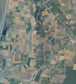
 USGS aerial imagery of the island. | |
| Geography | |
|---|---|
| Location | Northern California |
| Coordinates | 38°14′08″N 121°34′45″W[1] |
| Adjacent to | Sacramento-San Joaquin River Delta |
| Administration | |
| State | California |
| County | Solano |
Grand Island is located in Sacramento County, California at 38°14′08″N 121°34′45″W,[1] and managed by Reclamation District 3.[6]
Seamless Wikipedia browsing. On steroids.