Grade II* listed buildings in Nottinghamshire
From Wikipedia, the free encyclopedia
There are over 20,000 Grade II* listed buildings in England. This page is a list of these buildings in the county of Nottinghamshire, by district.

Ashfield
| Name | Location | Type | Completed [note 1] | Date designated | Grid ref.[note 2] Geo-coordinates |
Entry number [note 3] | Image |
|---|---|---|---|---|---|---|---|
| Church of All Saints | Annesley | Statue | 1832 | 12 October 1988 | SK5109953620 53°04′39″N 1°14′19″W |
1275939 |  |
| Church of St Helen | Selston | Tower | Late 14th century | 13 October 1966 | SK4583453308 53°04′30″N 1°19′02″W |
1275170 |  |
| Church of St Mary Magdalene | Hucknall | Tower | 1925 | 12 October 1988 | SK5334649381 53°02′21″N 1°12′21″W |
1217611 |  |
| Church of St Mary Magdalene | Sutton-in-Ashfield | Tower | c. 1395 | 4 June 1980 | SK4894058959 53°07′32″N 1°16′12″W |
1221773 |  |
Bassetlaw
| Name | Location | Type | Completed [note 1] | Date designated | Grid ref.[note 2] Geo-coordinates |
Entry number [note 3] | Image |
|---|---|---|---|---|---|---|---|
| Barn and Attached Range of Farm Buildings at Manor Farm | Askham | Dovecote | 19th century | 14 November 1985 | SK7399274937 53°15′59″N 0°53′32″W |
1370116 |  Upload Photo |
| Church of St Nicholas | Askham | Parish Church | 12th century | 1 February 1967 | SK7397375000 53°16′01″N 0°53′33″W |
1045707 | 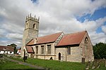 |
| Ranby Hall | Babworth | House | 19th century | 1 February 1967 | SK6547583042 53°20′25″N 1°01′05″W |
1045110 |  |
| Church of All Saints | Beckingham | Parish Church | 13th century | 1 February 1967 | SK7790090293 53°24′13″N 0°49′47″W |
1045129 |  |
| St Giles Church, Carburton | Carburton | Sundial | 18th century | 30 November 1966 | SK6111173286 53°15′11″N 1°05′08″W |
1370105 |  |
| Clumber Bridge (that Part in Worksop Rural District) | Clumber Park, Carburton | Road Bridge | c. 1770 | 30 November 1966 | SK6219473928 53°15′28″N 1°04′14″W |
1045732 |  |
| Drayton Gate | Clumber Park, Clumber and Hardwick | Gate Pier | Late 18th century | 13 February 1967 | SK6490974468 53°15′48″N 1°01′42″W |
1045058 | 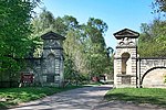 |
| Greek Garden Temple | Clumber Park, Clumber and Hardwick | Garden Temple | c. 1765 | 13 February 1967 | SK6297874535 53°15′51″N 1°03′26″W |
1156511 |  |
| Roman Garden Temple | Clumber Park, Clumber and Hardwick | Garden Temple | c. 1765 | 13 February 1967 | SK6281674762 53°15′58″N 1°03′35″W |
1156484 |  |
| The Grotto | Clumber Park, Clumber and Hardwick | Grotto | c. 1765 | 30 September 1977 | SK6214473938 53°15′32″N 1°04′12″W |
1045034 |  |
| Church of St Giles | Darlton | Parish Church | c. 1200 | 1 February 1967 | SK7787673674 53°15′16″N 0°50′03″W |
1212465 |  |
| Gate Piers and Flanking Walls to Normanton Gate | Elkesley | Gate Pier | c. 1700 | 30 September 1977 | SK6485574644 53°15′53″N 1°01′45″W |
1156026 |  |
| West Bridge over River Poulter | Elkesley | Road Bridge | 1789 | 1 February 1967 | SK6485175745 53°16′29″N 1°01′44″W |
1223918 |  Upload Photo |
| Church of Holy Trinity and Boundary Wall | Everton | Gate | 20th century | 1 February 1967 | SK6913691334 53°24′51″N 0°57′41″W |
1156568 | 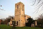 |
| Church of St Peter and St Paul | Gringley on the Hill | Parish Church | 13th century | 1 February 1967 | SK7359890666 53°24′28″N 0°53′40″W |
1370395 |  |
| Church of St James (ruin) | Haughton | Church | Early 12th century | 28 February 1952 | SK6911172986 53°14′58″N 0°57′56″W |
1267085 |  |
| North Engine House, Walkway and Cut Waters | Misterton | Engine House | Early 19th century | 23 November 1984 | SK7784895131 53°26′50″N 0°49′46″W |
1156775 |  |
| South Engine House and Boundary Wall | Misterton | Engine House | 1828 | 23 November 1984 | SK7783895118 53°26′50″N 0°49′46″W |
1370383 |  |
| Church of St Matthew | Normanton on Trent | Parish Church | 13th century | 1 February 1967 | SK7907069009 53°12′44″N 0°49′03″W |
1233792 | 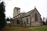 |
| North Leverton Windmill | North Leverton with Habblesthorpe | Tower Mill | 1813 | 28 February 1952 | SK7750782022 53°19′46″N 0°50′16″W |
1234469 |  |
| Church of St Peter and St Paul | North Wheatley | Parish Church | 13th century | 1 February 1967 | SK7621085868 53°21′51″N 0°51′22″W |
1234572 |  |
| The Old Hall and adjoining Old Hall Farm House | North Wheatley | Farmhouse | 20th century | 28 February 1952 | SK7619485749 53°21′47″N 0°51′23″W |
1275959 |  |
| Church of St Leonard | Ragnall | Parish Church | Restored 1864-7 | 1 February 1967 | SK8020773674 53°15′14″N 0°47′57″W |
1233804 |  |
| Church of St Wilfrid | Scrooby | Parish Church | Early 15th century | 1 February 1967 | SK6522090754 53°24′34″N 1°01′13″W |
1239733 |  |
| East Stable at Shireoaks Hall | Shireoaks | Dwelling | Early 18th century | 13 February 1967 | SK5521780631 53°19′11″N 1°10′21″W |
1045054 |  Upload Photo |
| Shireoaks Hall | Shireoaks | Country House | c. 1600 | 13 February 1967 | SK5524380596 53°19′10″N 1°10′20″W |
1370408 |  |
| West Stable and Attached Outbuildings at Shireoaks Hall | Shireoaks | Stable | Early 18th century | 13 February 1967 | SK5523280648 53°19′12″N 1°10′20″W |
1045055 |  |
| Church of All Saints | South Leverton | Parish Church | 12th century | 1 February 1967 | SK7833981106 53°19′16″N 0°49′31″W |
1275880 |  |
| Church of St Peter | Stokeham | Parish Church | 13th century | 1 February 1967 | SK7823876916 53°17′00″N 0°49′41″W |
1233882 |  |
| Church of St Peter and St Paul | Sturton le Steeple | Parish Church | 12th century | 1 February 1967 | SK7879983871 53°20′45″N 0°49′04″W |
1275773 |  |
| Arch | Serlby Park, Styrrup with Oldcotes | Arch | Early 18th century | 12 April 1985 | SK6337089855 53°24′06″N 1°02′54″W |
1224495 |  |
| The Old Grammar School, Number 4, and Attached Wall, Gate and Steps | Tuxford | House | 1952 | 28 February 1952 | SK7371871033 53°13′52″N 0°53′50″W |
1224333 | 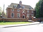 |
| Pair of Lodges Flanking North Drive | Welbeck Abbey, Welbeck | Lodge | Mid 18th century | 12 April 1985 | SK5603474328 53°15′47″N 1°09′41″W |
1266532 |  Upload Photo |
| Pair of Lodges Flanking the Entrance to Glass Court Drive, Tunnel Entrance and Wall | Welbeck | Wall | 19th century | 12 April 1985 | SK5627174353 53°15′48″N 1°09′28″W |
1224510 |  Upload Photo |
| Pair of Lodges Flanking the South Drive | Welbeck Abbey, Welbeck | Lodge | Mid 18th century | 12 April 1985 | SK5617474161 53°15′41″N 1°09′34″W |
1224870 |  Upload Photo |
| Church of St Paul | West Drayton | Parish Church | 12th century | 1 February 1967 | SK7111474747 53°15′54″N 0°56′07″W |
1224416 |  |
| Church of St Mary the Virgin with Boundary Walls and Gates | West Stockwith | Gate | 18th century | 1 February 1967 | SK7902794740 53°26′37″N 0°48′42″W |
1045087 |  |
| Sloswicke's Hospital | Retford | Almshouse | 1657 | 5 November 1976 | SK7059781352 53°19′28″N 0°56′30″W |
1302341 |  |
| Amcott House | Retford | House | Mid 18th century | 14 September 1949 | SK7073881112 53°19′20″N 0°56′22″W |
1178702 |  |
| Castle Farm with Attached Farmyard Wall and Outbuildings | Worksop | Farmhouse | 1758 | 13 February 1967 | SK5761177065 53°17′15″N 1°08′14″W |
1045026 |  Upload Photo |
| Church of St Michael the Archangel | West Retford | Church | 14th century | 14 September 1949 | SK7023481313 53°19′27″N 0°56′49″W |
1370357 |  |
| Clumber Cascade, Main Lake, Clumber Park | Clumber Park, Clumber and Hardwick | Bridge | 1763 | 13 February 1967 | SK6013976241 53°16′47″N 1°05′58″W |
1156520 |  |
| Depository at Canal Wharf | Worksop | Canal | 19th century | 10 April 1975 | SK5859879242 53°18′25″N 1°07′19″W |
1045059 |  |
| Gateford Hall | Gateford | House | Mid 17th century | 13 February 1967 | SK5695581550 53°19′40″N 1°08′47″W |
1370401 |  Upload Photo |
| Osberton Hall | Retford | Country House | 18th century | 13 February 1967 | SK6270279893 53°18′44″N 1°03′37″W |
1156774 |  |
| Parish Church of All Hallows | Ordsall | Lych Gate | 18th or early 19th century | 14 September 1949 | SK7043579719 53°18′35″N 0°56′40″W |
1045228 | 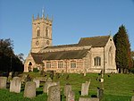 |
| Parish Church of St Swithun | Retford | Parish Church | 15th century | 14 September 1949 | SK7064681324 53°19′27″N 0°56′27″W |
1370346 |  |
| The Old Ship Inn | Worksop | Timber Framed House | Late 16th century | 13 February 1967 | SK5841678608 53°18′04″N 1°07′30″W |
1045065 | 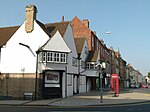 |
| 25 Grove Street | Retford | House | Late 18th century | 14 September 1949 | SK7065581175 53°19′22″N 0°56′27″W |
1302355 |  Upload Photo |
Broxtowe
City of Nottingham
| Name | Location | Type | Completed [note 1] | Date designated | Grid ref.[note 2] Geo-coordinates |
Entry number [note 3] | Image |
|---|---|---|---|---|---|---|---|
| Adams Building and Attached Railings | Lace Market | Workshop | 1995 | 12 July 1972 | SK5762639840 52°57′10″N 1°08′37″W |
1270430 |  |
| Albert Ball Memorial Homes | Lenton | Almshouses | 1922 | 30 November 1995 | SK5531339114 52°56′48″N 1°10′42″W |
1246781 |  |
| Arkwright Building, Nottingham Trent University | Nottingham | Public Library | 1877-81 | 12 July 1972 | SK5703840324 52°57′26″N 1°09′09″W |
1255017 |  |
| Boots D90 West Headquarters Building | Nottingham | Courtyard | 1966-1968 | 28 August 1996 | SK5497436919 52°55′37″N 1°11′01″W |
1268303 |  |
| Bromley House | Nottingham | Town House | 1752 | 11 August 1952 | SK5704439910 52°57′13″N 1°09′09″W |
1246247 |  |
| Camellia House 100 Metres South West of Wollaton Hall | Wollaton Park | Camellia House | 1823 | 12 July 1972 | SK5321339139 52°56′49″N 1°12′34″W |
1255271 |  |
| Cathedral Church of St Barnabas and Attached Boundary Wall | Nottingham | Boundary Wall | 1841-44 | 11 August 1952 | SK5672040028 52°57′17″N 1°09′26″W |
1247533 |  |
| Church of Holy Trinity | Lenton | Parish Church | 1842 | 30 November 1995 | SK5545539310 52°56′54″N 1°10′34″W |
1247151 | 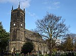 |
| Church of St Andrew and Boundary Wall | Nottingham | Gate | 1869-71 | 12 July 1972 | SK5703441190 52°57′54″N 1°09′08″W |
1058983 |  |
| Church of St Leodegarius and Attached Grave Enclosure | Basford | Tower | Rebuilt 1859-61 | 29 April 1964 | SK5529742774 52°58′46″N 1°10′40″W |
1271037 |  |
| Church of St Leonard and Attached Boundary Wall | Wollaton | Parish Church | c. 1200 | 11 August 1952 | SK5249239790 52°57′11″N 1°13′13″W |
1255283 |  |
| Church of St Martin | Bilborough | Tower | c. 1450 | 29 April 1964 | SK5202041811 52°58′16″N 1°13′37″W |
1255110 |  |
| Church of St Nicholas | Nottingham | Tower | 1906 | 11 August 1952 | SK5714539565 52°57′02″N 1°09′03″W |
1270639 |  |
| Church of St Wilfrid | Wilford | Tower | Late 15th century | 29 April 1964 | SK5663337797 52°56′05″N 1°09′32″W |
1271049 |  |
| Colwick Hall | Colwick | Country House | Early 18th century | 11 August 1952 | SK6017639027 52°56′43″N 1°06′21″W |
1254981 |  |
| Council House, Exchange Buildings and Adjoining Shops and Bank | Old Market Square | Council House | 1924-29 | 4 February 1988 | SK5730939900 52°57′12″N 1°08′54″W |
1270582 |  |
| County House | Nottingham | Townhouse | 15th of 16th century | 10 August 1952 | SK5758539633 52°57′04″N 1°08′40″W |
1270805 |  |
| Doric Temple and Attached Bridge 200 Metres South-east of Wollaton Hall | Wollaton Park | Bridge | Early 19th century | 10 August 1989 | SK5337539174 52°56′50″N 1°12′26″W |
1270389 | 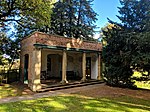 |
| Elite Building | Nottingham | Shop | 1921 | 12 July 1972 | SK5722240058 52°57′17″N 1°08′59″W |
1254539 |  |
| Enfield House and attached Area Wall | Nottingham | Town House | Mid 18th century | 11 August 1952 | SK5737039675 52°57′05″N 1°08′51″W |
1270637 |  |
| Former Police Station adjoining Shire Hall | Lace Market, Nottingham | Gate | 1905 | 12 July 1972 | SK5756239612 52°57′03″N 1°08′41″W |
1247636 |  |
| Gate and Railings to Forecourt of Number 24 and 26 Low Pavement | Nottingham | Gate | c. 1733 | 12 July 1972 | SK5739739679 52°57′05″N 1°08′50″W |
1270638 |  |
| Habitat and Rj's Homeshop | Nottingham | Merchants House | c. 1720 | 11 May 1988 | SK5706339951 52°57′14″N 1°09′07″W |
1254555 |  |
| Lenton Lodge (former Gateway to Wollaton Park) and attached Bollards | Nottingham | Gate Lodge | 1823-25 | 11 August 1952 | SK5483839187 52°56′50″N 1°11′07″W |
1270829 |  |
| Lenton War Memorial | Lenton | War memorial | 1823-25 | 30 November 1995 | SK5529039094 52°56′47″N 1°10′43″W |
1246782 |  |
| Midland Railway Station | Nottingham | Footbridge | 1904 | 12 July 1972 | SK5744539204 52°56′50″N 1°08′48″W |
1271301 |  |
| Newdigate House and Attached Railings and Boundary Wall | Nottingham | House | c. 1675 | 11 August 1952 | SK5705939600 52°57′03″N 1°09′08″W |
1271185 |  |
| Newton Building at Nottingham Trent University | Nottingham | Polytechnic | 1956-1958 | 24 April 1998 | SK5706340228 52°57′23″N 1°09′07″W |
1323704 |  |
| Nottingham Playhouse | Nottingham | Theatre | 1961-3 | 14 July 1994 | SK5679639939 52°57′14″N 1°09′22″W |
1255252 |  |
| People's Hall | Nottingham | House | 1750 | 12 July 1972 | SK5766540002 52°57′15″N 1°08′35″W |
1254499 |  |
| Railings and Gate to Forecourt at Willoughby House | Nottingham | Gate | c. 1743 | 12 July 1972 | SK5737939681 52°57′05″N 1°08′51″W |
1254748 |  |
| Sheriff House | Nottingham | Town House | 1768 | 11 August 1952 | SK5692639748 52°57′08″N 1°09′15″W |
1270499 |  |
| Shire Hall and Adjoining County Gaol | Lace Market | Gate | 1770-72 | 24 October 1988 | SK5759239606 52°57′03″N 1°08′39″W |
1254517 |  |
| Willoughby House | Nottingham | Town House | c. 1738 | 11 August 1952 | SK5738139665 52°57′05″N 1°08′51″W |
1254559 |  |
| 10 Pelham Street and 2A & 2B High Street | Nottingham | Commercial premises | c. 1905 | 4 October 1973 | SK5739439912 52°57′13″N 1°08′50″W |
1058999 |  |
| 24 and 26 Low Pavement | Nottingham | Town House | c. 1733 | 11 August 1952 | SK5739739671 52°57′05″N 1°08′50″W |
1254560 |  |
| 19 Castle Gate | Nottingham | Town House | 1775 | 11 August 1952 | SK5720439648 52°57′04″N 1°09′00″W |
1246653 |  |
| 56 Village Road | Clifton | Aisled House | 14th century | 14 April 1954 | SK5446434997 52°54′35″N 1°11′30″W |
1255237 |  |
Gedling
| Name | Location | Type | Completed [note 1] | Date designated | Grid ref.[note 2] Geo-coordinates |
Entry number [note 3] | Image |
|---|---|---|---|---|---|---|---|
| Bestwood Lodge Hotel and Terrace Wall | Bestwood Park, Bestwood St. Albans | Country House | 1862 | 13 December 1972 | SK5695246506 53°00′46″N 1°09′09″W |
1227444 |  |
| Bestwood Pumping Station | Bestwood St. Albans | Coal Shed | 1871-1874 | 5 September 1972 | SK5792848246 53°01′42″N 1°08′16″W |
1265233 |  |
| Emmanuel Church | Bestwood St. Albans | Parish Church | 1868 | 27 April 1987 | SK5663046423 53°00′44″N 1°09′27″W |
1235441 |  |
| Winding House and Headstocks at Bestwood Colliery | Bestwood St. Albans | Colliery | Late 19th century | 27 April 1987 | SK5563947460 53°01′18″N 1°10′19″W |
1235186 |  |
| Church of St Wilfrid | Calverton | Tower | 1763 | 13 October 1966 | SK6174049184 53°02′11″N 1°04′51″W |
1235903 |  |
| Brewhouse, Crewyard and Mill Barn at Hall Farmhouse | Linby | Brewhouse | Late 18th century | 27 April 1987 | SK5338051135 53°03′17″N 1°12′18″W |
1265319 |  |
| Church of St Michael | Linby | Tower | 13th century | 13 October 1966 | SK5345350892 53°03′09″N 1°12′14″W |
1265318 |  |
| Boatswain's Monument 30m north-east of Newstead Abbey | Newstead Park, Newstead | Commemorative Monument | 1808 | 13 October 1966 | SK5423053785 53°04′43″N 1°11′31″W |
1264302 |  |
| The Cannon Fort and adjoining Dock | Newstead Park, Newstead | Dock | c. 1750 | 13 October 1966 | SK5376053823 53°04′44″N 1°11′56″W |
1264406 |  |
| Engine House, Boiler House and Workshop at Papplewick Pumping Station | Ravenshead | Boiler House | 1881 | 18 October 1971 | SK5827452136 53°03′48″N 1°07′55″W |
1265301 |  |
| Church of St Swithun | Woodborough | Tower | 13th century | 13 October 1966 | SK6315147711 53°01′23″N 1°03′36″W |
1264188 |  |
| Woodborough Hall | Woodborough | House | circa 1660 | 15 July 1985 | SK6251447760 53°01′25″N 1°04′10″W |
1227555 |  Upload Photo |
| Church of the Good Shepherd | Arnold | Roman Catholic Church | 1962-1964 | 25 September 1998 | SK5805844326 52°59′35″N 1°08′11″W |
1376603 |  |
| Church of St Mary | Arnold | Tower | 14th century | 24 January 1950 | SK5868446146 53°00′34″N 1°07′37″W |
1235987 |  |
| Church of St Paul | Daybrook | Parish Church | 1892-96 | 27 April 1987 | SK5796645158 53°00′02″N 1°08′16″W |
1236096 |  |
Mansfield
| Name | Location | Type | Completed [note 1] | Date designated | Grid ref.[note 2] Geo-coordinates |
Entry number [note 3] | Image |
|---|---|---|---|---|---|---|---|
| Warsop Parish Centre | Warsop | Farmhouse | 15th century | 28 August 1962 | SK5674468837 53°12′49″N 1°09′06″W |
1251896 |  |
| Cavendish Monument and attached Railings | Mansfield | Commemorative Monument | 1849 | 17 March 1978 | SK5384161092 53°08′39″N 1°11′47″W |
1207176 |  |
| Church of St Edmund | Mansfield Woodhouse | Parish Church | 1304 | 28 January 1957 | SK5401763212 53°09′48″N 1°11′37″W |
1251828 |  |
| Church of St Mark and attached Boundary Wall | Mansfield | Parish Church | 1897 | 21 March 1994 | SK5377060448 53°08′19″N 1°11′52″W |
1214953 |  |
| Innisdoon and attached Garden Wall and Gate Piers | Mansfield | Arts and Crafts house and coach house | 1904-05 | 7 October 1977 | SK5361461615 53°08′56″N 1°11′59″W |
1214391 |  |
| St Peter's House | Mansfield | House | Late 17th century | 19 December 1955 | SK5406961059 53°08′38″N 1°11′35″W |
1213928 |  |
| The Old Meeting House | Mansfield | Unitarian Chapel | 1702 | 19 December 1955 | SK5360461143 53°08′41″N 1°12′00″W |
1207181 |  |
| The Old Town Hall and attached Piers and Railings | Mansfield | Civic building (1835–1836)[1] | 1836 | 17 March 1978 | SK5382461046 53°08′38″N 1°11′48″W |
1207179 |  |
| The Priory | Mansfield Woodhouse | House | 20th century | 28 January 1957 | SK5376163204 53°09′48″N 1°11′50″W |
1251852 |  |
| Waverley House | Mansfield | House | 1754 | 19 December 1955 | SK5369861217 53°08′43″N 1°11′55″W |
1288092 |  |
Newark and Sherwood
| Name | Location | Type | Completed [note 1] | Date designated | Grid ref.[note 2] Geo-coordinates |
Entry number [note 3] | Image |
|---|---|---|---|---|---|---|---|
| Averham Park House | Averham | House | 20th century | 11 August 1961 | SK7435056417 53°05′59″N 0°53′28″W |
1046003 |  Upload Photo |
| The Old House | Bleasby | House | 17th century | 11 August 1961 | SK7194949442 53°02′15″N 0°55′42″W |
1045572 |  Upload Photo |
| Church of St Mary of the Purification | Blidworth | Tower | 15th century | 11 August 1961 | SK5856655631 53°05′41″N 1°07′37″W |
1045529 |  |
| Carlton Hall | Carlton-on-Trent | Country House | 1765 | 7 August 1952 | SK7992264026 53°10′03″N 0°48′21″W |
1046012 |  |
| Church of St Mary | Carlton-on-Trent | Church | 12th century | 11 August 1961 | SK7994963938 53°10′00″N 0°48′20″W |
1178592 |  |
| Church of All Saints | Coddington | Parish Church | 13th century | 16 January 1967 | SK8349254493 53°04′52″N 0°45′18″W |
1157230 |  |
| Thatch Cottage and Boundary Wall | Collingham | House | Late 16th century | 17 October 1984 | SK8289461317 53°08′33″N 0°45′44″W |
1369947 |  |
| Church of St Michael | Cotham | Parish Church | 12th century | 16 January 1967 | SK7942447616 53°01′12″N 0°49′03″W |
1178419 |  |
| Church of St Andrew | Eakring | Church | 19th century | 11 August 1961 | SK6753662169 53°09′09″N 0°59′30″W |
1370132 |  |
| Church of St Oswald | East Stoke | Church | 13th century | 16 January 1967 | SK7479450061 53°02′33″N 0°53′09″W |
1045578 |  |
| Church of St Giles | Edingley | Church | 19th century | 11 August 1961 | SK6650855862 53°05′45″N 1°00′30″W |
1193510 |  |
| Church of All Saints | Elston | Church | 13th century | 16 January 1967 | SK7588247982 53°01′26″N 0°52′12″W |
1370154 |  |
| Elston Towers | Elston | Country House | 1872 | 8 May 1980 | SK7471548386 53°01′39″N 0°53′15″W |
1370153 |  |
| Church of St Denis | Morton | Parish Church | 1756 | 11 August 1961 | SK7270051357 53°03′16″N 0°55′01″W |
1302376 |  |
| Halloughton Manor Farm House | Halloughton | Farmhouse | 13th century | 7 August 1952 | SK6885451765 53°03′31″N 0°58′27″W |
1178664 |  |
| Church of St Nicholas | Hockerton | Parish Church | 12th century | 11 August 1961 | SK7159656445 53°06′01″N 0°55′56″W |
1045486 |  |
| Gazebo and Garden Wall at Kelham Hall | Kelham | Summerhouse | 1844-46 | 19 September 1985 | SK7751355543 53°05′29″N 0°50′38″W |
1045983 |  |
| Church of St Swithun | Kirklington | Tower | 17th century | 11 August 1961 | SK6791957607 53°06′41″N 0°59′13″W |
1045490 |  |
| Church of Holy Trinity | Kirton | Parish Church | 13th century | 11 August 1961 | SK6912069379 53°13′01″N 0°57′59″W |
1156898 |  |
| Old Hall Farm House | Kneesall | Farmhouse | 19th century | 11 August 1966 | SK7025564241 53°10′14″N 0°57′02″W |
1156929 |  |
| Langford Hall | Langford | Country House | 1780-90 | 16 January 1967 | SK8233757444 53°06′28″N 0°46′17″W |
1046033 |  |
| Langford Old Hall | Langford | Farmhouse | Early 19th century | 25 February 1952 | SK8205858865 53°07′14″N 0°46′31″W |
1369987 |  Upload Photo |
| Moorhouse Chapel | Moorhouse, Laxton and Moorhouse | Chapel | 1860 | 25 July 1980 | SK7530266780 53°11′34″N 0°52′28″W |
1045631 |  |
| The Old Hall | Lowdham | House | Early 17th century | 7 August 1952 | SK6649746744 53°00′50″N 1°00′37″W |
1045495 |  Upload Photo |
| Club Room and Stables at Rear of Ossington Hotel | Newark-on-Trent | Club | 1882 | 19 May 1971 | SK7974654134 53°04′43″N 0°48′40″W |
1196076 |  |
| Concrete Footbridge across River Trent | Newark-on-Trent | Footbridge | 1915 | 23 October 1989 | SK8014355107 53°05′14″N 0°48′17″W |
1297721 |  |
| Former Magnus School and adjoining Headmaster's House and English School | Newark-on-Trent | Teachers House | 1817 | 29 September 1950 | SK8004253903 53°04′35″N 0°48′24″W |
1288060 |  |
| Former White Hart Hotel | Newark-on-Trent | Inn | c. 1430 | 29 September 1950 | SK7989753840 53°04′33″N 0°48′32″W |
1196426 |  |
| Kiln Warehouse | Newark-on-Trent | Kiln | 1857 | 7 August 1989 | SK7975554359 53°04′50″N 0°48′39″W |
1196290 |  |
| Martin Forster House | Newark-on-Trent | Vicarage | c. 1730 | 29 September 1950 | SK8002353886 53°04′34″N 0°48′25″W |
1196098 |  |
| Ossington Hotel and adjoining Garden Walls and Summerhouse | Newark-on-Trent | Garden Wall | 1882 | 19 May 1971 | SK7972354108 53°04′42″N 0°48′41″W |
1287626 |  |
| Shalem House 1-4, The Friary | Newark-on-Trent | Apartment | 1992 | 29 September 1950 | SK8019454040 53°04′39″N 0°48′16″W |
1215654 |  |
| 40 & 41 Market Place | Newark-on-Trent | Coaching Inn | 1721 | 29 September 1950 | SK7987153848 53°04′33″N 0°48′33″W |
1297637 |  |
| 1, 3, & 5 Bridge Street and 27 & 28 Market Place | Newark-on-Trent | House | c. 1730 | 29 September 1950 | SK7994253880 53°04′34″N 0°48′29″W |
1297635 |  |
| Former Clinton Arms Hotel | Newark-on-Trent | Coaching Inn | Early 18th century | 29 September 1950 | SK7985353846 53°04′33″N 0°48′34″W |
1278230 |  |
| Church of St George | North Clifton | Parish Church | 13th century | 16 January 1967 | SK8185971259 53°13′55″N 0°46′30″W |
1046053 |  |
| Ollerton Hall | Ollerton | Country House | c. 1700 | 7 August 1952 | SK6547167543 53°12′03″N 1°01′17″W |
1045598 |  |
| Sundial 50m east of Church of Holy Rood | Ossington | Sundial | Early 17th century | 19 September 1985 | SK7594665171 53°10′42″N 0°51′54″W |
1301995 |  |
| Church of St John | Perlethorpe cum Budby | Parish Church | 1876 | 11 August 1961 | SK6454970956 53°13′54″N 1°02′04″W |
1045471 |  |
| Sundial 150m south of Thoresby Hall | Thoresby Park, Perlethorpe cum Budby | Sundial | Mid 18th century | 11 August 1961 | SK6384671071 53°13′58″N 1°02′42″W |
1157251 |  Upload Photo |
| Orangery, Fountain and Garden Wall at Rufford Abbey | Rufford | Bath House/Orangery | 1729 | 10 July 1975 | SK6458964700 53°10′32″N 1°02′06″W |
1370165 |  |
| The Gables | South Muskham | Farmhouse | c. 1600 | 21 November 1974 | SK7791757095 53°06′19″N 0°50′15″W |
1369972 |  |
| Winthorpe Bridge carrying Bypass over River Trent | South Muskham | Road Bridge | 1964 | 29 May 1998 | SK8052856733 53°06′06″N 0°47′55″W |
1323680 |  |
| Cranfield House and adjoining Garden Walls | Southwell | Clergy House | 1709 | 7 August 1952 | SK7025253896 53°04′40″N 0°57′10″W |
1046145 |  |
| Gateway and Flanking Walls at Minster Churchyard | Southwell | Gate | Mid 14th century | 11 August 1961 | SK7004653837 53°04′38″N 0°57′21″W |
1288504 |  Upload Photo |
| Norwood Park and the West Wing | Norwood Park, Southwell | Country House | cica 1763 | 7 August 1952 | SK6871754683 53°05′06″N 0°58′32″W |
1370212 | 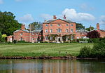 |
| Saracen's Head Hotel | Southwell | Assembly Rooms | 1805 | 7 August 1952 | SK7006553921 53°04′41″N 0°57′20″W |
1369925 |  |
| The Residence and Vicars Court and Adjoining Boundary Walls | Southwell | Clergy House | 1689 | 7 August 1952 | SK7027953787 53°04′36″N 0°57′09″W |
1211749 |  |
| Church of St Mary | Staunton | Parish Church | 14th century | 16 January 1967 | SK8052643274 52°58′51″N 0°48′08″W |
1045995 |  |
| Staunton Hall and Service Wing | Staunton | Country House | 16th century | 15 October 1984 | SK8056743213 52°58′49″N 0°48′05″W |
1302335 |  |
| Church of St Helen | Thorney | Parish Church | 1850 | 16 January 1967 | SK8592472843 53°14′44″N 0°42′50″W |
1302452 |  |
| Thurgarton Priory | Thurgarton | House | 13th century | 7 August 1952 | SK6917549165 53°02′07″N 0°58′11″W |
1045528 |  |
| Greet House | Upton | Workhouse | 1824 | 8 May 2000 | SK7115254284 53°04′52″N 0°56′21″W |
1045931 |  |
| Upton Hall | Upton | Country House | 17th century | 7 August 1952 | SK7348054406 53°04′55″N 0°54′16″W |
1179760 |  |
| Church of St Edmund | Walesby | Parish Church | 12th century | 11 August 1961 | SK6850170754 53°13′46″N 0°58′31″W |
1178711 | 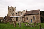 |
| Church of St Swithin | Wellow | Parish Church | 12th century | 11 August 1961 | SK6707466100 53°11′16″N 0°59′52″W |
1370185 |  |
| Winthorpe Hall | Winthorpe | Country House | c. 1760 | 16 January 1967 | SK8121856578 53°06′01″N 0°47′18″W |
1178886 |  |
Rushcliffe
| Name | Location | Type | Completed [note 1] | Date designated | Grid ref.[note 2] Geo-coordinates |
Entry number [note 3] | Image |
|---|---|---|---|---|---|---|---|
| Ivy Cottage and Adjoining Walls | Bunny | House | c. 1700 | 13 October 1966 | SK5820829539 52°51′37″N 1°08′13″W |
1277626 |  |
| Old School Incorporating Schoolhouse and Almshouses | Bunny | Apartment | 1986 | 14 May 1952 | SK5833329613 52°51′39″N 1°08′06″W |
1249034 |  |
| The Manor House | Costock | House | 1952 | 14 May 1952 | SK5738626402 52°49′56″N 1°08′59″W |
1260272 |  Upload Photo |
| Church of St Mary and All Saints | Hawsworth | Tower | 13th century | 1 December 1965 | SK7528343457 52°58′59″N 0°52′48″W |
1243797 |  |
| Wall and Gazebo at Holme Pierrepont Hall | Holme Pierrepont | Gate | Early 17th century | 13 November 1986 | SK6269339317 52°56′51″N 1°04′06″W |
1249200 |  Upload Photo |
| Church of St Luke | Kinoulton | Church | 1793 | 1 December 1965 | SK6765030721 52°52′11″N 0°59′47″W |
1264839 |  |
| Langar House | Langar cum Barnstone | Country House | Early 18th century | 12 February 1952 | SK7225934714 52°54′18″N 0°55′38″W |
1235998 |  |
| Church of St Margaret | Owthorpe | Church | Pre-1705 | 1 December 1965 | SK6723433439 52°53′39″N 1°00′07″W |
1236253 |  |
| Church of St Peter and St Paul | Shelford | Cross | 10th century | 1 December 1965 | SK6617142359 52°58′28″N 1°00′58″W |
1250021 |  |
| Shelford Manor House and Attached Wall and Pier | Shelford and Newton | House | c. 1580 | 28 November 1972 | SK6723343433 52°59′03″N 1°00′00″W |
1039570 |  Upload Photo |
| Stanford Hall | Stanford on Soar | Country House | Early 18th century | 14 May 1952 | SK5588423867 52°48′34″N 1°10′21″W |
1260097 |  |
| Church of St Anne | Sutton Bonington | Parish Church | 13th century | 13 October 1966 | SK5074425044 52°49′14″N 1°14′54″W |
1242374 |  |
| Church of St Michael | Sutton Bonington | Parish Church | 13th century | 13 October 1966 | SK5042825428 52°49′27″N 1°15′11″W |
1242372 |  |
| The Hall | Sutton Bonington | Country House | Early 18th century | 13 October 1966 | SK5046825299 52°49′22″N 1°15′09″W |
1242389 |  |
| Church of All Saints | Thrumpton | Parish Church | 13th century | 13 October 1966 | SK5097431162 52°52′32″N 1°14′39″W |
1242423 |  |
| Church of St Helen | West Leake | Parish Church | 12th century | 13 October 1966 | SK5274826428 52°49′58″N 1°13′07″W |
1242473 | 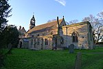 |
| Church of St John of Beverley | Whatton-in-the-Vale | Parish Church | 11th century | 1 December 1965 | SK7450139674 52°56′57″N 0°53′33″W |
1243823 |  |
| Church of St Peter and St Paul | Widmerpool | Parish Church | 14th century | 1 December 1965 | SK6287428206 52°50′52″N 1°04′04″W |
1242476 |  |
| Wiverton Hall Including Service Range to Rear Left | Wiverton Hall | Country House | 1814 | 12 February 1952 | SK7133536343 52°55′11″N 0°56′26″W |
1264494 |  |
| Church of the Holy Rood | Edwalton | Parish Church | 12th century | 13 December 1949 | SK5985035002 52°54′33″N 1°06′41″W |
1302765 |  |
| Test Match Hotel | West Bridgford | Public House | 1938 | 4 May 2000 | SK5889837182 52°55′44″N 1°07′31″W |
1380283 | 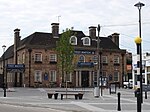 |
See also
Notes
- The date given is the date used by Historic England as significant for the initial building or that of an important part in the structure's description.
- Sometimes known as OSGB36, the grid reference is based on the British national grid reference system used by the Ordnance Survey.
- The "List Entry Number" is a unique number assigned to each listed building and scheduled monument by Historic England.
References
External links
Wikiwand - on
Seamless Wikipedia browsing. On steroids.

