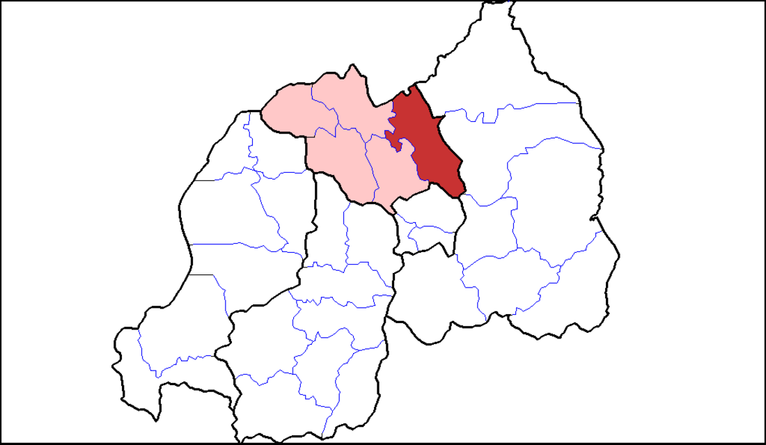
Gicumbi District
District in Rwanda From Wikipedia, the free encyclopedia
Gicumbi is a district (akarere) in Northern Province, Rwanda. Its capital is Byumba, which is also the provincial capital.
Geography
The district lies due-north of Kigali, straddling the major road from Kigali to Kampala. It is a hilly district.
Sectors
Gicumbi district is divided into 20 sectors (imirenge): Bukure, Bwisige, Byumba, Cyumba, Giti, Kaniga, Manyagiro, Miyove, Kageyo, Mukarange, Muko, Mutete, Nyamiyaga, Nyankenke II, Rubaya, Rukomo, Rushaki, Rutare, Ruvune, Rwamiko and Shangasha.
Gihembe refugee camp
Gihembe was a camp of Congolese refugees located in Gicumbi District and was home to 12,904 residents that are currently moved to Mahama refugee Camp in Kirehe District
On 15 December 2014, Gihembe Refugee Camp in Gicumbi District received a visit from Howard G. Buffett, who pledged funding to assist with repatriation of Congolese refugees.[2]
Climate
The Köppen climate classification subtype for this climate is subtropical highland climate or Cfb.
| Climate data for Gicumbi, Rwanda (1961-1990) | |||||||||||||
|---|---|---|---|---|---|---|---|---|---|---|---|---|---|
| Month | Jan | Feb | Mar | Apr | May | Jun | Jul | Aug | Sep | Oct | Nov | Dec | Year |
| Mean daily maximum °C (°F) | 24.1 (75.4) |
24.0 (75.2) |
23.8 (74.8) |
23.0 (73.4) |
22.6 (72.7) |
22.9 (73.2) |
23.3 (73.9) |
24.4 (75.9) |
24.6 (76.3) |
24.4 (75.9) |
23.4 (74.1) |
23.5 (74.3) |
23.7 (74.6) |
| Daily mean °C (°F) | 18.6 (65.5) |
18.6 (65.5) |
18.5 (65.3) |
18.1 (64.6) |
17.9 (64.2) |
17.8 (64.0) |
18.0 (64.4) |
18.9 (66.0) |
18.9 (66.0) |
18.8 (65.8) |
18.2 (64.8) |
18.3 (64.9) |
18.4 (65.1) |
| Mean daily minimum °C (°F) | 13.1 (55.6) |
13.2 (55.8) |
13.2 (55.8) |
13.1 (55.6) |
13.2 (55.8) |
12.6 (54.7) |
12.6 (54.7) |
13.3 (55.9) |
13.2 (55.8) |
13.1 (55.6) |
13.0 (55.4) |
13.1 (55.6) |
13.1 (55.5) |
| Average rainfall mm (inches) | 70.6 (2.78) |
77.7 (3.06) |
140.0 (5.51) |
159.3 (6.27) |
122.0 (4.80) |
20.0 (0.79) |
81 (3.2) |
56.7 (2.23) |
95.2 (3.75) |
111.4 (4.39) |
115.9 (4.56) |
71.2 (2.80) |
1,121 (44.14) |
| Average rainy days | 9 | 10 | 15 | 20 | 15 | 3 | 1 | 6 | 13 | 16 | 16 | 12 | 136 |
| Source: World Meteorological Organization[3] | |||||||||||||
See also
- Mulindi - Mulindi Tea Plantation, National Liberation Struggle Museum
References
External links
Wikiwand - on
Seamless Wikipedia browsing. On steroids.

