Geography of the Cook Islands
From Wikipedia, the free encyclopedia
This article was imported from the CIA's World Factbook. |

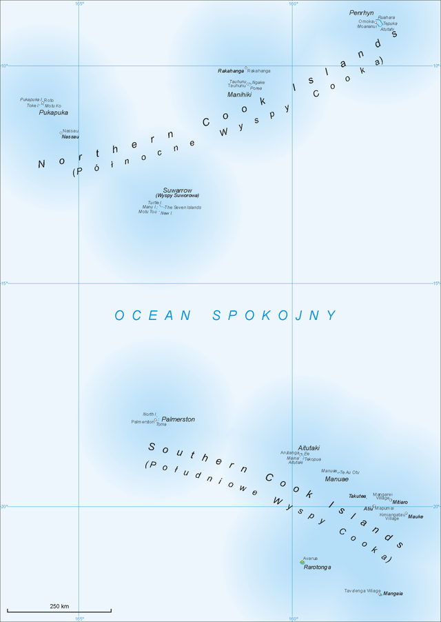
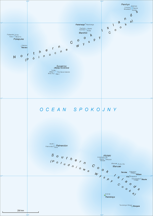
The Cook Islands can be divided into two groups: the Southern Cook Islands and the Northern Cook Islands. The country is located in Oceania, in the South Pacific Ocean, about halfway between Hawaii and New Zealand.
From December through to March, the Cook Islands are in the path of tropical cyclones, the most notable of which were cyclones Martin (1997) and Percy (2005).[1] Two terrestrial ecoregions lie within the islands' territory: the Central Polynesian tropical moist forests and the Cook Islands tropical moist forests.[2]
Islands and reefs
Southern Cook Islands
Northern Cook Islands
Table
| Island Group |
Island | Area (km2) |
Population | Density |
|---|---|---|---|---|
| Northern | Penrhyn | 10 | 226 | 22.6 |
| Northern | Rakahanga | 4 | 80 | 20.0 |
| Northern | Manihiki | 5 | 213 | 42.6 |
| Northern | Pukapuka | 1 | 444 | 444.0 |
| Northern | Tema Reef (submerged) | 0 | 0 | – |
| Northern | Nassau | 1 | 78 | 78.0 |
| Northern | Suwarrow | 0 | 0 | 0.0 |
| Southern | Palmerston | 2 | 58 | 28.0 |
| Southern | Aitutaki | 18 | 1,928 | 107.1 |
| Southern | Manuae | 6 | 0 | 0.0 |
| Southern | Takutea | 1 | 0 | 0.0 |
| Southern | Mitiaro | 22 | 155 | 7.1 |
| Southern | Atiu | 27 | 437 | 16.2 |
| Southern | Mauke | 18 | 297 | 16.5 |
| Southern | Winslow Reef (submerged) | 0 | 0 | – |
| Southern | Rarotonga | 67 | 13,044 | 194.7 |
| Southern | Mangaia | 52 | 499 | 9.6 |
| Total | Total | 237 | 17,459 | 73.7 |
Note: The table is ordered from north to south. Population figures from the 2016 census.[3]
Statistics
- Area
-
- Total: 236 km2 (91 sq mi)
- Land: 236 km2
- Water: 0 km2
- Area - comparative
- 1.3 times the size of Washington, DC
- Coastline
- 120 km (75 mi)
- Maritime claims
-
- Territorial sea: 12 nmi (22.2 km; 13.8 mi)
- Continental shelf: 200 nmi (370.4 km; 230.2 mi) or to the edge of the continental margin
- Exclusive economic zone: 200 nmi (370.4 km; 230.2 mi)
- Climate
- Tropical; moderated by trade winds; a dry season from April to November and a more humid season from December to March
- Terrain
- Low coral atolls in north; volcanic, hilly islands in south
- Elevation extremes
-
- Lowest point: Pacific Ocean 0 m
- Highest point: Te Manga 652 m (2,139 ft)
- Natural resources
- coconuts
- fresh water
- Land use
-
- Arable land: 4.17%
- Permanent crops: 4.17%
- Other: 91.67% (2012 est.)
- Natural hazards
- Typhoons (November to March)
- Tsunamis (Year-round)
- Time Zone
- UTC -10 (GMT -10)
- Largest Island
- Rarotonga
- Environment - international agreements
- Party to: Biodiversity, Climate Change-Kyoto Protocol, Desertification, Hazardous Wastes, Law of the Sea, Ozone Layer Protection
See also
References
External links
Wikiwand - on
Seamless Wikipedia browsing. On steroids.
