Gemarkung
From Wikipedia, the free encyclopedia
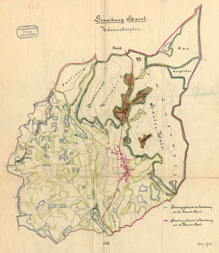
A Gemarkung (also Markung, in Switzerland also Gemarchen) is the entirety of all land plots of a specific municipality, or a specific large part of a municipality, recorded in the cadastre in the countries of Germany and Switzerland (For an equivalent concept in Austria and adjacent countries see Katastralgemeinde).

Gemarkung may be variously translated into English as: district,[1] cadastral district,[2][3] local subdistrict,[4] cadastral area,[5] tithing,[6] township,[6] parish,[7] section of a community area[8]
Gemarkung registers record the parcels' location, usage and geomorphology and the like qualities, however, the rights to the land (as property, or collateral liened by a mortgage) are kept in the Grundbuch (land register). A Gemarkung is made up of a number of, usually contiguous, plots of land/parcels (Flurstücke). In many cases, several "Flurstücke" are grouped together to form a Flur, usually a tract of open land or forest. In sum, the sequence of the three subdivisions is: Gemarkung - Flur - Flurstück.
External links
- „Gemarkungs- und Gemeindeverzeichnis“: Bayerisches Gemarkungsverzeichnis (ZIP-Archiv mit Textdatei)
- Gemarkungsgrenzen Bayern (hier Vermessungsamt 93 = Wolfratshausen)
- Gemarkungsverzeichnis Brandenburg Archived 2018-02-19 at the Wayback Machine (PDF-Datei; 571 kB)
- Gemarkungsverzeichnis Rheinland-Pfalz Archived 2016-02-24 at the Wayback Machine (ZIP-Archiv mit Excel-Tabelle; 215 kB)
- Gemarkung - Definitionen
References
Wikiwand - on
Seamless Wikipedia browsing. On steroids.
