Deschambault-Grondines was created in 2002 by the merger of the villages of Deschambault and Grondines. It is a member of the Fédération des Villages-relais du Québec. [1]' [2]
Deschambault
Summarize
Perspective
History
The village of Deschambault is located in the eastern part of the municipality. It has its origins in the Seigneurie de Chavigny, granted in 1640 by the Compagnie de la Nouvelle-France. In 1671, Jacques-Alexis Fleury, Sieur Deschambault, married the heiress of the seigneury and became its owner in 1683 through an exchange of land. He then gave his name to his new domain. The parish of Saint-Joseph-de-Deschambault was founded in 1713 and canonically erected in 1753. The parish municipality was created in 1855, and the village municipality separated from it in 1951. These two entities merged again in 1989.[3]' [4]
. . . At one time, Deschambault was said to have "a pilot every two houses." Very early on "the taste for the sea" developed there, because the St. Lawrence has long been the only way to access the village. "Everything was happening on the river!" says Father Jacques Paquin, coordinator of the Deschambault Navigators Committee."
Even after the opening of the Chemin du Roy, a route considered difficult, the seaway continued to be used more than the land route. Deschambault, a village of sailors, Le Soleil. Translated from French.[5]
Deschambault Built Heritage
Saint-Joseph church built between 1835 and 1839 according to the plans of the architect Thomas Baillairgé[6]
Old presbytery built between 1815 and 1818.
Water mill built in 1802 by Seigneur Joseph Chavigny de la Chevrotière.
Grondines
Summarize
Perspective
History
The name Grondines was named by Samuel de Champlain himself in 1674.[2] "Grondines" is from the French verb "gronder", meaning to rumble or roar.
The estate covered a land area of around 90 square miles or nearly 60,000 acres.[8]' [9] In 1646, the Governor of New-France at the time, Charles Jacques Huault de Montmagny,[10] gave the concession to the nuns hospitallers, administrators of Hôtel-Dieu de Québec, and thereafter, it was resold in 1683 to Lord Jacques Aubert.[8] Being the father-in-law of Louis Hamelin, the next lord of Grondines, the lordship passed to the Hamelin family afterwards, and was transmitted to their descendants until 1797, following the British Conquest.[8] In 1698, comte Louis de Buade of Château Frontenac award them concessions, extending their lordship with additional islands and isles.[11] This family was one of the eight seigneurial dynasties that lived permanently on their estate for six generations.[12]
A member of this family was also recognized as noble by the Sovereign Council of New France of Louis XIV in 1654, and would join the French-Canadian nobility, being the lord and commander Jacques-François Hamelin de Bourgchemin et de l'Hermitière, a descendant of Jacques Hamelin, bishop of Tulle.[17][18][19]'[20] In 1766, a member of the Hamelin de Chavigny also appeared in documents of the Canadian nobility, where they asked the king to keep in power the current Governor of Quebec James Murray, with the hope of being less penalized by the injustices they had to suffer after the British conquest.[21]
Opposite Cape Lauzon, in the middle of the St. Lawrence River, the Richelieu Rapids stretch for a distance of nearly 2 km. These rapids, which are virtually invisible, correspond to a narrowing of the channel, marked, especially at low tide, by a much stronger current than anywhere else on the St. Lawrence downstream of Montreal.[25]' [26]
From the canoes of the First Nations to the ships of the conquerors, the Richelieu Rapids have played a strategic role in the history of Cape Lauzon, Deschambault and all of Quebec. To this day, they still make life as hard for sailboats, rowboats, canoes, small boats as they do for the captains of large merchant ships.[27]
The St. Lawrence River limits the territory of Portneuf regional County (RCM) for nearly 70 km. Along the Chemin du Roi, from one village to another, several spaces allow you to rest, visit, picnic, fish, observe birds, dip your toes in the water. The main attraction remains the docks.[28]
In Grondines, the tip of the Anse des Grondines, also known in the vernacular: La Grande Pointe, Pointe de la Laille or Grande pointe de la Laille. The word laille could come from the English light, since there was a lighthouse at the end of the island.
According to historian Raymond Douville, this point is the origin of the name Grondines, probably given by the boaters who had to go around, at the rising tide, the many pebbles that the waves hit in dull roars and whose echoes resonated on the escarpments of the coast.[23]
Fossil found along the St. Lawrence River, Grondines
DESCRIPTION OF THE AREA
«. . . The part of the Grondines map-area underlain by Paleozoic rocks (approximately two-thirds of the whole) is a nearly featureless plain rising in the north and west to 250 feet above sea level, and dropping to tide water level along the Saint-Laurent.»
«. . . The Grondines and Sainte-Anne-de-la-Pérade swamp is one of the last, large, treed swamps on the river. It extends along seven kilometres of shoreline in the St. Lawrence River’s freshwater estuary.
The swamp shelters several at-risk species, including plants that are endemic to the freshwater estuary. It is a rare biodiversity hot spot on a global scale, according to the Atlas de la biodiversité du Québec (Quebec biodiversity atlas).»
The Grondines and Sainte-Anne-de-la-Pérade Swamp, A unique ecosystem.[31]

.jpg)


 Saint-Joseph church built between 1835 and 1839 according to the plans of the architect Thomas Baillairgé[6]
 Old presbytery built between 1815 and 1818.
 Water mill built in 1802 by Seigneur Joseph Chavigny de la Chevrotière.


 Saint-Charles-Borromée church built between 1839 and 1842 according to the plans of architect Thomas Baillairgé.
 Presbytery of Saint-Charles-des-Grondines, chemin du Roy
 Saint-Charles-Borromée Parish Cemetery, Sir Lomer-Gouin Road
 Information board, in front of the cemetery, Sir-Lomer-Gouin Road
 Commemorative plaque on the façade of the church


 La Chevrotière River, La Chevrotière Watermill, rue de Chavigny
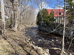 Rivière du Moulin, private property, Vieux moulin Hamelin, chemin Sir-Lomer-Gouin
 On the vintage truck: Paul Guilbault, Grondines, Charroyage général (Transport), chemin Sir-Lomer-Gouin


 Sign, Cap Lauzon,[25] a strategic location, rue de l'Église
 Wharf of Deschambault, from Cap Lauzon, rue Saint-Joseph
 From Cap Lauzon, rue Saint-Joseph
 From Cap Lauzon, rue Saint-Joseph


 Tidal flats, Ardea herodias. Great blue heron. Great Blue Heron and Killdeer Plover, chemin des Ancêtres
 Ordinary mill or windmill, tidal flats at low tide, from the wharf
 Private Property, Duck Cache Launch[22]
 Private Property, Canal déferrant du Cardinal (Cove),[29] the landfill, back beach
 Snow, ice and light fog, chemin des Ancêtres
 Wharf, breakwater, boat launch, harbour[28]
 Private property, clothesline & Swing, Sir-Lomer-Gouin Road


 Sanguinaria canadensis L. — Bloodroot
 Physocarpus opulifolius (L.) Maxim. — Nine-bark
 Hesperis matronalis L. — Dame's rocket
 Malva moschata L. — Musk mallow
 Centaurea nigra L. ― Black knapweed
 Impatiens glandulifera Royle. ― Giant Impatiens


