Colquitt, Georgia
City in Georgia, United States From Wikipedia, the free encyclopedia
Colquitt is a city and the county seat of Miller County, in the southwestern portion of the U.S. state of Georgia. The population was 2,001 at the 2020 census.[3][6] Colquitt has been the county seat of Miller County since Miller County was incorporated by the Georgia Legislature in 1856. The city formally incorporated on December 19, 1860,[1] and is Miller County's only incorporated municipality. Colquitt is named for U.S. Congressman and Senator Walter Terry Colquitt.[7]
Colquitt, Georgia | |
|---|---|
 Colquitt City Hall | |
 Seal | |
 Location in Miller County and the state of Georgia | |
| Coordinates: 31°10′23″N 84°43′43″W | |
| Country | |
| State | Georgia |
| County | Miller |
| Incorporated (City) | December 19, 1860[1] |
| Area | |
• Total | 8.27 sq mi (21.42 km2) |
| • Land | 8.23 sq mi (21.32 km2) |
| • Water | 0.04 sq mi (0.10 km2) |
| Elevation | 167 ft (51 m) |
| Population | |
• Total | 2,001 |
| • Density | 243.08/sq mi (93.85/km2) |
| Time zone | UTC-5 (Eastern (EST)) |
| • Summer (DST) | UTC-4 (EDT) |
| ZIP code | 39837 |
| Area code | 229 |
| FIPS code | 13-18000[4] |
| GNIS feature ID | 0355248[5] |
| Website | colquittga.gov |
The Colquitt Town Square Historic District was added to the National Register of Historic Places in 1983.
Geography
Colquitt is located in the center of Miller County at 31°10′23″N 84°43′43″W (31.173090, -84.728512).[8]
The city is located along U.S. Route 27, Georgia State Route 45, and Georgia State Route 91 in southwestern Georgia. U.S. 27 runs northwest–southeast through the center of town as Crawford Street, leading northwest 21 mi (34 km) to Blakely and southeast 22 mi (35 km) to Bainbridge. GA-45 runs north–south through the city concurrent with U.S. 27 and GA-91, and leads north 9 mi (14 km) to Damascus and southwest 14 mi (23 km) to Iron City. GA-91 also runs north–south through the city as well, and leads northeast 28 mi (45 km) to Newton and southwest 14 mi (23 km) to Donalsonville.
According to the United States Census Bureau, the city has a total area of 8.3 square miles (21 km2), of which 0.04 square miles (0.10 km2), or 0.48%, are water.[2]
Demographics
| Census | Pop. | Note | %± |
|---|---|---|---|
| 1880 | 119 | — | |
| 1900 | 320 | — | |
| 1910 | 600 | 87.5% | |
| 1920 | 810 | 35.0% | |
| 1930 | 832 | 2.7% | |
| 1940 | 1,416 | 70.2% | |
| 1950 | 1,664 | 17.5% | |
| 1960 | 1,556 | −6.5% | |
| 1970 | 2,026 | 30.2% | |
| 1980 | 2,065 | 1.9% | |
| 1990 | 1,991 | −3.6% | |
| 2000 | 1,939 | −2.6% | |
| 2010 | 1,992 | 2.7% | |
| 2020 | 2,001 | 0.5% | |
| U.S. Decennial Census[9] 1850-1870[10] 1870-1880[11] 1890-1910[12] 1920-1930[13] 1940[14] 1950[15] 1960[16] 1970[17] 1980[18] 1990[19] 2000[20] 2010[21] | |||
| Race | Num. | Perc. |
|---|---|---|
| White (non-Hispanic) | 802 | 40.08% |
| Black or African American (non-Hispanic) | 1,096 | 54.77% |
| Native American | 3 | 0.15% |
| Asian | 18 | 0.9% |
| Other/Mixed | 51 | 2.55% |
| Hispanic or Latino | 31 | 1.55% |
As of the 2020 United States census, there were 2,001 people, 854 households, and 520 families residing in the city.
Education
Colquitt is part of the Miller County School District.[23][24] It is served by:
- Miller County Elementary School
- Miller County Middle School
- Miller County High School
Public Library
Colquitt is home to the Miller County - James W. Merritt Jr. Memorial Library.[25] The library serves the citizens of Miller County with a collection of print and audiovisual materials. The library is located at 259 E. Main Street in Colquitt.
Notable people
- Peter Zack Geer, Lieutenant Governor of Georgia from 1963 to 1967[26]
- Charles Grant, NFL football player
- Brandon Miller, National Football League player with the Atlanta Falcons and Seattle Seahawks
- Keyon Nash, professional football player with the Oakland Raiders, as well as the Rhein Fire of NFL Europe, and the Canadian Football League's Toronto Argonauts
- Gordie Richardson, Major League Baseball player with the St. Louis Cardinals and New York Mets
- Zula Brown Toole, first woman to found a newspaper in Georgia, the Miller County Liberal in 1897[27]
Gallery
 James W. Merritt Jr. Memorial Library
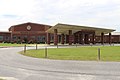 The middle/high school entrance of the Miller County School District school building
 Colquitt Post Office
 Colquitt-Miller County Chamber of Commerce and Welcome Center


References
Wikiwand - on
Seamless Wikipedia browsing. On steroids.