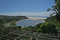
Chintsa
Place in Eastern Cape, South Africa From Wikipedia, the free encyclopedia
Chintsa (Xhosa for "crumbling banks"), alternatively rendered Cintsa,[2] is a village in the Wild Coast region of the Eastern Cape province, South Africa. It is situated 38 km north-east of East London[3] and 10 km north of Gonubie, at the mouth of the Chintsa River.
Chintsa
Cintsa | |
|---|---|
 Chintsa | |
| Coordinates: 32°49′S 28°6′E | |
| Country | South Africa |
| Province | Eastern Cape |
| District | Amathole |
| Municipality | Great Kei |
| Area | |
• Total | 4.10 km2 (1.58 sq mi) |
| Population (2011)[1] | |
• Total | 1,740 |
| • Density | 420/km2 (1,100/sq mi) |
| Racial makeup (2011) | |
| • Black African | 83.8% |
| • Coloured | 0.6% |
| • Indian/Asian | 0.2% |
| • White | 14.5% |
| • Other | 0.9% |
| First languages (2011) | |
| • Xhosa | 81.4% |
| • English | 12.1% |
| • Afrikaans | 4.3% |
| • Other | 2.3% |
| Time zone | UTC+2 (SAST) |
There are two resort areas catering to tourists interested in sea fishing to the east and west of the river.[4]
The village is in Xhosa country. It has a laid-back atmosphere with low-cost accommodation and unspoilt white sand beaches in Chintsa East, backed by forested dunes, lagoons and rivers.[5][6]
References
Wikiwand - on
Seamless Wikipedia browsing. On steroids.


