China Strait
A strait in Papua New Guinea From Wikipedia, the free encyclopedia
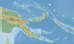
The China Strait is a navigable strait in the Milne Bay Province of Papua New Guinea between mainland New Guinea and Samarai Island.[1][2][3] The strait, 4 nautical miles (7 km) in length and .75 nautical miles (1 km) wide, connects the Solomon Sea with the Coral Sea[citation needed].
| China Strait | |
|---|---|
| Location | Papua New Guinea |
| Coordinates | 10°35′00″S 150°41′00″E |
| Type | strait |

References
External links
Wikiwand in your browser!
Seamless Wikipedia browsing. On steroids.
Every time you click a link to Wikipedia, Wiktionary or Wikiquote in your browser's search results, it will show the modern Wikiwand interface.
Wikiwand extension is a five stars, simple, with minimum permission required to keep your browsing private, safe and transparent.

