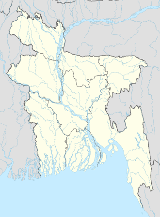
Chhagalnaiya
Place in Chittagong, Bangladesh From Wikipedia, the free encyclopedia
Chhagalnaiya (Bengali: ছাগলনাইয়া) is a town in Feni district of Chittagong Division, Bangladesh. The town is the administrative headquarters and urban centre of Chhagalnaiya Upazila.The urban area of Chhagalnaiya is the biggest in Chhagalnaiya Upazila and 2nd most populous in Feni district. Chhagalnaiya is 14.6 km away[2][better source needed] from the district headquarter, Feni city while the distance from the Divisional Headquarter, Chittagong is 96.6 km.[3][better source needed] The nearest airport from Chhagalnaiya town is Shah Amanat International Airport.[citation needed]
Chhagalnaiya
ছাগলনাইয়া Sagarnaiya | |
|---|---|
 A sculpture situated at the Zero point of Chhagalnaiya town | |
| Coordinates: 23.039483°N 91.514628°E | |
| Country | Bangladesh |
| Division | Chittagong |
| District | Feni |
| Upazila | Chhagalnaiya |
| Upazila headquarter | 1 October 1983 |
| Municipality | 3 June 2002 |
| Government | |
| • Type | Mayor–Council |
| • Body | Chhagalnaiya Municipality |
| • Paura Mayor | Mohammad Mostafa[1] |
| Area | |
• Total | 25.3 km2 (9.8 sq mi) |
| Population (2011) | |
• Total | 48,243 |
| • Density | 1,900/km2 (4,900/sq mi) |
| Time zone | UTC+6 (Bangladesh Time) |
| National Dialing Code | +880 |
Etymology
Despite some beliefs, the origin of the word chhagal (ছাগল, 'goat') in Chhagalnaiya has no connection to the Gandhi's goat stealing incident of 1946.[a][5] The Chhagalnaya-Parshuram region, located in this relatively ancient part of Noakhali, had a large portion of its area submerged underwater in the distant past. This body of water was known as either billasagar or sukh sagar (transl. sea of happiness), according to different opinions. Numerous boat wrecks have been discovered in this area once inhabited by boatmen, referred to as sagarer naiya (Bengali: সাগরের নাইয়া, lit. 'boatmen of the sea') in Bengali. Over time, sagarer naiya evolved into sagarnaiya in folk language, and eventually into chagalnaiya, the term used today. Some accounts suggest that during the early British period, the word sagar (sea) was mistakenly transcribed as sagol, resulting in sagolnaiya or Chhagalnaiya.[6]: 111
Climate
| ||||||||||||||||||||||||||||||||||||||||||||||||||||||||||||||||||||||||||||||||||||||||||||||||||||||||||||||||||||||||||||
Geography
Chhagalnaiya is located at 23.0361°N 91.5194°E. It has an average elevation of 8 metres.[citation needed]
Demography
According to 2011 Bangladesh census, Chhagalnaiya town has a population of about 48,243 of which 23,857 are male and 24,386 are female. [8]
Administration
The town is administered by a local governing body called Chhagalnaiya Municipality or Chhagalnaiya Paurashava which has divided the town into 9 wards. The town occupies an area of 27.04 km2 of which municipality governs an area of 25.2 5 km2.[citation needed]
Transport
The town is the road transport hub of the upazila. To the west it is connected by zilla road Z1031 to Feni, about 14 kilometres (8.7 mi) away. Z1035 runs north 23 kilometres (14 mi) to Parshuram. Z1032 runs south 11 kilometres (6.8 mi) to Muhuriganj, where it connects to the Dhaka-Chittagong Highway.[9]
Education
The literacy rate of the town is 62.7%. Some of the notable educational institution of the town are:
- Chhagalnaiya government college
- Chhagalnaiya academy
- Chhagalnaiya Govt. Pilot high school
- Chhagalnaiya Pilot girls high School
- Moulovi Samsul Karim College
- Radhanagar High School
- Karaiya High School
See also
Notes
- In Bangladesh, Gandhi is remembered for his visit to the coastal area of Noakhali, the site of a 1946 communal riot, where he walked through villages to calm the mobs. According to legend, during this time, some individuals opposed to Gandhi's philosophy stole his goat, which had been providing him with nourishing milk, and cooked it for dinner.[4]
References
Wikiwand - on
Seamless Wikipedia browsing. On steroids.

