Top Qs
Timeline
Chat
Perspective
Chai Nat province
Province of Thailand From Wikipedia, the free encyclopedia
Remove ads
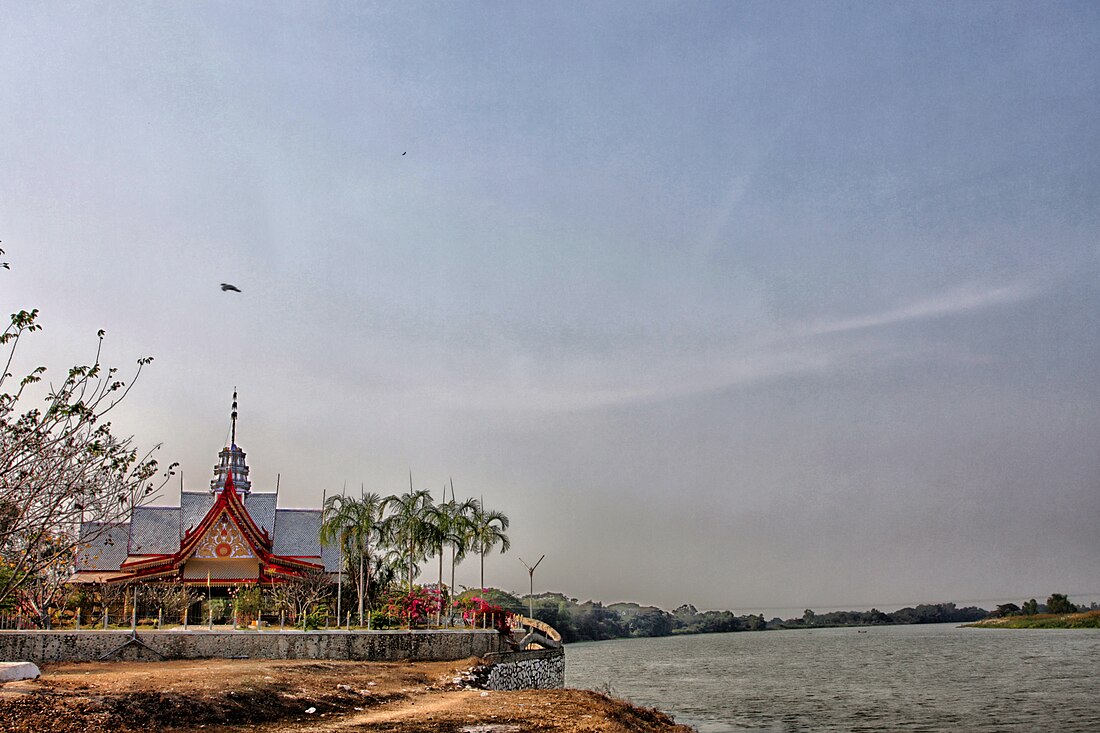
Chai Nat (Thai: ชัยนาท, pronounced [tɕʰāj nâːt]) is one of the central provinces (changwat) of Thailand.[5] Neighbouring provinces are (from north clockwise) Nakhon Sawan, Sing Buri, Suphan Buri, and Uthai Thani. The town of Chai Nat is 188 km north of Bangkok.[6]
According to the Ayutthaya Testimonies, the provincial center of Chai Nat was founded by the Siamese monarch Surindrarāja in the early 11th century. He renamed Ban Pran Nuea (บ้านพรานเนื้อ) as Phra Nakhon Chai Nat Buri (พระนครชัยนาทบุรี) and designated it as the new capital of the region, thereby superseding Phraek Si Racha as the principal administrative center of the polity.[7]: 41
Remove ads
Geography
Chai Nat is on the flat river plain of central Thailand's Chao Phraya River valley. In the south of the province, the Chao Phraya Dam (formerly Chai Nat Dam) impounds the Chao Phraya River, both for flood control as well as to divert water into the country's largest irrigation system for the irrigation of rice paddies in the lower river valley. The dam, part of the Greater Chao Phraya Project, was finished in 1957 and was the first dam constructed in Thailand. The total forest area is 64 km2 (25 sq mi) or 2.6 percent of the provincial area.[8]
Remove ads
History
Chai Nat was first established during the Ayutthaya period and was used as a successful base of operations for confronting the Burmese army. As the Burmese were defeated every time, the area earned the name Chai Nat, meaning 'place of victory'.[5]
After World War II, when the Japanese had left, economic conditions were bad and food was in short supply. Chai Nat suffered this problem especially badly when bandits gathered in the countryside stealing cattle and inciting violence and crime.[9]
Remove ads
Symbols
The provincial seal shows a dhammachakka with a mountain in the background. It refers to the Dhammachak Buddha image housed in the hall of Wat Dhammamoen, built on the slope of a mountain.[10]
The provincial tree is the bael fruit tree (Aegle marmelos), and the provincial flower is the Rainbow Shower tree (Cassia javanica). Bleeker's sheatfish (Phalacronotus bleekeri) is the provincial fish.
The slogan of the province is "Venerable Luang Pu Suk, renowned Chao Phraya Dam, famous bird park and tasty khao taengkwa pomelo."
Administrative divisions
Provincial government

Chai Nat is divided into eight districts (amphoes). The districts are further subdivided into 53 sub-districts (tambons) and 503 villages (mubans).
Local government
As of 26 November 2019 there are:[11] one Chai Nat Provincial Administrative Organization - PAO (ongkan borihan suan changwat) and 39 municipal (thesaban) areas in the province. Chai Nat has town (thesaban mueang) status. Further 38 subdistrict municipalities (thesaban tambon). The non-municipal areas are administered by 20 Subdistrict Administrative Organizations - SAO (ongkan borihan suan tambon).
Remove ads
Places

Apart from Chao Phraya Dam, Chai Nat also has various important places such as
- Chai Nat Bird Park: is the largest bird park in Chai Nat and Thailand, covering the area of 248 rai, include the largest aviary in Asia, and release the birds living in nature. Besides, there is also a public aquarium displaying freshwater fish species found in the Chao Phraya River.
- Wat Pak Khlong Makham Thao: a Thai temple in Wat Sing District, next to the mouth of Khlong Makham Thao (Tha Chin River). This temple used to be the residence of Luang Pu Suk. Suk was a revered monk who was known for producing many renowned amulets. He has many disciples, of whom the most respected was Prince Abhakara Kiartivongse, Prince of Chumphon.
- Sapphaya Old Police Station: an ancient police station of the district of Sapphaya, built since the King Rama V's reign older than 100 years. The station features a single level wooden building with a hip roof and received the ASA Architectural Conservation Award in 2018.
- Chai Nat Provincial Stadium, also known as Khao Plong Stadium: is a Chai Nat Provincial Stadium and the home stadium of Chainat Hornbill F.C.
Remove ads
Notable people
Born in Chai Nat
- Rong Wongsawan (1932–2009): writer
- Pongsri Woranuch (1938–2025): Luk thung singer
- Pumpuang Duangjan (1961–1992): Luk thung singer, actress
- Kapol Thongplub (b. 1967): DJ, TV host
- Muangchai Kittikasem (b. 1968): world-class professional boxer
- Saranyu Winaipanit (b. 1984): singer, actor
- Supanat Chalermchaichareonkij (b. 1986): singer, actor
- Natthanicha Jaisaen (b. 1998): world-class volleyball player
Remove ads
Human achievement index 2022
| Health | Education | Employment | Income |
| 68 | 24 | 72 | 67 |
| Housing | Family | Transport | Participation |
 |
 |
 |
|
| 46 | 63 | 60 | 19 |
| Province Chai Nat, with an HAI 2022 value of 0.6124 is "low", occupies place 73 in the ranking. | |||
Since 2003, United Nations Development Programme (UNDP) in Thailand has tracked progress on human development at sub-national level using the Human achievement index (HAI), a composite index covering all the eight key areas of human development. National Economic and Social Development Board (NESDB) has taken over this task since 2017.[3]
| Rank | Classification |
| 1–13 | "High" |
| 14–29 | "Somewhat high" |
| 30–45 | "Average" |
| 46–61 | "Somewhat low" |
| 62–77 | "Low" |
| Map with provinces and HAI 2022 rankings |
 |
Remove ads
References
External links
Wikiwand - on
Seamless Wikipedia browsing. On steroids.
Remove ads


