Top Qs
Timeline
Chat
Perspective
Cerna (Danube)
River in Mehedinți, Romania From Wikipedia, the free encyclopedia
Remove ads
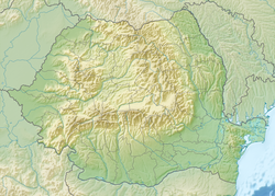
The Cerna (Hungarian: Cserna) is a river in Romania, a left tributary of the river Danube.[1][2] The Cerna has its source on the south-east side of the Godeanu Mountains and flows into the Danube near the town Orșova.[3] The upper reach of the river is sometimes called Cernișoara. With a length of 79 km (49 mi) and its basin of 1,380 km2 (530 sq mi),[2] it carves an erosive tectonic valley with numerous gorges, quite deep sometimes. There is a man-made lake on it (Tierna), just before it crosses the Băile Herculane spa, to perpetuate the old toponimic od Dierna.[clarification needed] The upper course of the Cerna is part of the Domogled-Valea Cernei National Park. The Cerna flows through the villages and towns Cerna-Sat, Țațu, Băile Herculane, Pecinișca, Bârza, Topleț, Coramnic and Orșova.
Remove ads
Tributaries
The following rivers are tributaries of the river Cerna (from source to mouth):[2]
- Left: Arsaca, Jelerău, Valea Mare
- Right: Șturu, Măneasa, Valea Cărbunelui, Valea lui Iovan, Balmez, Naiba, Olanul, Craiova, Iauna, Topenia, Iuta, Prisăcina, Belareca, Jardașița Mare, Sacherștița
References
Wikiwand - on
Seamless Wikipedia browsing. On steroids.
Remove ads


