Top Qs
Timeline
Chat
Perspective
Cato Point
From Wikipedia, the free encyclopedia
Remove ads
Remove ads
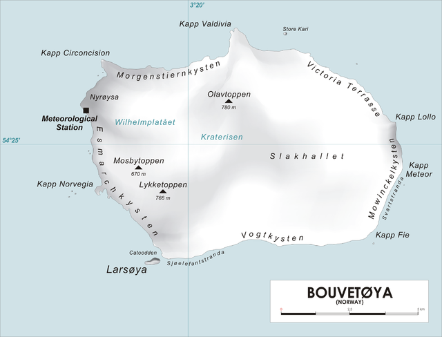
Cato Point (54°28′S 3°22′E)is a headland forming the southwest extremity of Bouvet Island. It was first charted in 1898 by a German expedition under Carl Chun. The Norwegian expedition under Captain Harald Horntvedt made a landing here from the Norvegia in December 1927; they applied the name.[1][2]

Remove ads
References
Wikiwand - on
Seamless Wikipedia browsing. On steroids.
Remove ads
