Castelnaud-la-Chapelle
Commune in Nouvelle-Aquitaine, France From Wikipedia, the free encyclopedia
Castelnaud-la-Chapelle (French pronunciation: [kastɛlno la ʃapɛl]; Occitan: Castelnòu e La Capèla) is a commune in the Dordogne department in Nouvelle-Aquitaine in southwestern France. It was created in 1973 by the merger of two former communes: Castelnaud-Fayrac and La Chapelle-Péchaud.[3] It is a member of Les Plus Beaux Villages de France (The Most Beautiful Villages of France) Association.
Castelnaud-la-Chapelle | |
|---|---|
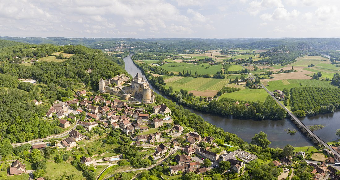
 View of Castelnaud-la-Chapelle and its castle | |
| Coordinates: 44°48′57″N 1°08′58″E | |
| Country | France |
| Region | Nouvelle-Aquitaine |
| Department | Dordogne |
| Arrondissement | Sarlat-la-Canéda |
| Canton | Vallée Dordogne |
| Government | |
| • Mayor (2020–2026) | Daniel Dejean[1] |
Area 1 | 20.88 km2 (8.06 sq mi) |
| Population (2022)[2] | 449 |
| • Density | 22/km2 (56/sq mi) |
| Time zone | UTC+01:00 (CET) |
| • Summer (DST) | UTC+02:00 (CEST) |
| INSEE/Postal code | 24086 /24250 |
| Elevation | 51–283 m (167–928 ft) (avg. 71 m or 233 ft) |
| 1 French Land Register data, which excludes lakes, ponds, glaciers > 1 km2 (0.386 sq mi or 247 acres) and river estuaries. | |
The Château de Castelnaud-la-Chapelle is located in the commune.
Geography
The river Céou flows northward through the western part of the commune, then flows into the Dordogne, which forms all of the commune's northern border.
The village is located above the confluence of the two rivers.
Population
| Year | Pop. | ±% |
|---|---|---|
| 1962 | 497 | — |
| 1968 | 440 | −11.5% |
| 1975 | 380 | −13.6% |
| 1982 | 374 | −1.6% |
| 1990 | 408 | +9.1% |
| 1999 | 426 | +4.4% |
| 2008 | 470 | +10.3% |
| 2018 | 452 | −3.8% |
See also
References
External links
Wikiwand - on
Seamless Wikipedia browsing. On steroids.


