Loading AI tools
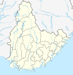
Botnsvatnet or Botsvatnet is a lake in the municipality of Valle in Agder county, Norway. The 5.61-square-kilometre (2.17 sq mi) lake is located just north of the lakes Rosskreppfjorden and Kolsvatnet and the mountain Urddalsknuten, and it lies to the southeast of the mountain Bergeheii. The village of Valle is located about 14 kilometres (8.7 mi) to the east of the lake. The lake sits at an elevation of 1,020 metres (3,350 ft) above sea level.[1]
| Botnsvatnet | |
|---|---|
| Location | Valle, Agder |
| Coordinates | 59.1797°N 07.2449°E |
| Primary outflows | Gjuvvassåni river |
| Catchment area | Kvina |
| Basin countries | Norway |
| Max. length | 5.8 kilometres (3.6 mi) |
| Max. width | 1.5 kilometres (0.93 mi) |
| Surface area | 5.61 km2 (2.17 sq mi) |
| Shore length1 | 25.18 kilometres (15.65 mi) |
| Surface elevation | 1,020 metres (3,350 ft) |
| References | NVE |
| 1 Shore length is not a well-defined measure. | |
Wikiwand in your browser!
Seamless Wikipedia browsing. On steroids.
Every time you click a link to Wikipedia, Wiktionary or Wikiquote in your browser's search results, it will show the modern Wikiwand interface.
Wikiwand extension is a five stars, simple, with minimum permission required to keep your browsing private, safe and transparent.

