Top Qs
Timeline
Chat
Perspective
Biryulyovo Vostochnoye District
District in Federal city of Moscow, Russia From Wikipedia, the free encyclopedia
Remove ads
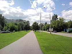
Biryulyovo Vostochnoye District (Russian: район Бирюлёво Восточное) is a territorial division (a district, or raion) in Southern Administrative Okrug, one of the 125 in the federal city of Moscow, Russia.[1] It is located in the south of the city and borders with Biryulyovo Zapadnoye in the west, Tsaritsyno in the north, Orekhovo-Borisovo (Severnoye and Yuzhnoye) in the east, and Moscow Ring Road (MKAD) in the south. The area of the district is 14.772 square kilometers (5.704 sq mi).[2] As of the 2010 Census, the total population of the district was 145,100.[3]
Remove ads
Remove ads
Municipal status
As a municipal division, the district is incorporated as Biryulyovo Vostochnoye Municipal Okrug.[4]
Economy
Transportation
The western border of the district is formed by a railway, and two railway stations (Biryulyovo-Tovarnaya and Biryulyovo-Passazhirskaya) are located in the district. They serve the Paveletsky suburban railway line. Another railway station within the limits of the district is Tsaritsyno serving the Kursky suburban railway line, Moscow, which is located next to the metro station of the same name.
Remove ads
References
Wikiwand - on
Seamless Wikipedia browsing. On steroids.
Remove ads


