Loading AI tools
Town in Tadjoura, Djibouti From Wikipedia, the free encyclopedia
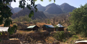
Bankouale (Arabic: بنكوالي) is a town in Tadjoura region of Djibouti. One of the distinctive features of Bankouale countryside is the widespread growing of vegetables. In the meantime there are also first approaches to establish gentle tourism.
Bankouale بنكوالي | |
|---|---|
Town | |
 | |
| Coordinates: 11°49′N 42°40′E | |
| Country | |
| Region | Tadjoura |
| Elevation | 640 m (2,100 ft) |
Bankouale has a hot arid climate (BWh) by the Köppen-Geiger system.
| Climate data for Bankouale | |||||||||||||
|---|---|---|---|---|---|---|---|---|---|---|---|---|---|
| Month | Jan | Feb | Mar | Apr | May | Jun | Jul | Aug | Sep | Oct | Nov | Dec | Year |
| Mean daily maximum °C (°F) | 25.0 (77.0) |
25.2 (77.4) |
27.2 (81.0) |
29.4 (84.9) |
32.9 (91.2) |
36.5 (97.7) |
36.9 (98.4) |
35.9 (96.6) |
34.0 (93.2) |
30.1 (86.2) |
27.2 (81.0) |
25.5 (77.9) |
30.5 (86.9) |
| Mean daily minimum °C (°F) | 16.0 (60.8) |
17.0 (62.6) |
18.3 (64.9) |
20.5 (68.9) |
23.2 (73.8) |
26.5 (79.7) |
25.6 (78.1) |
25.0 (77.0) |
25.0 (77.0) |
20.6 (69.1) |
18.1 (64.6) |
16.7 (62.1) |
21.0 (69.9) |
| Average rainfall mm (inches) | 30 (1.2) |
27 (1.1) |
18 (0.7) |
25 (1.0) |
10 (0.4) |
4 (0.2) |
16 (0.6) |
30 (1.2) |
29 (1.1) |
11 (0.4) |
38 (1.5) |
23 (0.9) |
261 (10.3) |
| Source: Climate-Data.org, altitude: 640 metres or 2,100 feet[1] | |||||||||||||
Seamless Wikipedia browsing. On steroids.
Every time you click a link to Wikipedia, Wiktionary or Wikiquote in your browser's search results, it will show the modern Wikiwand interface.
Wikiwand extension is a five stars, simple, with minimum permission required to keep your browsing private, safe and transparent.