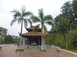
Bảo Thắng district
District in Northeast, Vietnam From Wikipedia, the free encyclopedia
Bảo Thắng is a rural district (huyện) of Lào Cai province in the Northeast region of Vietnam.
You can help expand this article with text translated from the corresponding article in Vietnamese. (March 2009) Click [show] for important translation instructions.
|
As of 2020, the district had a population of 103,262.[1] The district covers an area of 651.98 km². The district capital lies at Phố Lu.[2]
History
The administrative unit of Bảo Thắng was first established in 1059 by the Lý dynasty.[3]
Administrative divisions
Bảo Thắng district is subdivided to 14 commune-level subdivisions, including the townships of Phố Lu, Nông trường Phong Hải, Tằng Loỏng and the rural communes of: Bản Cầm, Bản Phiệt, Gia Phú, Phong Niên, Phú Nhuận, Sơn Hà, Sơn Hải, Thái Niên, Trì Quang, Xuân Giao, Xuân Quang.
References
Wikiwand - on
Seamless Wikipedia browsing. On steroids.


