Top Qs
Timeline
Chat
Perspective
Albula Pass
Swiss mountain pass From Wikipedia, the free encyclopedia

Remove ads
The Albula Pass (Romansh: Pass d'Alvra[2] or ⓘ,[3] German: Albulapass) (el. 2312 m) is a Swiss mountain pass in the canton of Graubünden. It lies at the heart of the Albula Alps, on the watershed between the Albula, tributary of the Rhine and the Ova d'Alvra, tributary of the Inn. Overlooking the pass are the ranges of Piz Üertsch (north) and Crasta Mora (south).[4]

Remove ads
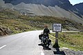
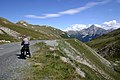
The Albula Pass is an important axis from central Graubünden to Engadin. It is traversed by a paved road from Thusis to La Punt, via Bergün. It is also traversed by the Albula Railway, although at a lower elevation through the Albula Tunnel (1,820 m), from Thusis to Bever, also via Bergün.
On the summit of the pass is a hospice. East of the pass, on the Engadin side, is a lake named Albulasee (2,294 m) which is 4.2 ha large.[5] West of the pass, at a further distance, is the larger Lai da Palpuogna, a popular stop on the Albula road.
The Albula Pass is one of the three paved road passes connecting the Engadin with the northern Grisons, the two other being the Julier Pass and the Flüela Pass.[4]
- Albula Pass
 Albula Railway
 Lai da Palpuogna


 Old road sign on the top
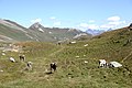


Remove ads
See also
References
External links
Wikiwand - on
Seamless Wikipedia browsing. On steroids.
Remove ads