Hastière
Municipality in French Community, Belgium From Wikipedia, the free encyclopedia
Hastière (French pronunciation: [as.tjɛʁ]; Walloon: Astire) is a municipality of Wallonia located in the province of Namur, Belgium.
Hastière
| |
|---|---|
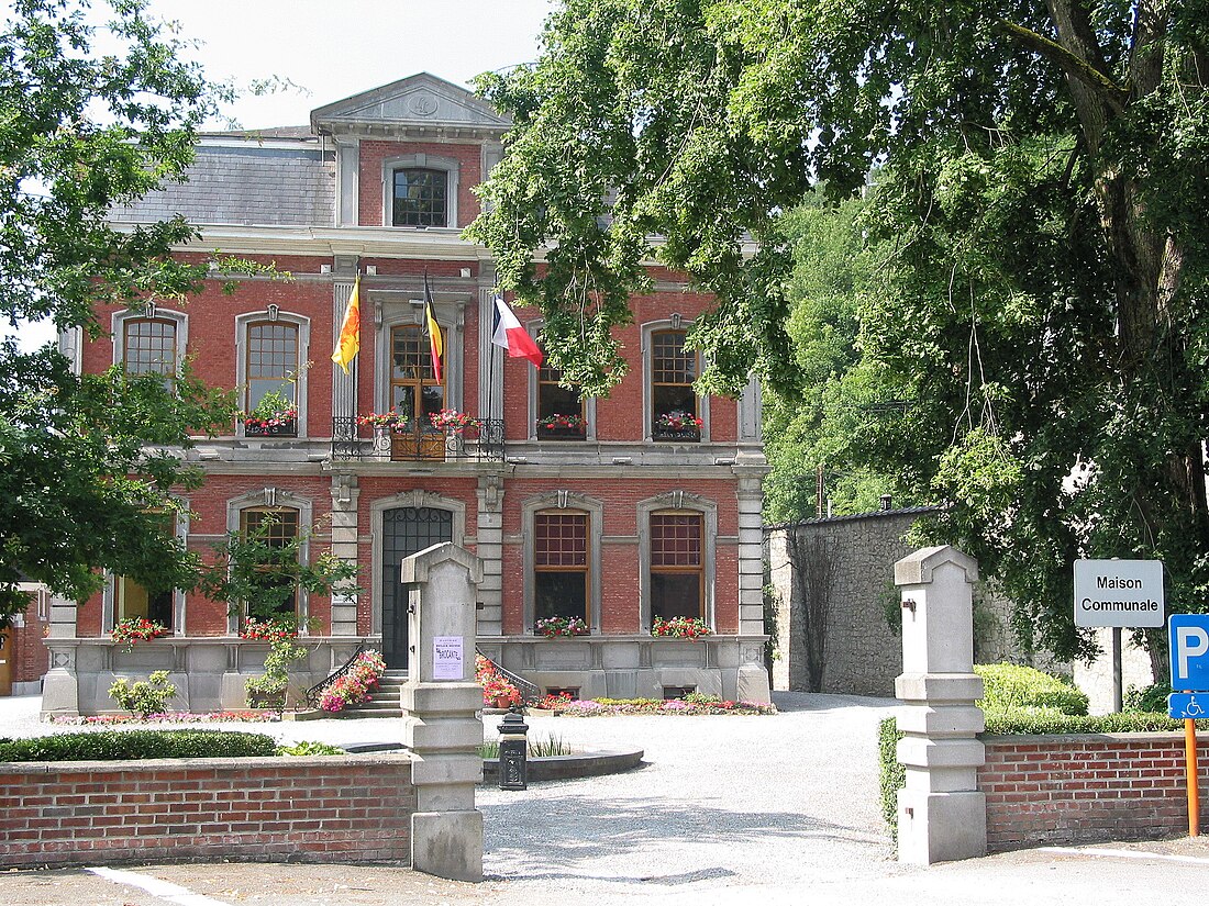
 Town Hall of Hastière | |
| Coordinates: 50°13′N 04°50′E | |
| Country | |
| Community | French Community |
| Region | Wallonia |
| Province | Namur |
| Arrondissement | Dinant |
| Government | |
| • Mayor | Claude Bultot (PS) |
| • Governing party/ies | PS |
| Area | |
| • Total | 56.59 km2 (21.85 sq mi) |
| Population (2018-01-01)[1] | |
| • Total | 5,979 |
| • Density | 110/km2 (270/sq mi) |
| Postal codes | 5540-5544 |
| NIS code | 91142 |
| Area codes | 082 |
| Website | www.hastiere.be |
On 1 January 2006 the municipality had 5,230 inhabitants. The total area is 56.46 square kilometres (21.8 sq mi), giving a population density of 93 inhabitants per square kilometre.
The municipality consists of the following districts: Agimont, Blaimont, Hastière-Lavaux (location of town hall), Hastière-par-delà, Heer, Hermeton-sur-Meuse, and Waulsort.
Hastière's attractions along the river Meuse include the Romanesque Abbey Church of Saint Peter, a former Benedictine monastery (at Hastière-Lavaux), the Renaissance Castle of Freÿr surrounded by 18th-century classical gardens and facing the rocks of Freÿr (north of Waulsort), and the 17th-century buildings of another former Benedictine monastery (at Waulsort).

See also
References
External links
Wikiwand in your browser!
Seamless Wikipedia browsing. On steroids.
Every time you click a link to Wikipedia, Wiktionary or Wikiquote in your browser's search results, it will show the modern Wikiwand interface.
Wikiwand extension is a five stars, simple, with minimum permission required to keep your browsing private, safe and transparent.


