Loading AI tools

District of Lancashire, England From Wikipedia, the free encyclopedia
West Lancashire is a local government district with borough status in Lancashire, England. The council is based in Ormskirk, and the largest town is Skelmersdale. The district borders Fylde to the north, over the Ribble Estuary; South Ribble, Chorley, and Wigan to the east; St Helens and Knowsley to the south; and Sefton to the south and west.
West Lancashire | |
|---|---|
Borough | |
The West Lancashire plain near Burscough | |
 Shown within the ceremonial county of Lancashire | |
| Sovereign state | United Kingdom |
| Constituent country | England |
| Region | North West England |
| Ceremonial county | Lancashire |
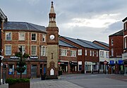
| Admin. HQ | Ormskirk |
| Government | |
| • Type | West Lancashire Borough Council |
| • Leadership | Leader and Cabinet |
| • MPs: |
|
| Area | |
| • Total | 134 sq mi (347 km2) |
| • Rank | 102nd |
| Population (2022) | |
| • Total | 119,367 |
| • Rank | Ranked 202nd |
| • Density | 890/sq mi (340/km2) |
| Ethnicity (2021) | |
| • Ethnic groups | |
| Religion (2021) | |
| • Religion | List
|
| Time zone | UTC+0 (Greenwich Mean Time) |
| • Summer (DST) | UTC+1 (British Summer Time) |
| Postcode | |
| ONS code |
|
The borough has a population of 117,400 and an area of 133.8 square miles (347 km2).[2] It is primarily rural, and the most populous settlements after Ormskirk and Skelmersdale are Burscough (9,935), Up Holland (7,578), and Tarleton (5,959).[3] The borough council is based in Ormskirk, and there are twenty-one civil parishes.
The west of the borough contains much of the southern part of the Lancashire Plain, a low-lying region of mossland. A large lake called Martin Mere occupied much of the area until it was drained for agriculture. The northern border of the borough is the Ribble Estuary, and both it and the remnant of Martin Mere are Ramsar sites.[4] In the east the land rises to Harrock Hill, Parbold Hill, and Ashurst Hill; the River Douglas flows west through the valley between the last two, then turns north and forms the borough boundary.
The district was created on 1 April 1974 under the Local Government Act 1972, covering the whole area of two former districts and parts of another two districts, all of which were abolished at the same time:[5]
In 2009 the district was awarded borough status, causing the council to change its name from West Lancashire District Council to West Lancashire Borough Council, and allowing the chairman of the council to take the title of mayor.[6][7]
Proposals to divide Lancashire into three unitary authorities were put forward in 2020, which would have seen both Lancashire County Council and West Lancashire Borough Council abolished.[8] The Government did not pursue that proposed reform, although left open the possibility of other forms of reorganisation in future.[9]
West Lancashire Borough Council | |
|---|---|
| Type | |
| Type | |
| Leadership | |
| Structure | |
| Seats | 45 councillors |
Political groups |
|
| Elections | |
Last election | 2 May 2024 |
Last election | 7 May 2026 |
| Meeting place | |
| 52 Derby Street, Ormskirk, L39 2DF | |
| Website | |
| www | |
West Lancashire Borough Council provides district-level services. County-level services are provided by Lancashire County Council.[14] Parts of the district are also covered by civil parishes, which form a third tier of local government.[15]
The council employs around 600 people, making it one of West Lancashire's largest employers. It is responsible for the administration of various services, such as leisure, waste collection, planning permission and pest control.[12]
The council has been under Labour majority control since 2023.
The first election to the council was held in 1973, initially operating as a shadow authority alongside the outgoing authorities until the new arrangements came into effect on 1 April 1974. Political control of the council since 1974 has been as follows:[16][17]
| Party in control | Years | |
|---|---|---|
| No overall control | 1974–1976 | |
| Conservative | 1976–1986 | |
| No overall control | 1986–1987 | |
| Conservative | 1987–1991 | |
| No overall control | 1991–1994 | |
| Labour | 1994–2002 | |
| Conservative | 2002–2014 | |
| No overall control | 2014–2015 | |
| Labour | 2015–2021 | |
| No overall control | 2021–2023 | |
| Labour | 2023–present | |
The role of mayor is largely ceremonial in West Lancashire. Political leadership is instead provided by the leader of the council. The leaders since 1992 have been:[18]
| Councillor | Party | From | To | |
|---|---|---|---|---|
| Alan Bullen | Labour | 1992 | 15 May 2002 | |
| Geoff Roberts | Conservative | 15 May 2002 | 21 May 2008 | |
| Ian Grant | Conservative | 21 May 2008 | 25 May 2014 | |
| David Westley | Conservative | 11 Jun 2014 | 20 May 2015 | |
| Ian Moran | Labour | 20 May 2015 | 8 May 2022 | |
| Yvonne Gagen | Labour | 18 May 2022 | ||
Following the 2024 election, the composition of the council was:[19]
| Party | Councillors | |
|---|---|---|
| Labour | 26 | |
| Conservative | 14 | |
| Our West Lancashire | 5 | |
| Total | 45 | |
The next election is due in 2026.
The council is based at 52 Derby Street in Ormskirk, which was originally a pair of large semi-detached Victorian houses called Beaconsfield (number 52) and Abbotsford (number 54).[20] Beaconsfield was purchased in 1925 by West Lancashire Rural District Council, one of the modern council's predecessors, and converted to become its headquarters, being formally opened on 30 July 1925.[21] Abbotsford was acquired later and the building has been significantly extended to the rear.[22]
Since the last boundary changes in 2023 the council has comprised 45 councillors representing 15 wards, with each ward electing three councillors. Elections are held three years out of every four, with a third of the council (one councillor for each ward) being elected each time for a four-year term. Lancashire County Council elections are held in the fourth year of the cycle when there are no borough council elections.[23]
The south of West Lancashire, including the towns of Burscough, Skelmersdale and Ormskirk fall under the West Lancashire constituency in the House of Commons, which has been represented by Labour Party MP Ashley Dalton since the 2023 West Lancashire by-election, whereas the north of West Lancashire falls under the South Ribble constituency, which has been represented by Conservative Party MP Katherine Fletcher since the 2019 general election.

Skelmersdale, a former New Town, and Ormskirk are the two main towns in the borough. These are surrounded by a patchwork of smaller settlements to the west and north.

There are 21 civil parishes in West Lancashire. The main towns of Skelmersdale and Ormskirk are unparished areas. There is a movement to establish a town council in Skelmersdale.[24] The parish council of Burscough takes the style "town council".[25]
All the civil parishes have a parish council, with the exception of Bispham, which has a parish meeting instead.
In terms of television, the area is served by BBC North West and ITV Granada broadcasting from the Winter Hill transmitter.[26]
Radio stations for the area are:
Local newspaper is the Lancashire Telegraph.[27]
West Lancashire is twinned with:[28]
|
|