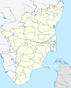
Villupuram Junction (station code: VM[1]) is an NSG–3 category Indian railway station in Tiruchirappalli railway division of Southern Railway zone.[2] It is a railway station in Viluppuram, Tamil Nadu. Being a prominent railway station, it serves as the distribution point of rail traffic from Chennai, the state capital of Tamil Nadu, towards the southern and central parts of the state. It is the third largest junction by number of branch lines in the state of Tamil Nadu after Salem junction,Tiruchchirapalli Junction.[3]
Villuppuram Junction | |||||
|---|---|---|---|---|---|
 Viluppuram Railway | |||||
| General information | |||||
| Location | East Pondy Road, Keelperumpakkam, Viluppuram, Viluppuram district, Tamil Nadu India | ||||
| Coordinates | 11.9426°N 79.4997°E | ||||
| Elevation | 44 metres (144 ft) | ||||
| Owned by | Indian Railways | ||||
| Operated by | Southern Railway zone | ||||
| Line(s) | Chennai Egmore–Kumbakonam–Thanjavur main line Viluppuram–Trichy Chord Line Viluppuram–Pondicherry branch line Viluppuram–Katpadi branch line | ||||
| Platforms | 6 | ||||
| Tracks | 15 | ||||
| Connections | Auto rickshaw, Taxi, Bus | ||||
| Construction | |||||
| Structure type | Standard (on ground station) | ||||
| Parking | Yes | ||||
| Accessible | |||||
| Other information | |||||
| Status | Functioning | ||||
| Station code | VM[1] | ||||
| Zone(s) | Southern Railway | ||||
| Division(s) | Tiruchirapalli | ||||
| History | |||||
| Opened | 1879 | ||||
| Rebuilt | 2011 | ||||
| Electrified | 25 kV AC 50 Hz | ||||
| |||||
Location and layout
Villupuram railway station covers about 20 acres of a vast area, six platforms – Platforms 1 to 3 occupy a length of 600 metres (2,000 ft) and platforms 4 to 6 occupy a length of 550 metres each and few goods/freight train lines which occupies 650 metres (2,130 ft) each and there are few shunting lines. The Railway lines can be crossed with the help of a mass structured over bridge. The railway station is located off the East Pondy Road in the Keelperumpakkam neighborhood. The station is located in close proximity of 3 km (1.9 mi) from the arterial GST Road. Several landmark places such as Railway mixed high school, Aringar Anna Science & Arts College, Municipal Ground, Government Hospital Building, and TNEB Block are located at close proximity from the station.
The Villupuram Old Bus Stand (Town bus stand) is situated at 2 km (1.2 mi) and New bus stand (Central bus stand) is situated at 4 km (2.5 mi) from the Villupuram Junction railway station. The nearest airport is the Puducherry Airport located at a distance of over 40 km (25 mi) and Chennai Airport is 143 km (89 mi) away from Villupuram.
Lines
Five railway lines branch out of the Villupuram Junction railway station.
- Double electrified BG (broad-gauge) line towards Chennai Beach via Chengalpattu Junction.[4][5]
- Double electrified BG (broad-gauge) line towards Tiruchchirapalli Junction via Virudhachalam Junction and Ariyalur. Electrification work was completed in 2009. Also called "Chord Line" to Tiruchirapalli.[6][7][8][9]
- Single electrified BG (broad-gauge) line towards Tiruchirapalli Junction via Cuddalore Port Junction, Mayiladuthurai Junction, Kumbakonam and Thanjavur Junction. Also called as main line
- Single electrified BG (broad-gauge) line towards Katpadi Junction via Tiruvannamalai and Vellore Cantonment.[10][11]
- Single electrified BG (broad-gauge) line to Puducherry.[12][13][14]
Gauge conversion was underway in 2010, making rail traffic even heavier. Villupuram Junction has been undergone a massive infrastructure upgrade to handle this traffic.
Railway lines
| Line no. | Towards |
|---|---|
| 1 | Vridhachalam Junction (South) |
| 2 | Cuddalore Port Junction (South East) |
| 3 | Puducherry (East) |
| 4 | Chengalpattu Junction (North) |
| 5 | Katpadi Junction (North West) |
Projects and development
It is one of the 73 stations in Tamil Nadu to be named for upgradation under Amrit Bharat Station Scheme of Indian Railways.[15]
References
External links
Wikiwand in your browser!
Seamless Wikipedia browsing. On steroids.
Every time you click a link to Wikipedia, Wiktionary or Wikiquote in your browser's search results, it will show the modern Wikiwand interface.
Wikiwand extension is a five stars, simple, with minimum permission required to keep your browsing private, safe and transparent.


