Loading AI tools
Village and civil parish in Norfolk, England From Wikipedia, the free encyclopedia
Themelthorpe is a civil parish in the English county of Norfolk, 3 miles (4.8 km) north-east of Reepham. It covers an area of 1.04 sq mi (2.7 km2) and had a population of 65 in 27 households at the 2001 census.[1] For the purposes of local government, it lies within the district of Broadland.
| Themelthorpe | |
|---|---|
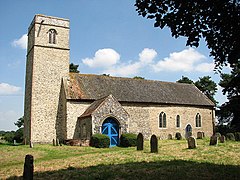
 St Andrew's church, Themelthorpe | |
Location within Norfolk | |
| Area | 2.69 km2 (1.04 sq mi) |
| Population | 65 |
| • Density | 24/km2 (62/sq mi) |
| OS grid reference | TG055238 |
| Civil parish |
|
| District | |
| Shire county | |
| Region | |
| Country | England |
| Sovereign state | United Kingdom |
| Post town | DEREHAM |
| Postcode district | NR20 |
| Dialling code | 01362 |
| Police | Norfolk |
| Fire | Norfolk |
| Ambulance | East of England |
The Themelthorpe Curve was built to join two separate stretches of railway:
It was to be the final section of railway track built in Norfolk by British Rail and was the sharpest curve in the whole of the British rail network.[2]
The curve was opened in 1960, to shorten the route of freight trains carrying concrete products running from a terminal at Lenwade, and was closed by 1985. It is now part of the Marriott's Way footpath, which links Aylsham with Norwich.
Seamless Wikipedia browsing. On steroids.
Every time you click a link to Wikipedia, Wiktionary or Wikiquote in your browser's search results, it will show the modern Wikiwand interface.
Wikiwand extension is a five stars, simple, with minimum permission required to keep your browsing private, safe and transparent.