Situbondo Regency
Regency of East Java, Indonesia From Wikipedia, the free encyclopedia
Situbondo Regency (Madurese: Kabhupatèn Situbânḍâ) is a regency (kabupaten) in the east of East Java province, Indonesia. It covers an area of 1,658.03 km2, and had a population of 647,619 at the 2010 Census[2] and 685,967 at the 2020 Census;[3] the official estimate as at mid 2023 was 684,343 (comprising 334,698 males and 349,645 females).[1] It is located towards the eastern end of Java, before Banyuwangi. Its administrative centre is Situbondo, a small town within the regency. One of its famous tourist sites is Baluran National Park.
This article needs additional citations for verification. (November 2014) |
Situbondo Regency
Kabupaten Situbondo | |
|---|---|
 Savannah Bekol | |
 Coat of arms | |
 Location within East Java | |
| Coordinates: 7°42′S 114°00′E | |
| Country | Indonesia |
| Province | East Java |
| Capital | Situbondo |
| Anniversary | 15 August 1818 |
| Government | |
| • Regent | Karna Suswandi |
| • Regent | Drs. H. Karna Suswandi, M.M. |
| • Vice Regent | Hj. Khoirani, S.Pd., M.M. |
| Area | |
• Total | 1,658.03 km2 (640.17 sq mi) |
| Population (mid 2023 estimate)[1] | |
• Total | 684,343 |
| • Density | 410/km2 (1,100/sq mi) |
| Time zone | UTC+7 (IWST) |
| Area code | (+62) 338 |
| Website | situbondokab |


Administrative districts
Summarize
Perspective
The Regency is divided into seventeen districts (kecamatan), tabulated below with their areas and their population totals from the 2010 Census[2] and the 2020 Census,[3] together with the official estimates as at mid 2023.[1] The table also includes the locations of the district headquarters and the number of administrative villages in each district (totaling 132 rural desa and 4 urban kelurahan), and its post codes.
| Kode Wilayah | Name of District (kecamatan) | Area in km2 | Pop'n Census 2010 | Pop'n Census 2020 | Pop'n Estimate mid 2023 | Admin centre | No. of villages | Post codes |
|---|---|---|---|---|---|---|---|---|
| 35.12.15 | Sumbermalang | 89.76 | 26,319 | 28,466 | 28,559 | Tlogosari | 9 | 68355 |
| 35.12.01 | Jatibanteng | 104.05 | 21,847 | 23,083 | 22,902 | Jatibanteng | 8 | 68357 |
| 35.12.16 | Banyuglugur | 67.33 | 22,443 | 24,583 | 23,984 | Banyuglugur | 7 | 68359 |
| 35.12.02 | Besuki | 27.70 | 61,211 | 65,110 | 65,481 | Besuki | 10 | 68356 |
| 35.12.03 | Suboh | 30.70 | 26,186 | 28,178 | 28,580 | Buduan | 8 | 68354 |
| 35.12.04 | Mlandingan | 54.881 | 22,371 | 23,809 | 24,393 | Mlandingan Kulon | 7 | 68353 |
| 35.12.17 | Bungatan | 68.12 | 24,417 | 25,982 | 25,885 | Bungatan | 7 | 68358 |
| 35.12.05 | Kendit | 111.88 | 28,172 | 29,310 | 29,899 | Kendit | 7 | 68352 |
| 35.12.06 | Panarukan | 59.97 | 53,034 | 58,315 | 59,084 | Wringin Anom | 8 | 68351 |
| 35.12.07 | Situbondo | 30.86 | 46,854 | 48,656 | 48,783 | Patokan | 6 (a) | 68311 - 68316 |
| 35.12.09 | Mangaran | 37.18 | 31,937 | 34,181 | 34,988 | Mangaran | 6 | 68363 |
| 35.12.08 | Panji | 46.33 | 68,286 | 66,926 | 67,415 | Mimbaan | 12 (b) | 68321 - 68323 |
| 35.12.10 | Kapongan | 51.54 | 36,990 | 38,939 | 39,746 | Kesambi Rampak | 10 | 68362 |
| 35.12.11 | Arjasa | 185.15 | 39,708 | 43,637 | 43,301 | Arjasa | 8 | 68371 |
| 35.12.12 | Jangkar | 75.66 | 36,321 | 41,012 | 39,923 | Jangkar | 8 | 68372 |
| 35.12.13 | Asembagus | 226.05 | 47,256 | 49,661 | 49,625 | Asembagus | 10 | 68373 |
| 35.12.14 | Banyuputih (c) | 390.88 | 54,267 | 56,119 | 51,685 | Sumberanyar | 5 | 68374 |
| Totals | 1,658.03 | 647,619 | 685,967 | 684,343 | Situbondo | 136 |
Note: (a) including 2 kelurahan - Dawuhan and Patokan. (b) including 2 kelurahan - Ardirejo and Mimbaan. (c) including the offshore island of Pulau Karangmas.
Climate
Situbondo has a tropical savanna climate (Aw) with heavy rainfall from December to March and moderate to little rainfall from April to November.
| Climate data for Situbondo | |||||||||||||
|---|---|---|---|---|---|---|---|---|---|---|---|---|---|
| Month | Jan | Feb | Mar | Apr | May | Jun | Jul | Aug | Sep | Oct | Nov | Dec | Year |
| Mean daily maximum °C (°F) | 31.1 (88.0) |
31.1 (88.0) |
31.3 (88.3) |
31.7 (89.1) |
31.7 (89.1) |
31.6 (88.9) |
31.5 (88.7) |
31.9 (89.4) |
33.0 (91.4) |
33.6 (92.5) |
33.2 (91.8) |
31.9 (89.4) |
32.0 (89.6) |
| Daily mean °C (°F) | 26.0 (78.8) |
26.0 (78.8) |
26.1 (79.0) |
26.4 (79.5) |
26.3 (79.3) |
25.9 (78.6) |
25.4 (77.7) |
25.8 (78.4) |
26.6 (79.9) |
27.2 (81.0) |
27.2 (81.0) |
26.5 (79.7) |
26.3 (79.3) |
| Mean daily minimum °C (°F) | 20.9 (69.6) |
21.0 (69.8) |
21.0 (69.8) |
21.2 (70.2) |
20.9 (69.6) |
20.2 (68.4) |
19.3 (66.7) |
19.7 (67.5) |
20.2 (68.4) |
20.8 (69.4) |
21.2 (70.2) |
21.1 (70.0) |
20.6 (69.1) |
| Average rainfall mm (inches) | 281 (11.1) |
243 (9.6) |
193 (7.6) |
77 (3.0) |
64 (2.5) |
35 (1.4) |
20 (0.8) |
6 (0.2) |
4 (0.2) |
18 (0.7) |
67 (2.6) |
187 (7.4) |
1,195 (47.1) |
| Source: Climate-Data.org[4] | |||||||||||||
History
This section is empty. You can help by adding to it. (June 2020) |
Demographic Information
This section is empty. You can help by adding to it. (June 2020) |
Future Projects
This section is empty. You can help by adding to it. (June 2020) |
Gallery

 Two groups of men under a large banyan tree in Situbondo
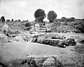 River and washed away bridge in the area of Situbondo


References
Wikiwand - on
Seamless Wikipedia browsing. On steroids.