Loading AI tools
Road signs in Canada may conform to the Manual of Uniform Traffic Control Devices for Canada (MUTCDC)[1][2] by the Transportation Association of Canada (TAC)[3] for use by Canadian jurisdictions. Although it serves a similar role to the MUTCD from the US Federal Highway Administration, it has been independently developed and has a number of key differences with its American counterpart, most notably the inclusion of bilingual (English/French) signage for jurisdictions such as New Brunswick with significant anglophone and francophone population, and a heavier reliance on symbols rather than text legends.
This article needs additional citations for verification. (February 2015) |
Signs for the most part employ one or two languages: English, French or both. However, some signs are trilingual, incorporating English, French and an indigenous language.


Bilingual (English and Inuinnaqtun) in Cambridge Bay.
In Quebec, modern signs read either Arrêt or Stop.[4] Both stop and arrêt are considered valid French words and the Office québécois de la langue française (OQLF) notes that the use of "stop" on stop signs is attested in French since 1927.[5] In practice, however, it can be empirically observed (for instance, with Google Street View) that arrêt predominates in French-speaking areas (i.e., most of the geographic extent of Quebec), while stop can be found in majority English-speaking areas such as Montreal's West Island suburbs. At the time of the debates surrounding the adoption of the Charter of the French Language ("Bill 101") in 1977, the usage of stop on the older dual-word signs was considered to be English and therefore controversial; some signs were occasionally vandalized with red spray paint to turn the word stop into "101".[6] However, it was later officially determined by the OQLF that stop is a valid French word in this context, and the older dual arrêt + stop usage is therefore not considered bilingual but merely redundant and therefore deprecated (à éviter). All newly installed signs thus use either one word or the other, but not both.
The province of New Brunswick has bilingual stop arrêt in English-speaking areas. Acadian regions of Nova Scotia and Prince Edward Island also have bilingual signs. Some areas in Manitoba and Ontario also have bilingual signs. Entry points to the country through Canada Customs and other federally-regulated sites (including airports) also have bilingual stop signs. On First Nations or Inuit territories, stop signs sometimes use the local aboriginal language in addition to or instead of English and/or French. Other parts of Canada use stop.
Wikimedia Commons has media related to Manual of Uniform Traffic Control Devices for Canada.
The following are samples of Canadian road signs.
Gallery of stop signs
 | This page is a candidate to be copied to Wikimedia Commons. If the page can be re-written into an encyclopedic article, please do so and remove this message. |
 Stop (English)
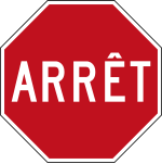 Stop (French)
 Stop (English and French)
 Stop (French and English)
 Stop (Inuktitut and English)
 Stop (Cree)
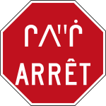 Stop (Cree and French)
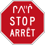 Stop (Cree and English and French)


.svg)
.svg)
Gallery of other signs
Alphanumeric reference IDs from the Manual of Uniform Traffic Control Devices for Canada are included.
 RA-2
RA-2
Yield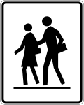 RA-3
RA-3
School Crossing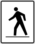 RA-4
RA-4
Pedestrian Crossing RA-5
RA-5
Pedestrian Crossing RA-6
RA-6
Railway Crossing RB-1
RB-1
Maximum Speed Limit
(ex: 50 km/h)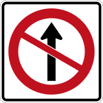 RB-10
RB-10
Do not proceed straight ahead RB-14L
Left turn required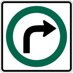 RB-14R
Right turn required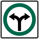 RB-14b
Turn left or right RB-15
RB-15
Must proceed straight only, turns prohibited RB-16
RB-16
No U-Turn RB-17
RB-17
No right turn on red RB-21
RB-21
One Way RB-23
RB-23
No entry RB-24
RB-24
Two-way traffic RB-25
RB-25
Keep right RB-33
RB-33
Motorists must not pass cyclists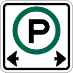 RB-53
RB-53
Parking Permitted (24/7 variant) RB-55
RB-55
No stopping RB-61
RB-61
Truck route RB-64
RB-64
Snowmobile trail. RB-66
RB-66
No pedestrians RB-67
RB-67
No bicycles RB-69
RB-69
Hazardous material route RB-79
RB-79
Cyclists must dismount their bikes and walk RB-81
RB-81
Bus Lane
In Quebec, taxis are often included and thus shown and as well as time periods in force. In Quebec bus and taxi are spelled out & the arrow at bottom left is not shown RB-91
RB-91
Bike Lane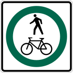 RB-93
RB-93
Shared Path for Pedestrians and Cyclists RC-5
RC-5
No Littering IB-23
IB-23
Bicycle route marker IC-13
IC-13
Parking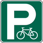 IC-19
IC-19
Bicycle parking ID-23
ID-23
Passing lane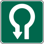 ID-31
ID-31
Dead end ID-32
ID-32
Traffic-Calmed Neighbourhood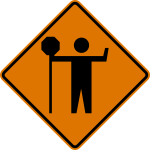 TC-21
TC-21
Traffic control flagger ahead WA-7S
WA-7S
Advisory speed tab WA-8
WA-8
End of road WA-11
WA-11
Approaching an intersection WA-18
WA-18
Railway crossing ahead WA-23
WA-23
Road narrows ahead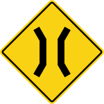 WA-24
WA-24
Narrow structure ahead (usually a bridge) WA-25
WA-25
Rough pavement ahead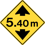 WA-26
WA-26
Height restriction ahead WA-39
WA-39
Roundabout ahead WB-1
WB-1
Stop sign ahead WB-2
WB-2
Yield sign ahead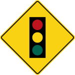 WB-4
WB-4
Traffic signal ahead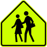 WC-1
WC-1
School zone WC-2
WC-2
Pedestrian crosswalk ahead WC-5
WC-5
Road surface slippery when wet WC-7
WC-7
Bicycle crossing ahead WC-11
WC-11
Drawbridge ahead WC-16
WC-16
School crosswalk ahead WC-43
WC-43
Two-way bicycle lane crossing.


Wikimedia Commons has media related to British Columbia road signs.
 Trans-Canada Highway marker.
 Generic highway shield.
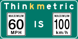 This sign is posted after the Canada–US border to remind US drivers that Canada uses the metric system.
The imperial speed limit (left) is a BC-style sign, rather than an MUTCD-standard one as would be used in the US. Disaster response route. All non-emergency vehicles must refrain from using such a route if a major disaster occurs.
 School zone.
 Crosswalk ahead.
 Crosswalk with flashing lights ahead.
 School bus stop ahead.
 Keep left of obstacle.
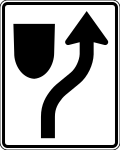 Keep right of obstacle.
 Gentle curve ahead.
 Sharp curve ahead.
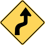 Double curve ahead.
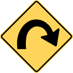 Hairpin curve ahead.
 Multiple curves ahead.
 Stop sign ahead.
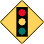 Traffic signal ahead.
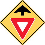 Yield ahead.
- Height restriction ahead.
 Slow.
Slow. This sign is posted when there is a history of vehicles taking a curve too quickly and losing control. The sunburst emphasizes that drivers need to take extra caution when going through the curve.[7]
 Road narrows.
- Road surface slippery when wet.
 Watch for fallen/falling rocks and other debris.
 End of pavement.
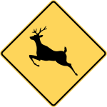 Deer area.
 Moose area.
 Elk area.
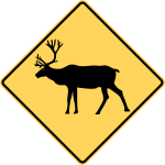 Caribou area.
 Bighorn sheep area.
 Ram area.
 Mountain goat area.
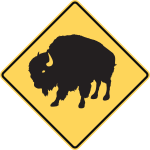 Bison area.
 Wild horse area.
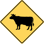 Cattle area.
 Bear area.
 Drawbridge.
.svg)


Wikimedia Commons has media related to Ontario road signs.
The Ministry of Transportation of Ontario (MTO) also has historically used its own MUTCD which bore many similarities to the TAC MUTCDC. However, as of approximately 2000, MTO has been developing the Ontario Traffic Manual (OTM), a series of smaller volumes each covering different aspects of traffic control (e.g., sign design principles).
Sign classification
The Ontario Traffic Manual Committee categorizes all road signs into two main categories: freeway and non-freeway sign types. Signs are then subcategorized into two additional groups: urban and rural.[8]
Examples of Ontario regulatory and warning road signs
 Some Ontario maximum speed signs have an additional tab at the bottom of the speed limit, reminding motorists that the unit of speed is kilometres per hour. The "km/h" tab sign (Rb-7t) is mandatory on all King's Highways because of the likelihood of unfamiliar interprovincial and international travellers.[8]
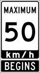 Where there is a change in the legal speed limit, the first maximum speed sign in the new zone must be accompanied by a "BEGINS" tab sign (Rb-84t).[8]
- RC-4
No Littering  No right turn or straight ahead
 No left turn or straight ahead
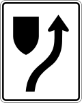 Keep right
 The purpose of the VEHICLES OVER 5 TONNES MUST HAVE VALID TRANSPONDER sign is to indicate to heavy vehicles that they are required to have valid toll devices known as transponders when travelling on toll roads. Specifically, the sign above is located before entrance ramps to the 407 ETR (Express Toll Route).[8]
 The purpose of the FASTEN SEAT BELT sign is to remind passengers in vehicles to ensure that their seat belts are fastened while the vehicle is travelling. The sign is placed at exits from locations which generate a large percentage of foreign or tourist traffic, where drivers may be unfamiliar with Ontario seat belt laws.[8]
 A blue metric reminder signage used in Ontario, Canada is seen near the US borders.
 WA-8
WA-8
End of road- WA-11
Intersection - WA-24
Narrow passage  WA-25
WA-25
Rough pavement ahead- WA-28
Road narrows ahead - WA-30
Drawbridge ahead - WA-39
Roundabout ahead  WB-1
WB-1
Stop sign ahead WB-1A
WB-1A
Yield sign ahead- WB-2
Traffic signal ahead 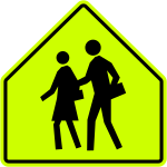 WC-1
WC-1
School crosswalk ahead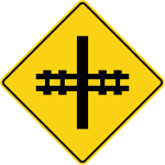 WC-4
WC-4
Railway level crossing ahead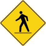 WC-7
WC-7
Pedestrian crosswalk ahead Temporary no stopping (Unofficial)


Wikimedia Commons has media related to Road signs of Quebec.
The following are samples of Quebec road signs.[9][10][11] A notable difference between Quebec road signs and those of the rest of Canada is Quebec's use of a white chevron on a red background to mark road alignment around a curve, whereas the remainder of the country employs a black chevron on a yellow background.
Quebec gallery
| This page is a candidate to be copied to Wikimedia Commons. If the page can be re-written into an encyclopedic article, please do so and remove this message. |
 The logo for Le ministère des Transports du Québec (English: Ministry of Transportation of Quebec).
 Metric signage reminder in Quebec, posted near US border and at major airports
The imperial speed limit (left) is a Quebec-style sign, rather than an MUTCD-standard one as would be used in the US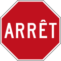 ARRÊT (Translation: STOP)
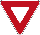 Yield sign
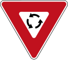 Yield at roundabout
 Do not enter
 Left or right turn required
 French-language version of do not enter (plate type)
 Maximum speed (50 km/h)
 No left turn
 No right turn
 Route for dangerous goods vehicles
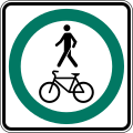 Shared path
 Dangerous goods vehicles prohibited
 No overtaking
 No parking
 Parking permitted
for 2 hours No stopping
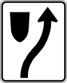 Keep right
 Keep left
 No littering
 Stop ahead
 Yield ahead
 Traffic signal ahead
 Roundabout ahead
 School bus stop ahead
 Deer crossing
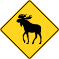 Moose crossing
 Reindeer crossing
 Cattle crossing
 Skier crossing
 Dogsled crossing
 End of road
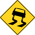 Slippery surface, often accompanied by 0 °C
 Pavement ends
 Uneven surface
 Bump
Bump Dip
Dip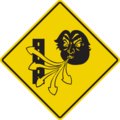 Dangerous Crosswinds (Some variants include a pictogram of snowflakes, while others include flashing lights and a plaque that says "Reduced Visibility" or "When The Lights Flash")
 Road closed
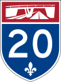 Example of autoroute shield
 Example of provincial highway shield
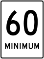 MAXIMUM SPEED signs along Quebec autoroutes are accompanied by a MINIMUM SPEED sign. The minimum sign is positioned directly below the maximum speed sign on the same post.
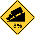 Steep downgrade, with slope given as a percentage. Used on Quebec Route 138 between Quebec City and La Malbaie and elsewhere
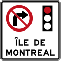 This sign is used at all entry points to the island of Montreal to remind drivers that turning right on red is prohibited within the entire island.
 Turning right on red is prohibited within Quebec at specific intersections. Otherwise it is permitted.
 One way, sens unique
 Chevron marker


These signs have been superseded but can still be seen in some places.
 Yield (1954–1961)
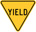 Yield (1961-1971)
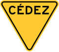 Yield (1954–1961) (Quebec)
 Yield (1961-1971) (Quebec)
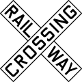 Railway Crossing
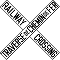 Railway Crossing (Quebec)
 Railway level crossing ahead
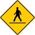 Crosswalk Ahead
 Playground Zone
 School zone (1966-1980)
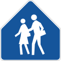 School zone (1980-2007)
 School crosswalk (1966-1995)
 Pedestrian crosswalk (1966-1995)
.svg)
_(old).svg)
_(old).svg)
.svg)
_(old).svg)
_(old).svg)
.svg)
.svg)
.svg)
.svg)
.svg)
_(old).svg)
.svg)
Wikiwand in your browser!
Seamless Wikipedia browsing. On steroids.
Every time you click a link to Wikipedia, Wiktionary or Wikiquote in your browser's search results, it will show the modern Wikiwand interface.
Wikiwand extension is a five stars, simple, with minimum permission required to keep your browsing private, safe and transparent.