Loading AI tools
Municipality in the Mexican state of Yucatán From Wikipedia, the free encyclopedia
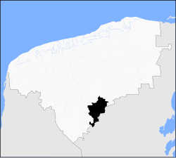
Peto Municipality is a municipality in the Mexican state of Yucatán. It has a municipal seat of the same name and is located in the centre-south portion of the Yucatán, 135 km to the south-east of state capital Mérida.
Peto | |
|---|---|
 | |
 Location of Peto in Yucatán | |
| Coordinates: 20°07′N 89°55′W | |
| Country | |
| State | |
| Government | |
| • Type | PRI |
| • Municipal President | Jose Vicente Dominguez Canto[1] |
| Area | |
| • Total | 3,136 km2 (1,211 sq mi) |
| [1] | |
| Elevation | 35 m (115 ft) |
| Population | |
| • Total | 22,386 |
| Time zone | UTC-6 (Central Standard Time) |
| • Summer (DST) | UTC-5 (Central Daylight Time) |
| INEGI Code | 058 |
| Major Airport | Merida (Manuel Crescencio Rejón) International Airport |
| IATA Code | MID |
| ICAO Code | MMMD |
The municipality is made up of 74 communities, the most important include the following:
Seamless Wikipedia browsing. On steroids.
Every time you click a link to Wikipedia, Wiktionary or Wikiquote in your browser's search results, it will show the modern Wikiwand interface.
Wikiwand extension is a five stars, simple, with minimum permission required to keep your browsing private, safe and transparent.