Loading AI tools
Commune in Ilfov, Romania From Wikipedia, the free encyclopedia
Periș is a commune in the far northwestern corner of Ilfov County, Muntenia, Romania. The commune is composed of three villages: Bălteni, Buriaș and Periș. It used to include Brătulești and Cocioc villages, until these were absorbed by other villages in the commune. In Romanian, its name means "a place where pear trees grow".
Periș | |
|---|---|
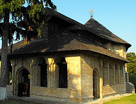
 St. Nicholas Church in Bălteni | |
 Location in Ilfov County | |
| Coordinates: 44°41′N 26°1′E | |
| Country | Romania |
| County | Ilfov |
| Government | |
| • Mayor (2020–2024) | Anghel Albu (PNL) |
| Area | 77.97 km2 (30.10 sq mi) |
| Highest elevation | 137 m (449 ft) |
| Lowest elevation | 105 m (344 ft) |
| Population (2021-12-01)[1] | 7,357 |
| • Density | 94/km2 (240/sq mi) |
| Time zone | EET/EEST (UTC+2/+3) |
| Postal code | 077150 |
| Vehicle reg. | IF |
| Website | www |
Periș is situated on the border of the county with Dâmbovița and Prahova counties, 33.5 km (20.8 mi) north of the capital city, Bucharest. It lies on the right bank of the river Ialomița and on both sides of the river Vlăsia.
The surface area of the commune is 77.97 km2 (30.10 sq mi), and its altitude ranges from 105 to 137 m (344 to 449 ft) above sea level.
It was the site of the Battle of Periș, on August 24, 1546, where Mircea the Shepherd, Voivode of Wallachia, launched a surprise attack on the boyars opposing his rule and greatly decimated them.
Seamless Wikipedia browsing. On steroids.
Every time you click a link to Wikipedia, Wiktionary or Wikiquote in your browser's search results, it will show the modern Wikiwand interface.
Wikiwand extension is a five stars, simple, with minimum permission required to keep your browsing private, safe and transparent.