Loading AI tools
River in Illinois, United States From Wikipedia, the free encyclopedia
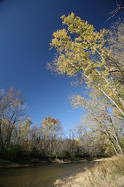
The Middle Fork of the Vermilion River is a tributary of the Vermilion River (Wabash River) in Illinois. The Middle Fork rises in Ford County and flows southeast to join the Vermilion near Danville.[2]
| Middle Fork Vermilion River | |
|---|---|
 | |
 | |
| Physical characteristics | |
| Source | |
| • location | Confluence of a drainage ditch and Prairie Creek in Ford County southeast of Paxton, Illinois |
| • coordinates | 40°24′15″N 88°01′05″W |
| Mouth | |
• location | Confluence with the Salt Fork forming the Vermilion River west of Danville, Illinois |
• coordinates | 40°06′13″N 87°43′02″W |
• elevation | 535 ft (163 m) |
| Length | 77 mi (124 km) |
| Discharge | |
| • location | Oakwood, Illinois |
| • average | 416 cu/ft. per sec.[1] |
| Basin features | |
| Progression | Middle Fork → Vermilion → Wabash → Ohio → Mississippi → Gulf of Mexico |
| GNIS ID | 413502 |
| Type | Scenic |
| Designated | May 11, 1989 |


In its natural state, the Middle Fork drained a large upland marsh in what is now Ford County. The Middle Fork has been extended into the marsh by drainage ditches. Including the ditches, the Middle Fork is about 77 miles (124 km) long.[3]
The Middle Fork is Illinois' only designated National Wild and Scenic River. Parks and access points include:
The following cities, towns and villages are among those in the watershed of the Middle Fork:
Parts of the following counties are drained by the Middle Fork:
Seamless Wikipedia browsing. On steroids.
Every time you click a link to Wikipedia, Wiktionary or Wikiquote in your browser's search results, it will show the modern Wikiwand interface.
Wikiwand extension is a five stars, simple, with minimum permission required to keep your browsing private, safe and transparent.