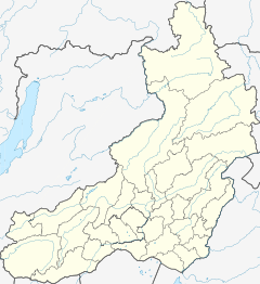
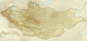
The Menza (Russian: Менза; Mongolian: Минж гол) is a river in Zabaykalsky Krai in Russia, and Töv Province, Mongolia. It is the largest tributary of the Chikoy. Its length is 337 kilometres (209 mi). The area of its basin is 13,800 square kilometres (5,300 sq mi).[1]
| Menza | |
|---|---|
 View of the river | |
Mouth location in Transbaikal Krai, Russia | |
| Location | |
| Countries | Russia, Mongolia |
| Province and Federal subject | Töv Province and Transbaikal Krai |
| Physical characteristics | |
| Source | |
| • location | Khentii Mountains |
| • coordinates | 48°36′29″N 108°19′26″E |
| Mouth | Chikoy |
• coordinates | 50°13′35″N 108°36′30″E |
| Length | 337 km (209 mi) |
| Basin size | 13,800 km2 (5,300 sq mi) |
| Basin features | |
| Progression | Chikoy→ Selenga→ Lake Baikal→ Angara→ Yenisey→ Kara Sea |
Course
The Menza has its source in the northern part of the Khentii Mountains in Mongolia. It flows across mountainous areas, first northeastwards, entering Zabaykalsky Krai, then bends to the northwest across the western edge of the Khentei-Daur Highlands, joining the Chikoy on its left bank. The Burkal (Буркал) is its most important tributary.[2]
 |
See also
References
External links
Wikiwand in your browser!
Seamless Wikipedia browsing. On steroids.
Every time you click a link to Wikipedia, Wiktionary or Wikiquote in your browser's search results, it will show the modern Wikiwand interface.
Wikiwand extension is a five stars, simple, with minimum permission required to keep your browsing private, safe and transparent.


