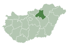
Ludas is a village in Heves County, Northern Hungary Region, Hungary.
Ludas | |
|---|---|
Village (község) | |
 Location of Heves County in Hungary | |
Location of Ludas in Hungary | |
| Coordinates: 47°43′55″N 20°05′28″E | |
| Country | |
| Region | Northern Hungary |
| County | Heves County |
| Subregion | Gyöngyös District |
| Government | |
| • Mayor | Mónika Csengeri Vargáné [1] |
| Area | |
| • Total | 10.79 km2 (4.17 sq mi) |
| Population (1 Jan. 2015) | |
| • Total | 736 |
| • Density | 67.84/km2 (175.7/sq mi) |
| Time zone | UTC+1 (CET) |
| • Summer (DST) | UTC+2 (CEST) |
| Postal code | 3274 |
| Area code | 37 |
| Website | www |
Communications
Ludas is 1 kilometre (0.62 mi) both from Road 3 and the Budapest-Miskolc railway line. The M3 motorway, built in 1998, bypasses the settlement at a distance of 3 kilometres (2 mi) and has reduced traffic congestion.
Sights to visit
- church (1794)
- Taródy palace (c. 1780)
References
External links
Wikiwand in your browser!
Seamless Wikipedia browsing. On steroids.
Every time you click a link to Wikipedia, Wiktionary or Wikiquote in your browser's search results, it will show the modern Wikiwand interface.
Wikiwand extension is a five stars, simple, with minimum permission required to keep your browsing private, safe and transparent.

