Loading AI tools
There are several lighthouses in the U.S. state of Texas, including several listed on the National Register of Historic Places.[1] Not every lighthouse in Texas is listed here as some have very little information known about them. Saluria, and Swash lights for example were built right before the civil war and were both destroyed by confederate forces.
| Name | Image | Location | Coordinates | Year first lit | Automated | Year deactivated | Current Lens | Focal Height |
|---|---|---|---|---|---|---|---|---|
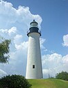
| Aransas Pass Light |  |
Port Aransas | 27°51′51″N 97°03′23″W | 1857 | Never | Active[2] (Inactive: 1952-1988) |
Unknown | Unknown |
| Brazoz River Light | N/A | Brazoria County | N/A | 1896[3] | Never | 1967[3] (Demolished) |
None | Unknown |
| Brazos Santiago Light | N/A | South Padre Island | N/A | 1854[3] (First) 1943[3] (Last) |
Unknown | 1974[3] | None | Unknown |
| Clopper's Bar Light | N/A | Morgan's Point | N/A | 1854[4] | Never | 1880[4] (Demolished) |
None | 35 ft (11 m)[4] |
| Corpus Christi Light | N/A | Corpus Christi | N/A | 1859[5] | Never | 1878[5] (Demolished) |
None | 72 ft (22 m)[5] |
| Double Bayou Light | N/A | Oak Island | 29.3923°N 94.4129°W[6] | 1900[6] | Never | 1915[6] (Destroyed) |
None | Unknown |
| East Shoal Light | N/A | Galveston | N/A | 1872[7] | Never | 1875[7] (Destroyed) |
None | Unknown |
| Fort Point Light | Galveston | 29.337°N 94.770°W | 1882[8] | Never | 1909[8] (Dismantled in 1953) |
None | 48 ft (15 m)[8] | |
| Galveston Jetty Light (North) |
N/A | Galveston | N/A | 1897[9] | Never | Unknown (Removed) |
None | 42 ft (13 m)[9] |
| Galveston Jetty Light (South) |
N/A | Galveston | N/A | 1883[10] (First) 1918[10] (Last) |
1972 | 1980 (Destroyed in 2000[10]) |
None | 42 ft (13 m)[10] |
| Halfmoon Reef Light |  |
Port Lavaca | 28°38′12.8″N 96°37′2.2″W | 1858 | Never | 1942 (Moved to shore) |
None | Unknown |
| Halfmoon Shoal Light | N/A | Texas City | N/A | 1854[3] (First) 1902[3] (Last) |
Never | 1930s[3] (Demolished) |
None | 35 ft (11 m) |
| Matagorda Island Light |  |
Port Lavaca | 28°20′16.4″N 96°25′26.7″W | 1852 (First) 1873 (Current) |
1956 | Active (Inactive: 1995-1999) |
Unknown | 91 ft (28 m) |
| Point Bolivar Light |  |
Point Bolivar | 29°21′59.8″N 94°46′1.85″W | 1852 (First) 1872 (Current) |
Never | 1933 | None | 116 ft (35 m) |
| Point Isabel Light |  |
Port Isabel | 26°4′40″N 97°12′27″W | 1853 | Never | Active (Inactive: 1905-1955) |
Unknown | Unknown |
| Redfish Bar Light | N/A | Galveston | N/A | 1854 | Never | 1936 (Destroyed) |
None | Unknown |
| Redfish Bar Cut Light | N/A | Galveston | N/A | 1900 | Never | 1936 (Destroyed) |
None | 39 ft (12 m) |
| Sabine Bank Light |  |
Port Arthur | 29.4727°N 93.7226°W | 1906 | 1923 | 2001 (Replaced with skeleton tower) |
None | Unknown |
| Trinity River Light | N/A | Trinity Bay | N/A | 1900[11] | Never | 1915[11] (Destroyed) |
None | 16 ft (4.9 m)[11] |
| Name | Image | Location | Coordinates | Year first lit | Automated | Year deactivated | Current Lens | Focal Height |
|---|---|---|---|---|---|---|---|---|
| Beacon Island Light | N/A | League City | N/A | 1983 (Private) |
Always | 2023 | Unknown | 120 ft (37 m) |
| Horseshoe Bay Light | N/A | Horseshoe Bay | N/A | 1972 | Always | Active | Unknown | Unknown |
| Kemah Standpipe | N/A | Kemah | N/A | 2006 | Always | Active | Third-order Fresnel (Replica) |
151 ft (46 m) |
| Lake Buchanan Light | N/A | Buchanan Dam | N/A | 1984 | Always | Active (Inactive: 1990-2006) |
Unknown | 140 ft (43 m) |
| Lake Canyon Yacht Club | N/A | Canyon Lake | N/A | 1985 | Always | Active | Unknown | Unknown |
| Lake Conroe Light | N/A | Willis | N/A | 1977 (Rebuilt in 1999) |
Always | 2024 | Unknown | Unknown |
Wikiwand in your browser!
Seamless Wikipedia browsing. On steroids.
Every time you click a link to Wikipedia, Wiktionary or Wikiquote in your browser's search results, it will show the modern Wikiwand interface.
Wikiwand extension is a five stars, simple, with minimum permission required to keep your browsing private, safe and transparent.