Loading AI tools
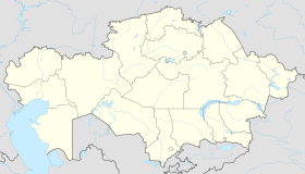
Kurshim, also Kurchum or Kurchim (Kazakh: Күршім, Kürşım) is a selo and administrative center of Kurshim District of East Kazakhstan Region, Kazakhstan. Population: 8,490 (2009 Census results);[1] 10,502 (1999 Census results).[1]
Kurshim | |
|---|---|
| Coordinates: 48°34′20″N 83°39′15″E | |
| Country | |
| Region | East Kazakhstan |
| District | Kurshim |
| Population (2009) | |
| • Total | 8,490 |
| Time zone | UTC+6 (+6) |
The Kurchum River flows past the town and Lake Zaysan lies to the south.[2][3] The town lies on the road between the villages of Altyn Kala to the north-west and Surulen to the east; this road connects with the M38 road in the southeast which leads to Jeminay across the Chinese border in Xinjiang. The town is served by a small airport, Kurchum Airport, and Antonov An-2 biplanes fly in and out of the airport.[4] In late 1989 or early 1990 the town was affected by an earthquake which destroyed the Kurchum Hospital,[5] amongst other buildings. The landscape around the town is dominated by estuarine plains.
| Climate data for Kurshim (1991–2020) | |||||||||||||
|---|---|---|---|---|---|---|---|---|---|---|---|---|---|
| Month | Jan | Feb | Mar | Apr | May | Jun | Jul | Aug | Sep | Oct | Nov | Dec | Year |
| Mean daily maximum °C (°F) | −12.7 (9.1) |
−9.2 (15.4) |
0.2 (32.4) |
15.4 (59.7) |
22.3 (72.1) |
27.6 (81.7) |
29.5 (85.1) |
28.4 (83.1) |
22.1 (71.8) |
13.4 (56.1) |
1.2 (34.2) |
−8.9 (16.0) |
10.8 (51.4) |
| Daily mean °C (°F) | −18.8 (−1.8) |
−16.0 (3.2) |
−6.2 (20.8) |
8.0 (46.4) |
14.8 (58.6) |
20.2 (68.4) |
22.1 (71.8) |
20.4 (68.7) |
13.8 (56.8) |
6.1 (43.0) |
−4.7 (23.5) |
−14.5 (5.9) |
3.8 (38.8) |
| Mean daily minimum °C (°F) | −24.5 (−12.1) |
−22.5 (−8.5) |
−12.4 (9.7) |
0.9 (33.6) |
7.0 (44.6) |
12.5 (54.5) |
14.8 (58.6) |
12.4 (54.3) |
6.0 (42.8) |
−0.3 (31.5) |
−9.7 (14.5) |
−19.9 (−3.8) |
−3.0 (26.6) |
| Average precipitation mm (inches) | 17.9 (0.70) |
14.2 (0.56) |
14.9 (0.59) |
20.0 (0.79) |
24.2 (0.95) |
25.3 (1.00) |
25.3 (1.00) |
18.8 (0.74) |
17.8 (0.70) |
26.2 (1.03) |
27.7 (1.09) |
24.6 (0.97) |
256.9 (10.11) |
| Average precipitation days (≥ 1.0 mm) | 5.1 | 4.5 | 4.1 | 4.5 | 4.8 | 5.0 | 5.1 | 3.2 | 3.7 | 5.4 | 6.4 | 6.2 | 58.0 |
| Source: NOAA[6] | |||||||||||||
Wikiwand in your browser!
Seamless Wikipedia browsing. On steroids.
Every time you click a link to Wikipedia, Wiktionary or Wikiquote in your browser's search results, it will show the modern Wikiwand interface.
Wikiwand extension is a five stars, simple, with minimum permission required to keep your browsing private, safe and transparent.
