Koror (city)
City in Koror State, Palau From Wikipedia, the free encyclopedia
Koror (English: /ˈkɔːˌrɔːr/, KAW-rawr;[1]) is the largest city and the commercial centre in Palau, home to about half of the country's population, located on Koror Island (also Oreor Island). During the interwar period it served as the capital of the South Seas Mandate, a group of islands that made up the League of Nations mandated territory held by the Empire of Japan. It was subsequently the capital of Palau until it was replaced by Ngerulmud in 2006.[2]
Koror | |
|---|---|
| City of Koror | |
     Top: Koror coastline; Middle: Koror State Government Building, Belau National Museum; WCTC Shopping Center, Etpison Museum | |
 Location within Koror state | |
 Koror Location in Palau | |
| Coordinates: 7°20.5167′N 134°28.75′E | |
| Country | Palau |
| State | |
| Founded | 1866 |
| Population (1993) | |
• Total | 7,000 |
| Time zone | UTC+9 (Palau Standard Time) |
| Area code | (+680) 488 |
History
Koror was the administrative center of the Japanese South Sea Mandate, and thousands of Japanese lived in the city.[3]
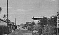
- Images of Koror during the Japanese period


Parts of the city were destroyed by American aerial bombardment during World War II, and after the United States occupied the city they burnt or tore down the remainder of the city, leaving only a few buildings for the occupation forces.[4][5]
In 1976, a copra-processing plant was opened in Koror.
Today, Koror remains a commercial center for its importance of tourism as the city's economy.
Geography
Summarize
Perspective
In 1993, Koror was home to more than 7,000 people, but in the recent past the number was at times even greater as large numbers of people from other areas would stay in Koror to conduct business. The town is composed of ten hamlets where traditional roots are strong. Koror sprawls across the western end of Oreor Island along a low ridge. This is the volcanic island half of Oreor; the rock island half is, like most of the rock islands, uninhabited.[6] Koror is a part of the Koror Metropolitan Area.
Climate
Koror has a tropical rainforest climate (Köppen Af)[7] with hot, humid weather conditions throughout the year.
| Climate data for Palau | |||||||||||||
|---|---|---|---|---|---|---|---|---|---|---|---|---|---|
| Month | Jan | Feb | Mar | Apr | May | Jun | Jul | Aug | Sep | Oct | Nov | Dec | Year |
| Mean daily maximum °C (°F) | 30.6 (87.1) |
30.6 (87.1) |
30.9 (87.6) |
31.3 (88.3) |
31.4 (88.5) |
31.0 (87.8) |
30.6 (87.1) |
30.7 (87.3) |
30.9 (87.6) |
31.1 (88.0) |
31.4 (88.5) |
31.1 (88.0) |
31.0 (87.7) |
| Daily mean °C (°F) | 27.3 (81.1) |
27.2 (81.0) |
27.5 (81.5) |
27.9 (82.2) |
28.0 (82.4) |
27.6 (81.7) |
27.4 (81.3) |
27.5 (81.5) |
27.7 (81.9) |
27.7 (81.9) |
27.9 (82.2) |
27.7 (81.9) |
27.6 (81.7) |
| Mean daily minimum °C (°F) | 23.9 (75.0) |
23.9 (75.0) |
24.1 (75.4) |
24.4 (75.9) |
24.5 (76.1) |
24.2 (75.6) |
24.1 (75.4) |
24.3 (75.7) |
24.5 (76.1) |
24.4 (75.9) |
24.4 (75.9) |
24.2 (75.6) |
24.2 (75.6) |
| Average rainfall mm (inches) | 271.8 (10.70) |
231.6 (9.12) |
208.3 (8.20) |
220.2 (8.67) |
304.5 (11.99) |
438.7 (17.27) |
458.2 (18.04) |
379.7 (14.95) |
301.2 (11.86) |
352.3 (13.87) |
287.5 (11.32) |
304.3 (11.98) |
3,758.3 (147.97) |
| Average rainy days | 19.0 | 15.9 | 16.7 | 14.8 | 20.0 | 21.9 | 21.0 | 19.8 | 16.8 | 20.1 | 18.7 | 19.9 | 224.6 |
| Mean monthly sunshine hours | 198.4 | 194.9 | 244.9 | 234.0 | 210.8 | 168.0 | 186.0 | 176.7 | 198.0 | 179.8 | 183.0 | 182.9 | 2,357.4 |
| Source: Hong Kong Observatory[8] | |||||||||||||
Economy
Koror is the main tourist destination in Palau and has many resorts, nightclubs, restaurants, and hotels. The government is also a large employer in the city. Tuna export and copra production are two other economic activities of the city.[1]
Places of interest
Twin towns and sister cities
Koror City is twinned with:
 Angeles City, Philippines[9]
- Davao City, Philippines[10]
 Gilroy, United States[11]
 Manado, Indonesia[citation needed]
References
Wikiwand - on
Seamless Wikipedia browsing. On steroids.