Glan (Nahe)
River in Germany From Wikipedia, the free encyclopedia
River in Germany From Wikipedia, the free encyclopedia
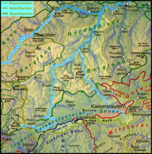
The Glan (German pronunciation: [ɡlaːn] ) is a river in southwestern Germany, right tributary of the Nahe. It is approximately 68 km (42 miles) long. It rises in the Saarland, northwest of Homburg. It flows generally north, through Rhineland-Palatinate, and empties into the Nahe near Odernheim am Glan, at Staudernheim, across the Nahe from Bad Sobernheim. Other towns along the Glan are Altenglan, Glan-Münchweiler, Lauterecken and Meisenheim.
| Glan | |
|---|---|
 The source of the Glan in Höchen | |
 Catchment and course[1] | |
| Location | |
| Country | Germany |
| States | Saarland Rhineland-Palatinate |
| Reference no. | DE: 2546 |
| Physical characteristics | |
| Source | |
| • location | in Höchen |
| • coordinates | 49°23′29″N 7°16′33″E |
| • elevation | ca. 480 m above sea level (NHN) |
| Mouth | |
• location | After flowing through Odernheim below Staudernheim from the right into the Nahe |
• coordinates | 49°46′34″N 7°42′52″E |
• elevation | ca. 131 m above sea level (NHN) |
| Length | 89.67 km [2] |
| Basin size | 1,221.976 km² [2] |
| Basin features | |
| Progression | Nahe → Rhine → North Sea |
| River system | Rhine |
| Landmarks | Small towns: Bexbach, Lauterecken, Meisenheim |
| Tributaries | |
| • left | Kohlbach, Ohmbach, Kuselbach, Steinalp, Jeckenbach |
| • right | Mohrbach, Reichenbach, Talbach, (Wald)-Lauter, Odenbach, |
 Bridge over the Glan in Meisenheim
 Nature reserve near the confluence | |
The Celtic root of the name comes either from glann (shining) or from glen (U-shaped valley).
Seamless Wikipedia browsing. On steroids.
Every time you click a link to Wikipedia, Wiktionary or Wikiquote in your browser's search results, it will show the modern Wikiwand interface.
Wikiwand extension is a five stars, simple, with minimum permission required to keep your browsing private, safe and transparent.