File:Malawi_relief_location_map.jpg
From Wikipedia, the free encyclopedia
Size of this preview: 292 × 599 pixels. Other resolutions: 117 × 240 pixels | 234 × 480 pixels | 945 × 1,937 pixels.
Original file (945 × 1,937 pixels, file size: 487 KB, MIME type: image/jpeg)
| This is a file from the Wikimedia Commons. Information from its description page there is shown below. Commons is a freely licensed media file repository. You can help. |
Summary
| DescriptionMalawi relief location map.jpg |
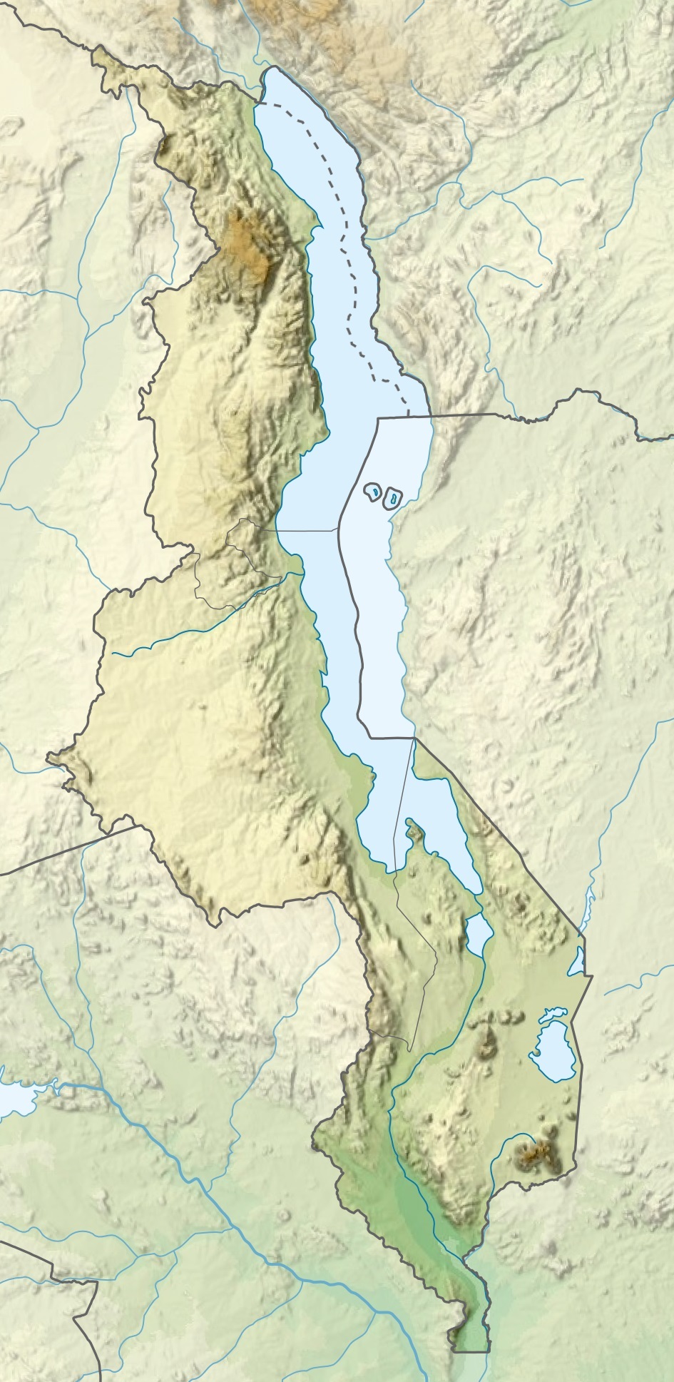
Español: Mapa de localización de Malaui
Deutsch: Positionskarte von Malawi
Quadratische Plattkarte. Geographische Begrenzung der Karte:
English: Location map of Malawi
Equirectangular projection. Geographic limits of the map:
|
| Date | |
| Source |
This file was derived from: |
| Author |
|
Licensing
I, the copyright holder of this work, hereby publish it under the following licenses:

|
Permission is granted to copy, distribute and/or modify this document under the terms of the GNU Free Documentation License, Version 1.2 or any later version published by the Free Software Foundation; with no Invariant Sections, no Front-Cover Texts, and no Back-Cover Texts. A copy of the license is included in the section entitled GNU Free Documentation License.http://www.gnu.org/copyleft/fdl.htmlGFDLGNU Free Documentation Licensetruetrue |
This file is licensed under the Creative Commons Attribution-Share Alike 3.0 Unported license.
- You are free:
- to share – to copy, distribute and transmit the work
- to remix – to adapt the work
- Under the following conditions:
- attribution – You must give appropriate credit, provide a link to the license, and indicate if changes were made. You may do so in any reasonable manner, but not in any way that suggests the licensor endorses you or your use.
- share alike – If you remix, transform, or build upon the material, you must distribute your contributions under the same or compatible license as the original.
You may select the license of your choice.
Captions
Add a one-line explanation of what this file represents
Items portrayed in this file
depicts
20 January 2015
image/jpeg
File history
Click on a date/time to view the file as it appeared at that time.
| Date/Time | Thumbnail | Dimensions | User | Comment | |
|---|---|---|---|---|---|
| current | 20:29, 3 March 2020 | | 945 × 1,937 (487 KB) | Sémhur | Adding Tanzanian border claim (from https://www.nbs.go.tz/index.php/en/census-surveys/gis/385-2012-phc-shapefiles-level-one-and-two) |
| 19:26, 20 January 2015 |  | 945 × 1,937 (499 KB) | Milenioscuro | User created page with UploadWizard |
File usage
The following pages on the English Wikipedia use this file (pages on other projects are not listed):
- 1989 Malawi earthquake
- 2009 Karonga earthquakes
- Chipata Mountain
- Chiradzulu Mountain
- Dedza Mountain
- Dinosaur Beds
- Kasungu National Park
- Kholombidzo Hydroelectric Power Station
- Lake Chilwa
- Lake Kaulime
- Lake Kazuni
- Lake Malawi
- Lake Malawi National Park
- Lake Malombe
- Lengwe National Park
- Lilongwe
- List of fossiliferous stratigraphic units in Malawi
- Liwonde National Park
- Lupata Group
- Majete Wildlife Reserve
- Mulanje Massif
- Mwabvi Wildlife Reserve
- Nkhotakota Wildlife Reserve
- Ntchisi Mountain
- Nyika National Park
- Ruo River
- User:Ty654/List of earthquakes from 1985-1989 exceeding magnitude 6+
- User:Ty654/List of earthquakes from 2005-2009 exceeding magnitude 6+
- Draft:Lilongwe National Park
- Module:Location map/data/Malawi
- Module:Location map/data/Malawi/doc
Global file usage
The following other wikis use this file:
- Usage on af.wikipedia.org
- Usage on ast.wikipedia.org
- Usage on avk.wikipedia.org
- Usage on az.wikipedia.org
- Usage on ban.wikipedia.org
- Usage on bar.wikipedia.org
- Usage on be.wikipedia.org
- Usage on bg.wikipedia.org
- Usage on bn.wikipedia.org
- Usage on da.wikipedia.org
- Usage on de.wikipedia.org
- Malawi
- Malawisee
- Mulanje (Bergmassiv)
- Kapichira-Wasserfälle
- Shire-Hochland
- Elephant Marsh
- Malombesee
- Chilwa-See
- Nyika-Plateau
- Chizumulu
- Nchenachena
- Nganda
- Salanjama
- Kasungu-Nationalpark
- Viphya Mountains
- Chongoni
- Vorlage:Positionskarte Malawi
- Wikipedia:Kartenwerkstatt/Positionskarten/Afrika
- Chisi Island
- Kaulime-See
- Likoma (Insel)
- Chiuta-See
- Tagebau Kayelekera
View more global usage of this file.
Metadata
This file contains additional information, probably added from the digital camera or scanner used to create or digitize it.
If the file has been modified from its original state, some details may not fully reflect the modified file.
| Horizontal resolution | 72 dpi |
|---|---|
| Vertical resolution | 72 dpi |
| Software used | GIMP 2.8.22 |
| Exif version | 2.1 |
| Supported Flashpix version | 1 |
| Color space | Uncalibrated |
Retrieved from "https://en.wikipedia.org/wiki/File:Malawi_relief_location_map.jpg"