File:LocationAntarctica.png
From Wikipedia, the free encyclopedia
Original file (2,759 × 1,404 pixels, file size: 50 KB, MIME type: image/png)
| This is a file from the Wikimedia Commons. Information from its description page there is shown below. Commons is a freely licensed media file repository. You can help. |

|
File:Antarctica Location.svg is a vector version of this file. It should be used in place of this PNG file when not inferior.
File:LocationAntarctica.png → File:Antarctica Location.svg
For more information, see Help:SVG.
|
 |
Summary
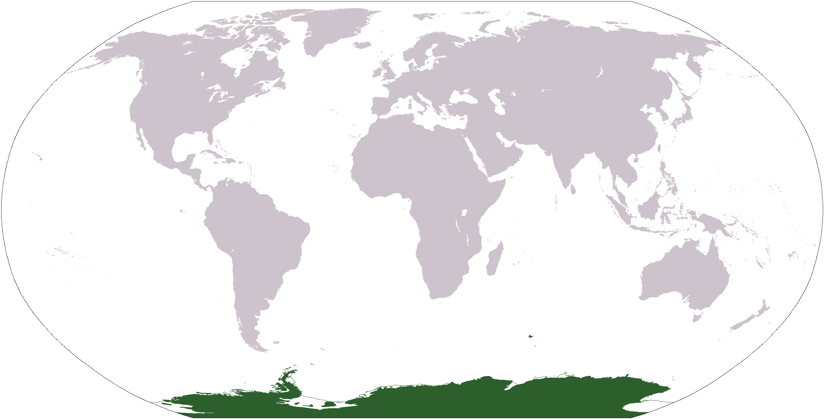
World map depicting Antarctica; map adapted from PDF world map at CIA World Fact Book.
Updated March 31, 2006 to remove green above 60°S line. in december there is 24 hours of sun light
Licensing
| Public domainPublic domainfalsefalse |
This image is in the public domain because it contains materials that originally came from the United States Central Intelligence Agency's World Factbook.
Bahasa Indonesia ∙ čeština ∙ Deutsch ∙ eesti ∙ English ∙ español ∙ Esperanto ∙ français ∙ galego ∙ hrvatski ∙ italiano ∙ Nederlands ∙ norsk nynorsk ∙ polski ∙ português ∙ sicilianu ∙ slovenščina ∙ suomi ∙ Türkçe ∙ Zazaki ∙ беларуская (тарашкевіца) ∙ македонски ∙ русский ∙ српски / srpski ∙ українська ∙ ქართული ∙ বাংলা ∙ தமிழ் ∙ മലയാളം ∙ 한국어 ∙ 日本語 ∙ 中文 ∙ 中文(简体) ∙ 中文(繁體) ∙ العربية ∙ +/− |
 |
File history
Click on a date/time to view the file as it appeared at that time.
| Date/Time | Thumbnail | Dimensions | User | Comment | |
|---|---|---|---|---|---|
| current | 17:13, 23 April 2013 | | 2,759 × 1,404 (50 KB) | User02062000 | |
| 17:10, 23 April 2013 |  | 2,759 × 1,404 (50 KB) | User02062000 | Reverted to version as of 18:54, 20 December 2005 | |
| 12:37, 19 January 2008 |  | 2,759 × 1,404 (97 KB) | F l a n k e r | Transparency | |
| 01:04, 31 March 2006 |  | 2,759 × 1,404 (55 KB) | David Kernow~commonswiki | ||
| 18:54, 20 December 2005 |  | 2,759 × 1,404 (50 KB) | E Pluribus Anthony~commonswiki | World map: Antarctica (location) | |
| 12:38, 28 April 2005 |  | 2,759 × 1,404 (39 KB) | Ghalas | Extracted from CIA World Factbook PDF world map, then rasterized and colored. {{PD-USGov-CIA-WF}} |
File usage
- Antarctic realm
- List of biogeographic provinces
- Talk:Antarctica/Archive 2
- User:David Kernow/Template:Continents of the world
- User:David Kernow/Wikipedia:Browse
- User:Nurg/Template:Continents of the world
- User:Ooga Booga/Temp-10
- Category:Antarctic realm
- Category:Antarctic realm biota
- Category:Antarctic realm fauna
- Category:Antarctic region
- Category:Antarctica
- Category:Biota of Antarctica
- Category:Catholic Church in Antarctica
- Category:Environment of Antarctica
- Category:Fauna of Antarctica
- Category:Fauna of subantarctic islands
- Category:Flora of Antarctica
- Category:Flora of the Antarctic
- Category:Fungi of Antarctica
- Category:Lichens of Antarctica
- Category:Lichens of the Antarctic
- Category:Natural history of Antarctica
- Category:Prehistoric vertebrates of Antarctica
- Category:Subantarctic
- Category:Vertebrates of Antarctica
Global file usage
The following other wikis use this file:
- Usage on af.wikipedia.org
- Usage on am.wikipedia.org
- Usage on ang.wikipedia.org
- Usage on arc.wikipedia.org
- Usage on ar.wikipedia.org
- Usage on arz.wikipedia.org
- Usage on ba.wikipedia.org
- Usage on bcl.wikipedia.org
- Usage on be-tarask.wikipedia.org
- Usage on bjn.wikipedia.org
- Usage on bn.wikipedia.org
- Usage on bo.wikipedia.org
- Usage on bpy.wikipedia.org
- Usage on br.wikipedia.org
View more global usage of this file.
Metadata
This file contains additional information, probably added from the digital camera or scanner used to create or digitize it.
If the file has been modified from its original state, some details may not fully reflect the modified file.
| File change date and time | 06:52, 20 December 2005 |
|---|---|
| Horizontal resolution | 37 dpc |
| Vertical resolution | 37 dpc |