File:Barents_Sea_map.png
From Wikipedia, the free encyclopedia
Size of this preview: 657 × 600 pixels. Other resolutions: 263 × 240 pixels | 526 × 480 pixels | 841 × 768 pixels | 1,187 × 1,084 pixels.
Original file (1,187 × 1,084 pixels, file size: 654 KB, MIME type: image/png)
| This is a file from the Wikimedia Commons. Information from its description page there is shown below. Commons is a freely licensed media file repository. You can help. |
Summary
| DescriptionBarents Sea map.png |
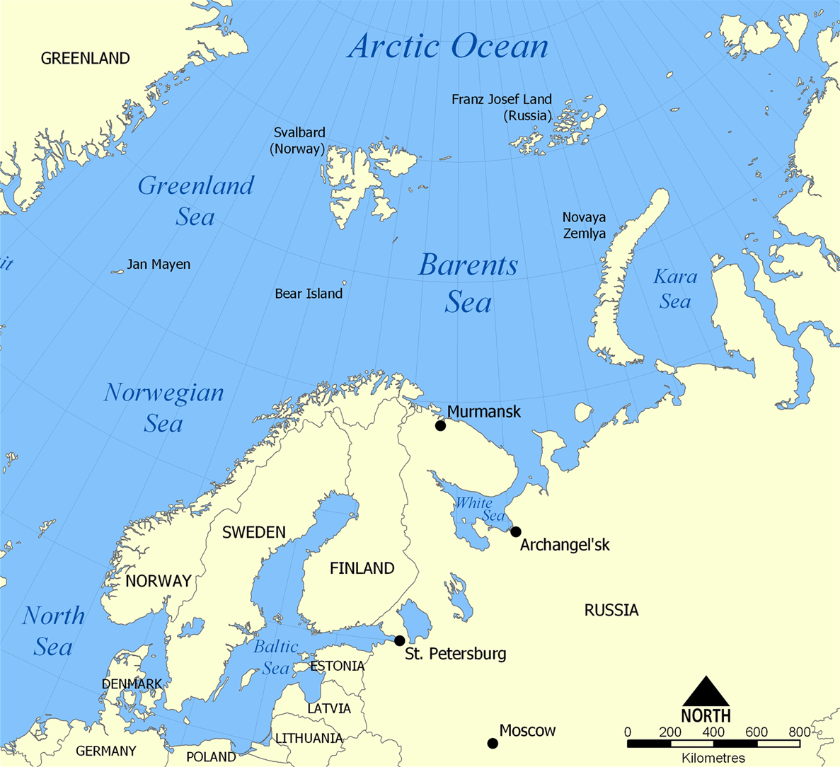
English: The location of the Barents Sea north of Russia and Norway, and the surrounding seas and islands. Also includes political borders with their corresponding nation-states listed. |
| Date | |
| Source | Own work |
| Author | NormanEinstein |
| Other versions |
[edit]
|


Licensing
I, the copyright holder of this work, hereby publish it under the following licenses:

|
Permission is granted to copy, distribute and/or modify this document under the terms of the GNU Free Documentation License, Version 1.2 or any later version published by the Free Software Foundation; with no Invariant Sections, no Front-Cover Texts, and no Back-Cover Texts. A copy of the license is included in the section entitled GNU Free Documentation License.http://www.gnu.org/copyleft/fdl.htmlGFDLGNU Free Documentation Licensetruetrue |
| This file is licensed under the Creative Commons Attribution-Share Alike 3.0 Unported license. | ||
| ||
| This licensing tag was added to this file as part of the GFDL licensing update.http://creativecommons.org/licenses/by-sa/3.0/CC BY-SA 3.0Creative Commons Attribution-Share Alike 3.0truetrue |
You may select the license of your choice.
Captions
The location of the Barents Sea
Barents Sea
Items portrayed in this file
depicts
some value
25 November 2005
image/png
f7a5ee6d4b4514fe0c001142a4b0f0bf17f69b6f
669,295 byte
1,084 pixel
1,187 pixel
File history
Click on a date/time to view the file as it appeared at that time.
| Date/Time | Thumbnail | Dimensions | User | Comment | |
|---|---|---|---|---|---|
| current | 20:52, 29 March 2012 | | 1,187 × 1,084 (654 KB) | Ras67 | cropped |
| 06:11, 5 February 2006 |  | 1,200 × 1,098 (680 KB) | Berkut~commonswiki | pngout-ed (13% file size reduction) | |
| 16:40, 25 November 2005 |  | 1,200 × 1,098 (781 KB) | NormanEinstein | This map shows the location of the Barents Sea north of Russia and Norway, and the surrounding seas and islands. Created by NormanEinstein, November 25, 2005. {{GFDL-self}} Category:Maps of seas |
File usage
The following pages on the English Wikipedia use this file (pages on other projects are not listed):
- Arctic naval operations of World War II
- Atlantification of the Arctic
- Barents Sea
- Convoy PQ 12
- Convoy PQ 18
- Convoy PQ 8
- Convoy QP 14
- Fishing industry in Russia
- Keith Jessop
- List of Russian explorers
- List of oil and gas fields of the Barents Sea
- Operation Fritham
- Operation Gearbox
- Operation Gearbox II
- Operation Orator
- User:NormanEinstein/gallery
Global file usage
The following other wikis use this file:
- Usage on af.wikipedia.org
- Usage on ar.wikipedia.org
- Usage on arz.wikipedia.org
- Usage on ast.wikipedia.org
- Usage on azb.wikipedia.org
- Usage on bcl.wikipedia.org
- Usage on be-tarask.wikipedia.org
- Usage on bg.wikipedia.org
- Usage on bn.wikipedia.org
- Usage on bs.wikipedia.org
- Usage on ca.wikipedia.org
- Usage on cs.wikipedia.org
- Usage on cs.wikinews.org
- Usage on da.wikipedia.org
- Usage on de.wiktionary.org
- Usage on el.wikipedia.org
- Usage on en.wikisource.org
- Usage on en.wiktionary.org
- Usage on eo.wikipedia.org
- Usage on es.wikipedia.org
- Usage on eu.wikipedia.org
- Usage on fa.wikipedia.org
- Usage on fi.wikipedia.org
- Usage on fo.wikipedia.org
- Usage on fr.wikipedia.org
- Usage on fr.wikinews.org
- Usage on he.wikipedia.org
- Usage on hi.wikipedia.org
- Usage on hu.wiktionary.org
- Usage on hy.wikipedia.org
- Usage on id.wikipedia.org
- Usage on ilo.wikipedia.org
- Usage on io.wikipedia.org
- Usage on is.wikipedia.org
- Usage on it.wikipedia.org
- Usage on ja.wikipedia.org
- Usage on ja.wiktionary.org
- Usage on ka.wikipedia.org
- Usage on ko.wikipedia.org
View more global usage of this file.
Retrieved from "https://en.wikipedia.org/wiki/File:Barents_Sea_map.png"