File:Antarctica_Map.png
From Wikipedia, the free encyclopedia
Size of this preview: 488 × 600 pixels. Other resolutions: 195 × 240 pixels | 502 × 617 pixels.
Original file (502 × 617 pixels, file size: 52 KB, MIME type: image/png)
| This is a file from the Wikimedia Commons. Information from its description page there is shown below. Commons is a freely licensed media file repository. You can help. |
- Deutsch: Karte der Antarktis
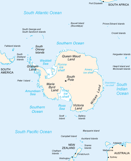
- English: Map of Antarctica
- Español: Mapa de la Antártida
- Polski: Mapa Antarktydy
- For a French version, see : Image:Antarctique_carte.png
- For an German version, see : Image:Antarctica_Karte.png
| Public domainPublic domainfalsefalse |
This image is in the public domain because it contains materials that originally came from the United States Central Intelligence Agency's World Factbook.
Bahasa Indonesia ∙ čeština ∙ Deutsch ∙ eesti ∙ English ∙ español ∙ Esperanto ∙ français ∙ galego ∙ hrvatski ∙ italiano ∙ Nederlands ∙ norsk nynorsk ∙ polski ∙ português ∙ sicilianu ∙ slovenščina ∙ suomi ∙ Türkçe ∙ Zazaki ∙ беларуская (тарашкевіца) ∙ македонски ∙ русский ∙ српски / srpski ∙ українська ∙ ქართული ∙ বাংলা ∙ தமிழ் ∙ മലയാളം ∙ 한국어 ∙ 日本語 ∙ 中文 ∙ 中文(简体) ∙ 中文(繁體) ∙ العربية ∙ +/− |
 |
derivative works
Derivative works of this file: Map-antarctica-ross-ice-shelf-red-x.png
Captions
Add a one-line explanation of what this file represents
Items portrayed in this file
depicts
image/png
b2152c9a291130c09cc5041edaffc03eed5b5e51
53,433 byte
617 pixel
502 pixel
File history
Click on a date/time to view the file as it appeared at that time.
| Date/Time | Thumbnail | Dimensions | User | Comment | |
|---|---|---|---|---|---|
| current | 23:16, 15 December 2004 | | 502 × 617 (52 KB) | Mschlindwein |
File usage
The following pages on the English Wikipedia use this file (pages on other projects are not listed):
- 80th parallel south
- Adams Glacier (Wilkes Land)
- Bell Glacier
- Bibliography of Antarctica
- Blair Glacier
- Blodgett Iceberg Tongue
- Bond Glacier
- Conger Glacier
- De Haven Glacier
- Dibble Iceberg Tongue
- DuBeau Glacier
- Elliott Glacier
- Farthest South
- Filchner–Ronne Ice Shelf
- Freeman Glacier
- Frost Glacier
- Giacomo Bove
- Gilchrist Glacier
- Glenzer Glacier
- Holmes Glacier
- May Glacier
- Ocean fisheries
- Palmer Land
- Peterson Glacier
- Polynesian navigation
- Pourquoi Pas Glacier
- Remenchus Glacier
- Robinson Glacier
- Sandford Glacier
- Second German Antarctic Expedition
- Snedeker Glacier
- Southern Ocean
- Thompson Glacier
- Totten Glacier
- Tracy Glacier (Antarctica)
- Underwood Glacier
- Waldron Glacier
- Whittle Glacier
- Wikipedia:WikiProject Antarctica
- Portal:Oceans
Global file usage
The following other wikis use this file:
- Usage on an.wikipedia.org
- Usage on ar.wikipedia.org
- Usage on avk.wikipedia.org
- Usage on azb.wikipedia.org
- Usage on be.wikipedia.org
- Usage on bjn.wikipedia.org
- Usage on blk.wikipedia.org
- Usage on bn.wikipedia.org
- Usage on br.wikipedia.org
- Usage on bs.wikipedia.org
- Usage on ca.wikipedia.org
- Usage on cs.wikipedia.org
- Usage on da.wikipedia.org
- Usage on de.wikinews.org
- Usage on eo.wikipedia.org
- Usage on es.wikipedia.org
- Usage on es.wikibooks.org
- Usage on fa.wikipedia.org
- Usage on fi.wikipedia.org
- Usage on fy.wikipedia.org
- Usage on ga.wikipedia.org
- Usage on gl.wikipedia.org
View more global usage of this file.
Retrieved from "https://en.wikipedia.org/wiki/File:Antarctica_Map.png"