File:2012-05-28_Fotoflug_Cuxhaven_Wilhelmshaven_DSCF9867_(crop).jpg
From Wikipedia, the free encyclopedia
Original file (1,906 × 2,848 pixels, file size: 4.74 MB, MIME type: image/jpeg)
| This is a file from the Wikimedia Commons. Information from its description page there is shown below. Commons is a freely licensed media file repository. You can help. |
Summary
| Description2012-05-28 Fotoflug Cuxhaven Wilhelmshaven DSCF9867 (crop).jpg |
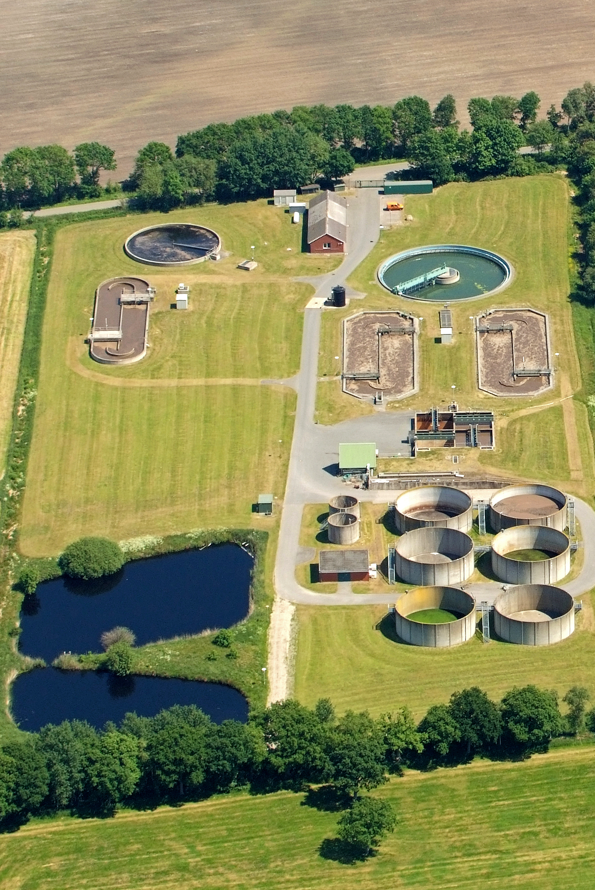
Deutsch: Wasseraufbereitungsanlage in Schiffdorf (Fotoflug vom Flugplatz Nordholz-Spieka über Cuxhaven und Wilhelmshaven) |
| Date | |
| Source | Own work |
| Author | Martina Nolte |
| Other versions | File:2012-05-28 Fotoflug Cuxhaven Wilhelmshaven DSCF9867.jpg |
| Attribution (required by the license) InfoField | Foto: Martina Nolte / Lizenz: Creative Commons CC-by-sa-3.0 de |
InfoField | Foto: Martina Nolte |
| Object location | 53° 32′ 44.85″ N, 8° 40′ 15.81″ E | View this and other nearby images on: OpenStreetMap |
|---|
| Camera location | 53° 32′ 32.4″ N, 8° 39′ 21″ E | View this and other nearby images on: OpenStreetMap |
|---|
Licensing
| It is not permitted to upload this file to Facebook, Youtube, Twitter and many other social networks! This file has been released under a license that is incompatible with the terms of service and licensing terms of Facebook, Youtube, Twitter etc. More information is provided by the Legal Team of the Wikimedia Foundation. This file cannot be used at any pages which use different terms than the license granted here. |

|
.jpg)
In printed material: "Photo: Martina Nolte, Lizenz: https://creativecommons.org/licenses/by-sa/3.0/de/legalcode"
1. Provide my name as given above: Martina Nolte,
2. a copy of, or the URI for, the applicable license: https://creativecommons.org/licenses/by-sa/3.0/de/legalcode,
3. in the case of an adaptation, a credit identifying the modification.
This license and the rights granted hereunder will terminate automatically upon any breach by you of the terms of this license. Any of the above conditions can be waived if you get permission from the copyright holder. If you have questions or wish any different conditions or a higher resolution, please contact me through
kontakt martina-nolte.de
 or my discussion page
- You are free:
- to share – to copy, distribute and transmit the work
- to remix – to adapt the work
- Under the following conditions:
- attribution – You must give appropriate credit, provide a link to the license, and indicate if changes were made. You may do so in any reasonable manner, but not in any way that suggests the licensor endorses you or your use.
- share alike – If you remix, transform, or build upon the material, you must distribute your contributions under the same or compatible license as the original.

| Dieses Foto entstand aufgrund eines Projektes, das von Wikimedia Deutschland e. V. gefördert wurde.
Im Rahmen des „Community-Projektbudgets“ sollen Luftbilder u.a. von Inseln, Halligen, Sanden und Küstenstädten der deutschen Nordseeküste angefertigt werden. Das Projekt „Fotoflüge“ wurde im September 2011 begonnen. |
Captions
Items portrayed in this file
depicts
some value
28 May 2012
53°32'32.39999"N, 8°39'20.99999"E
53°32'44.851"N, 8°40'15.809"E
image/jpeg
6cd6bed05c038055f7067f18a936e076b19fd6cd
4,972,334 byte
2,848 pixel
1,906 pixel
File history
Click on a date/time to view the file as it appeared at that time.
| Date/Time | Thumbnail | Dimensions | User | Comment | |
|---|---|---|---|---|---|
| current | 21:49, 10 June 2012 | | 1,906 × 2,848 (4.74 MB) | Martina Nolte | == {{int:filedesc}} == {{Information |Description={{de|Fotoflug vom Flugplatz Nordholz-Spieka über Cuxhaven und Wilhelmshaven}} |Source={{own}}|other_fields={{Credit line |Aut... |
File usage
Global file usage
The following other wikis use this file:
- Usage on bcl.wikipedia.org
- Usage on be.wikipedia.org
- Usage on bn.wikipedia.org
- Usage on cv.wikipedia.org
- Usage on de.wikipedia.org
- Usage on el.wikipedia.org
- Usage on et.wikipedia.org
- Usage on eu.wikipedia.org
- Usage on fa.wikipedia.org
- Usage on fr.wikipedia.org
- Usage on fy.wikipedia.org
- Usage on gl.wikipedia.org
- Usage on ha.wikipedia.org
- Usage on hi.wikipedia.org
- Usage on hu.wikipedia.org
- Usage on hy.wikipedia.org
- Usage on id.wikipedia.org
- Usage on it.wikipedia.org
- Usage on lt.wikipedia.org
- Usage on mzn.wikipedia.org
- Usage on no.wikipedia.org
- Usage on oc.wikipedia.org
- Usage on pl.wikipedia.org
- Usage on ps.wikipedia.org
- Usage on pt.wikipedia.org
- Usage on ru.wikipedia.org
- Usage on sh.wikipedia.org
- Usage on sk.wikipedia.org
- Usage on sr.wikipedia.org
- Usage on sv.wikipedia.org
- Usage on th.wikipedia.org
- Usage on uk.wikipedia.org
- Usage on vi.wikipedia.org
- Usage on zh.wikipedia.org
Metadata
This file contains additional information, probably added from the digital camera or scanner used to create or digitize it.
If the file has been modified from its original state, some details may not fully reflect the modified file.
| Camera manufacturer | FUJIFILM |
|---|---|
| Camera model | FinePix S5Pro |
| Exposure time | 1/900 sec (0.0011111111111111) |
| F-number | f/7.1 |
| ISO speed rating | 500 |
| Date and time of data generation | 13:17, 28 May 2012 |
| Lens focal length | 82 mm |
| User comments | (C) MARTINA NOLTE |
| Latitude | 53° 32′ 32.4″ N |
| Longitude | 8° 39′ 21″ E |
| Altitude | 581 meters above sea level |
| Orientation | Normal |
| Horizontal resolution | 300 dpi |
| Vertical resolution | 300 dpi |
| Software used | Adobe Photoshop Elements 5.0 Windows |
| File change date and time | 23:47, 10 June 2012 |
| Y and C positioning | Co-sited |
| Exposure Program | Aperture priority |
| Exif version | 2.21 |
| Date and time of digitizing | 13:17, 28 May 2012 |
| Meaning of each component |
|
| Image compression mode | 3.2 |
| Shutter speed | 9.83 |
| APEX aperture | 5.66 |
| APEX brightness | 8.5 |
| Exposure bias | 0.33 |
| Maximum land aperture | 3 APEX (f/2.83) |
| Metering mode | Center weighted average |
| Light source | Shade |
| Flash | Flash did not fire, compulsory flash suppression |
| Supported Flashpix version | 1 |
| Color space | sRGB |
| Focal plane X resolution | 1,861 |
| Focal plane Y resolution | 1,861 |
| Focal plane resolution unit | 3 |
| Sensing method | One-chip color area sensor |
| File source | Digital still camera |
| Scene type | A directly photographed image |
| Custom image processing | Custom process |
| Exposure mode | Auto exposure |
| White balance | Manual white balance |
| Focal length in 35 mm film | 123 mm |
| Scene capture type | Standard |
| Subject distance range | Unknown |
| GPS time (atomic clock) | 11:17 |
| Satellites used for measurement | 10 |
| GPS date | 28 May 2012 |
| GPS tag version | 0.0.2.2 |
| Supported Flashpix version | 1 |
| Image width | 1,906 px |
| Image height | 2,848 px |
| Date metadata was last modified | 01:47, 11 June 2012 |
| IIM version | 2 |