Eratosthenes Point
Antarctic headland From Wikipedia, the free encyclopedia
Antarctic headland From Wikipedia, the free encyclopedia
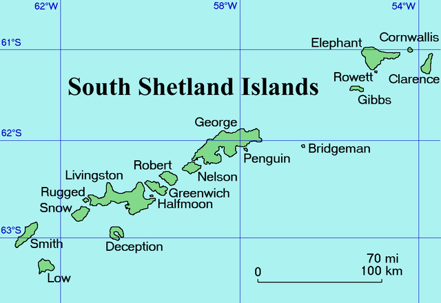
Eratosthenes Point (Bulgarian: нос Ератостен, romanized: nos Eratosthenes, IPA: ['nɔs ɛrɐto'stɛn]) is the ice-covered, rock-tipped northwest entrance point to Digges Cove on the north coast of Elephant Island in the South Shetland Islands, Antarctica situated just west of the terminus of Snellius Glacier. The area was visited by early 19th century sealers.[1]


The feature is named after the Greek mathematician and geographer Eratosthenes (c. 276-194 BC) who was the first to calculate the circumference of the Earth; in association with other names in the area deriving from the early development or use of geodetic instruments and methods.
Eratosthenes Point is located at 61°05′39″S 55°03′24″W,[2] which is 17.2 km east-southeast of Cape Yelcho and 10.57 km west of Point Wild. British mapping of the area in 1822,1972 and 2009.
Seamless Wikipedia browsing. On steroids.
Every time you click a link to Wikipedia, Wiktionary or Wikiquote in your browser's search results, it will show the modern Wikiwand interface.
Wikiwand extension is a five stars, simple, with minimum permission required to keep your browsing private, safe and transparent.