Datakhel
Town in Khyber Pakhtunkhwa, Pakistan From Wikipedia, the free encyclopedia
Town in Khyber Pakhtunkhwa, Pakistan From Wikipedia, the free encyclopedia
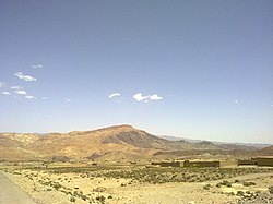
Datakhel (Pashto: دته خېل) or Datta Khel is a town in North Waziristan district of Khyber Pakhtunkhwa, Pakistan.[2][3][4]
Datakhel
دته خېل | |
|---|---|
Town | |
 | |
 | |
| Coordinates: 32°54′18.4″N 69°44′56″E | |
| Country | |
| Province | |
| District | North Waziristan |
| Tehsil | Datta Khel |
| Elevation | 2,010 m (6,590 ft) |
| Population | |
| • Total | 1,037 |
| Time zone | UTC+5 (PST) |
It is part of Datta Khel Tehsil of North Waziristan district.[5]
Datakhel is located around 41 km South West of near by towns of Miran Shan and 21 km of Boya in North Wizaristan.[6][7][8] According to the 2017 census, the population of Datakhel, is 1037 with total number of household stands at 171.[1]
On Sept 25, 2008, as an indication of escalating tensions between nations, Pakistani forces fired warning shots at American aircraft after they crossed into Pakistan's territory in the area of Saidgai, in North Waziristan's Datakhel region.
On March 17, 2011, a US airstrike that killed 44 people in the city led to widespread condemnation in Pakistan.[9]
Seamless Wikipedia browsing. On steroids.
Every time you click a link to Wikipedia, Wiktionary or Wikiquote in your browser's search results, it will show the modern Wikiwand interface.
Wikiwand extension is a five stars, simple, with minimum permission required to keep your browsing private, safe and transparent.