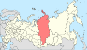
Bogotolsky District (Russian: Богото́льский райо́н) is an administrative[1] and municipal[6] district (raion), one of the forty-three in Krasnoyarsk Krai, Russia. It is located in the southwest of the krai and borders with Tyukhtetsky District in the north, Bolsheuluysky District in the southeast, Achinsky District in the east, Nazarovsky and Sharypovsky Districts in the south, and with Kemerovo Oblast in the west. The area of the district is 2,924 square kilometers (1,129 sq mi).[2] Its administrative center is the town of Bogotol (which is not administratively a part of the district).[1] Population: 11,267 (2010 Russian census);[5] 12,415 (2002 Census);[8] 14,978 (1989 Soviet census).[9]
Quick Facts Боготольский район, Country ...
Close
The history of the district dates back to the formation of the settlement of Bogotolsky (modern Bogotol); presumably, in 1703.[10] In the 17th century, the territory of what is now Bogotolsky District was settled by the Turkic tribes (Chulym Tatars).[10] The name "Bogotol" (meaning a small beautiful valley) was borrowed from the language of those tribes.[10]
Russians settled this area in the end of the 17th century.[10] Peasants were engaged in agriculture and cattle breeding.[10]
The modern district was founded on May 25, 1925.[2]
Within the framework of administrative divisions, Bogotolsky District is one of the forty-three in the krai.[1] The town of Bogotol serves as its administrative center, despite being incorporated separately as a krai town[1]—an administrative unit with the status equal to that of the districts.[11] The district is divided into eight selsoviets.[1]
As a municipal division, the district is incorporated as Bogotolsky Municipal District and is divided into eight rural settlements (corresponding to the administrative district's selsoviets).[6] The krai town of Bogotol is incorporated separately from the district as Bogotol Urban Okrug.[12]
Notes
Charter of Bogotolsky District, Article 6.1
Charter of Bogotolsky District, Article 6.2
"Об исчислении времени". Официальный интернет-портал правовой информации (in Russian). June 3, 2011. Retrieved January 19, 2019. Federal State Statistics Service (May 21, 2004). Численность населения России, субъектов Российской Федерации в составе федеральных округов, районов, городских поселений, сельских населённых пунктов – районных центров и сельских населённых пунктов с населением 3 тысячи и более человек [Population of Russia, Its Federal Districts, Federal Subjects, Districts, Urban Localities, Rural Localities—Administrative Centers, and Rural Localities with Population of Over 3,000] (XLS). Всероссийская перепись населения 2002 года [All-Russia Population Census of 2002] (in Russian). Всесоюзная перепись населения 1989 г. Численность наличного населения союзных и автономных республик, автономных областей и округов, краёв, областей, районов, городских поселений и сёл-райцентров [All Union Population Census of 1989: Present Population of Union and Autonomous Republics, Autonomous Oblasts and Okrugs, Krais, Oblasts, Districts, Urban Settlements, and Villages Serving as District Administrative Centers]. Всесоюзная перепись населения 1989 года [All-Union Population Census of 1989] (in Russian). Институт демографии Национального исследовательского университета: Высшая школа экономики [Institute of Demography at the National Research University: Higher School of Economics]. 1989 – via Demoscope Weekly. Official website of Bogotolsky District. History (in Russian)
Sources
- Законодательное собрание Красноярского края. Закон №10-4765 от 10 июня 2010 г. «О перечне административно-территориальных единиц и территориальных единиц Красноярского края», в ред. Закона №7-3007 от 16 декабря 2014 г. «Об изменении административно-территориального устройства Большеулуйского района и о внесении изменений в Закон края "О перечне административно-территориальных единиц и территориальных единиц Красноярского края"». Вступил в силу 1 июля 2010 г. Опубликован: "Ведомости высших органов государственной власти Красноярского края", №33(404), 5 июля 2010 г. (Legislative Assembly of Krasnoyarsk Krai. Law #10-4765 of June 10, 2010 On the Registry of the Administrative-Territorial Units and the Territorial Units of Krasnoyarsk Krai, as amended by the Law #7-3007 of December 16, 2014 On Changing the Administrative-Territorial Structure of Bolsheuluysky District and on Amending the Krai Law "On the Registry of the Administrative-Territorial Units and the Territorial Units of Krasnoyarsk Krai". Effective as of July 1, 2010.).
- Законодательное собрание Красноярского края. Закон №13-2868 от 24 декабря 2004 г. «Об установлении границ и наделении соответствующим статусом муниципального образования Боготольский район и находящихся в его границах иных муниципальных образований», в ред. Закона №3-706 от 8 ноября 2007 г «О внесении изменений в Закон края "Об установлении границ и наделении соответствующим статусом муниципального образования Боготольский район и находящихся в его границах иных муниципальных образований"». Вступил в силу через десять дней после официального опубликования. Опубликован: "Ведомости высших органов государственной власти Красноярского края", №1, 10 января 2005 г. (Legislative Assembly of Krasnoyarsk Krai. Law #13-2868 of December 24, 2004 On Establishing the Borders and Granting an Appropriate Status to the Municipal Formation of Bogotolsky District and to Other Municipal Formations Within Its Borders, as amended by the Law #3-706 of November 8, 2007 On Amending the Krai Law "On Establishing the Borders and Granting an Appropriate Status to the Municipal Formation of Bogotolsky District and to Other Municipal Formations Within Its Borders". Effective as of ten days after the official publication.).
- Законодательное собрание Красноярского края. Закон №10-4763 от 10 июня 2010 г. «Об административно-территориальном устройстве Красноярского края», в ред. Закона №8-3263 от 19 марта 2015 г. «О внесении изменений в Закон края "Об административно-территориальном устройстве Красноярского края"». Вступил в силу на следующий день после официального опубликования. Опубликован: "Ведомости высших органов государственной власти Красноярского края", №31(402), 28 июня 2010 г. (Legislative Assembly of Krasnoyarsk Krai. Law #10-4763 of June 10, 2010 On the Administrative-Territorial Structure of Krasnoyarsk Krai, as amended by the Law #8-3263 of March 19, 2015 On Amending the Krai Law "On the Administrative-Territorial Structure of Krasnoyarsk Krai". Effective as of the day following the official publication.).
- Боготольский районный Совет депутатов. Решение №6-21 от 26 ноября 1997 г. «Устав Боготольского района Красноярского края», в ред. Решение №52-366 от 17 июля 2009 г «О внесении изменений и дополнений в Устав Боготольского района Красноярского края». Вступил в силу в день, следующий за днём официального опубликования, осуществляемого при наличии государственной регистрации, за исключением положений, для которых предусмотрены иные сроки. (Bogotolsky District Council of Deputies. Decision #6-21 of November 26, 1997 Charter of Bogotolsky District of Krasnoyarsk Krai, as amended by the Decision #52-366 of July 17, 2009 On Amending and Supplementing the Charter of Beryozovsky District of Krasnoyarsk Krai. Effective as of the day following the official publication, carried out after the state registration; with the exception of clauses for which different dates of taking effect are specified.).
- Законодательное собрание Красноярского края. Закон №12-2510 от 12 ноября 2004 г. «Об установлении границ муниципального образования город Боготол и о наделении его статусом городского округа», в ред. Закона №7-2269 от 30 октября 2008 г «О внесении изменений в Закон края "Об установлении границ муниципального образования город Боготол и о наделении его статусом городского округа"». Вступил в силу через 10 дней после официального опубликования. Опубликован: "Ведомости высших органов государственной власти Красноярского края", №32, 29 ноября 2004 г. (Legislative Assembly of Krasnoyarsk Krai. Law #12-2510 of November 12, 2004 On Establishing the Borders of the Municipal Formation of the Town of Bogotol and on Granting It Urban Okrug Status, as amended by the Law #7-2269 of October 30, 2008 On Amending the Krai Law "On Establishing the Borders of the Municipal Formation of the Town of Bogotol and on Granting It Urban Okrug Status". Effective as of the day 10 days after the official publication.).


.png)
.gif)