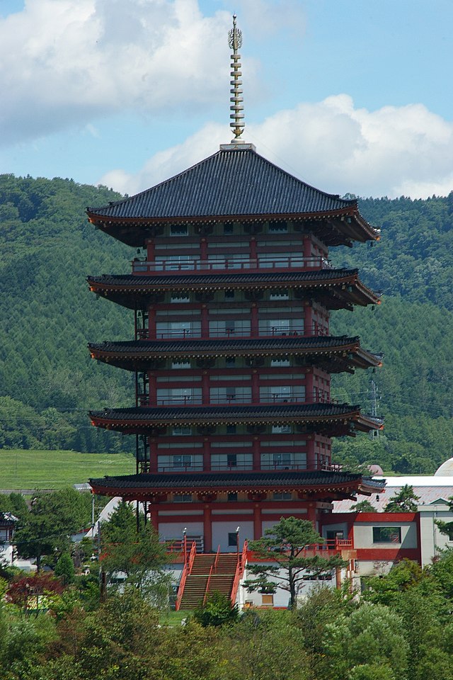
Ashibetsu
City in Hokkaido, Japan From Wikipedia, the free encyclopedia
City in Hokkaido, Japan From Wikipedia, the free encyclopedia
Ashibetsu (芦別市, Ashibetsu-shi) is a city located in Sorachi Subprefecture, Hokkaido, Japan.
Ashibetsu
芦別市 | |
|---|---|
 | |
 Location of Ashibetsu in Hokkaido (Sorachi Subprefecture) | |
| Coordinates: 43°31′N 142°11′E | |
| Country | Japan |
| Region | Hokkaido |
| Prefecture | Hokkaido (Sorachi Subprefecture) |
| Government | |
| • Mayor | Hiromu Konno |
| Area | |
| • Total | 865.02 km2 (333.99 sq mi) |
| Population (October 1, 2020) | |
| • Total | 12,555 |
| • Density | 15/km2 (38/sq mi) |
| Time zone | UTC+09:00 (JST) |
| City hall address | 1-3 Kita-ichijō Higashi, Ashibetsu-shi, Hokkaidō 075-8711 |
| Climate | Dfb |
| Website | www |
| Symbols | |
| Bird | Great tit |
| Flower | Lily |
| Tree | Mizunara (Quercus crispula) |

As of 1 October 2020, the city had an estimated population of 12,555 and a density of 15 persons per km2. The total area is 865.02 km2.
Ashibetsu was once a prosperous coal mining city, its population exceeding 70,000 at its peak, but its population has fallen since the closing of the coal mines.[1]
Ashibetsu is in the northern part of Yūbari Mountains. Mount Ashibetsu is south of the city.
There are two theories about the origin of "Ashibetsu". In both theories the name means Ashibetsu River, which flows through the city.[1]
| Climate data for Ashibetsu (1991−2020 normals, extremes 1978−present) | |||||||||||||
|---|---|---|---|---|---|---|---|---|---|---|---|---|---|
| Month | Jan | Feb | Mar | Apr | May | Jun | Jul | Aug | Sep | Oct | Nov | Dec | Year |
| Record high °C (°F) | 7.6 (45.7) |
13.2 (55.8) |
15.5 (59.9) |
28.7 (83.7) |
33.0 (91.4) |
35.7 (96.3) |
37.2 (99.0) |
36.7 (98.1) |
33.1 (91.6) |
25.4 (77.7) |
20.9 (69.6) |
14.3 (57.7) |
37.2 (99.0) |
| Mean daily maximum °C (°F) | −1.9 (28.6) |
−0.7 (30.7) |
3.8 (38.8) |
11.4 (52.5) |
18.8 (65.8) |
23.0 (73.4) |
26.5 (79.7) |
26.9 (80.4) |
22.6 (72.7) |
15.5 (59.9) |
7.1 (44.8) |
0.1 (32.2) |
12.8 (55.0) |
| Daily mean °C (°F) | −6.4 (20.5) |
−5.6 (21.9) |
−1.0 (30.2) |
5.5 (41.9) |
12.3 (54.1) |
16.9 (62.4) |
20.9 (69.6) |
21.4 (70.5) |
16.6 (61.9) |
9.6 (49.3) |
2.7 (36.9) |
−3.8 (25.2) |
7.4 (45.4) |
| Mean daily minimum °C (°F) | −11.3 (11.7) |
−11.1 (12.0) |
−6.1 (21.0) |
0.0 (32.0) |
6.1 (43.0) |
11.8 (53.2) |
16.4 (61.5) |
17.0 (62.6) |
11.7 (53.1) |
4.7 (40.5) |
−1.2 (29.8) |
−7.8 (18.0) |
2.5 (36.5) |
| Record low °C (°F) | −26.3 (−15.3) |
−25.7 (−14.3) |
−23.8 (−10.8) |
−11.2 (11.8) |
−2.4 (27.7) |
1.8 (35.2) |
8.0 (46.4) |
8.4 (47.1) |
1.7 (35.1) |
−2.7 (27.1) |
−13.3 (8.1) |
−21.1 (−6.0) |
−26.3 (−15.3) |
| Average precipitation mm (inches) | 65.3 (2.57) |
53.1 (2.09) |
59.4 (2.34) |
53.7 (2.11) |
66.7 (2.63) |
76.3 (3.00) |
122.9 (4.84) |
152.7 (6.01) |
142.8 (5.62) |
116.1 (4.57) |
128.3 (5.05) |
98.2 (3.87) |
1,141.6 (44.94) |
| Average snowfall cm (inches) | 161 (63) |
140 (55) |
108 (43) |
14 (5.5) |
0 (0) |
0 (0) |
0 (0) |
0 (0) |
0 (0) |
2 (0.8) |
67 (26) |
177 (70) |
666 (262) |
| Average precipitation days (≥ 1.0 mm) | 17.2 | 14.9 | 14.1 | 11.8 | 11.2 | 9.1 | 10.7 | 11.8 | 12.5 | 15.4 | 18.7 | 20.4 | 167.8 |
| Average snowy days (≥ 3 cm) | 18.3 | 16.2 | 13.3 | 1.9 | 0 | 0 | 0 | 0 | 0 | 0.2 | 6.3 | 18.5 | 74.7 |
| Mean monthly sunshine hours | 76.1 | 84.6 | 129.5 | 160.4 | 188.1 | 169.7 | 163.1 | 155.9 | 155.0 | 126.5 | 69.0 | 55.9 | 1,533.9 |
| Source: Japan Meteorological Agency[5][6] | |||||||||||||
Per Japanese census data,[7] the population of Ashibetsu has declined precipitously over the past half-century. Of the residents who remain, nearly half are age 65 or older.[7]
| Year | Pop. | ±% |
|---|---|---|
| 1970 | 42,730 | — |
| 1980 | 32,946 | −22.9% |
| 1990 | 25,078 | −23.9% |
| 2000 | 21,026 | −16.2% |
| 2010 | 16,628 | −20.9% |
| 2020 | 12,555 | −24.5% |
Seamless Wikipedia browsing. On steroids.
Every time you click a link to Wikipedia, Wiktionary or Wikiquote in your browser's search results, it will show the modern Wikiwand interface.
Wikiwand extension is a five stars, simple, with minimum permission required to keep your browsing private, safe and transparent.